MyTopo
Chimney Springs Oregon US Topo Map
Couldn't load pickup availability
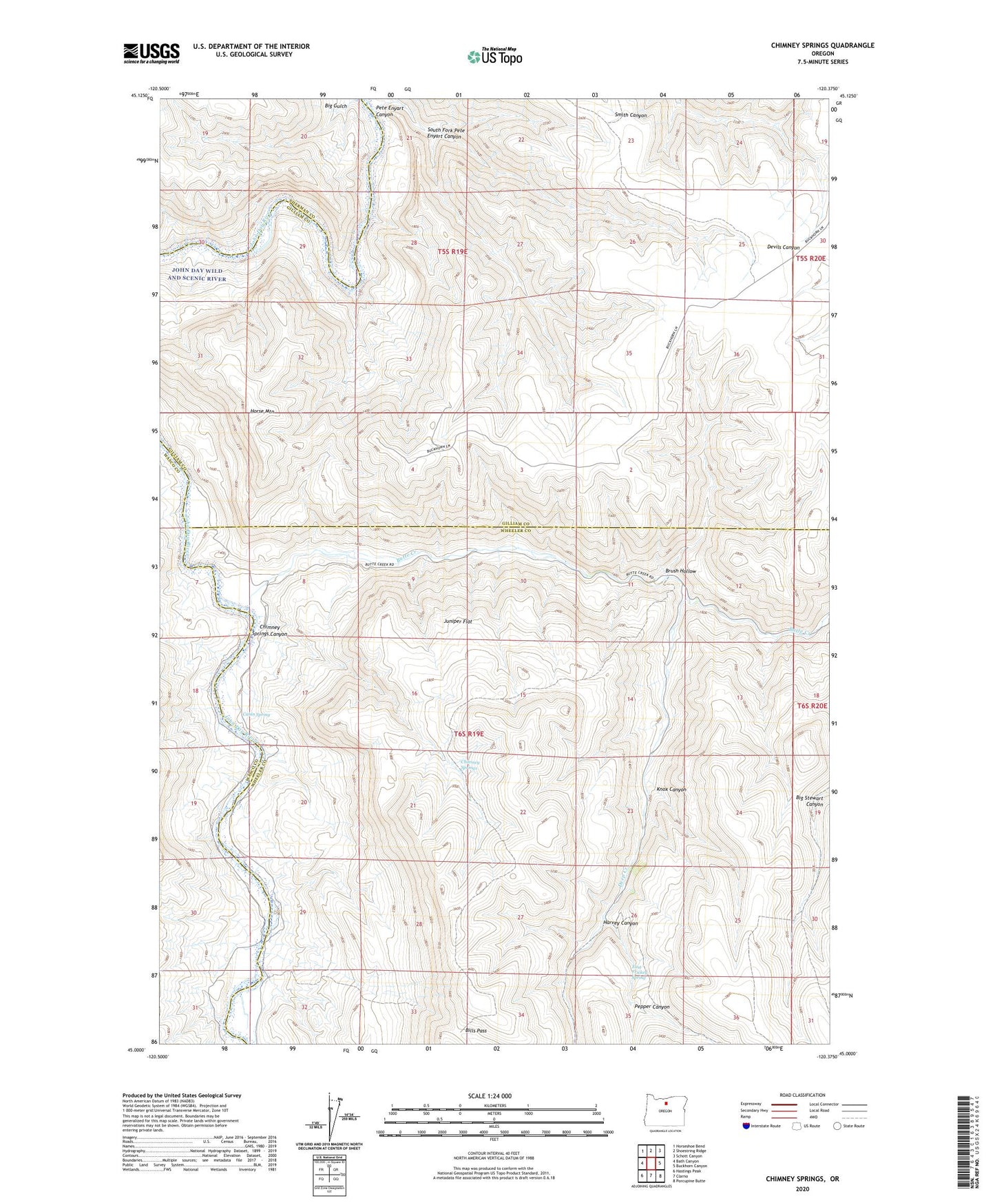
2023 topographic map quadrangle Chimney Springs in the state of Oregon. Scale: 1:24000. Based on the newly updated USGS 7.5' US Topo map series, this map is in the following counties: Gilliam, Wheeler, Wasco, Sherman. The map contains contour data, water features, and other items you are used to seeing on USGS maps, but also has updated roads and other features. This is the next generation of topographic maps. Printed on high-quality waterproof paper with UV fade-resistant inks.
Quads adjacent to this one:
West: Bath Canyon
Northwest: Horseshoe Bend
North: Shoestring Ridge
Northeast: Schott Canyon
East: Buckhorn Canyon
Southeast: Porcupine Butte
South: Clarno
Southwest: Hastings Peak
This map covers the same area as the classic USGS quad with code o45120a4.
Contains the following named places: Big Gulch, Bills Pass, Brush Hollow, Buckhorn Ranch, Butte Creek, Cabin Spring, Chimney Springs, Chimney Springs Canyon, Deep Creek, East Frickey Spring, Harvey Canyon, Horse Mountain, Juniper Flat, Knox Canyon, Pepper Canyon, Pete Enyart Canyon, South Fork Pete Enyart Canyon