MyTopo
Bedford Point Oregon US Topo Map
Couldn't load pickup availability
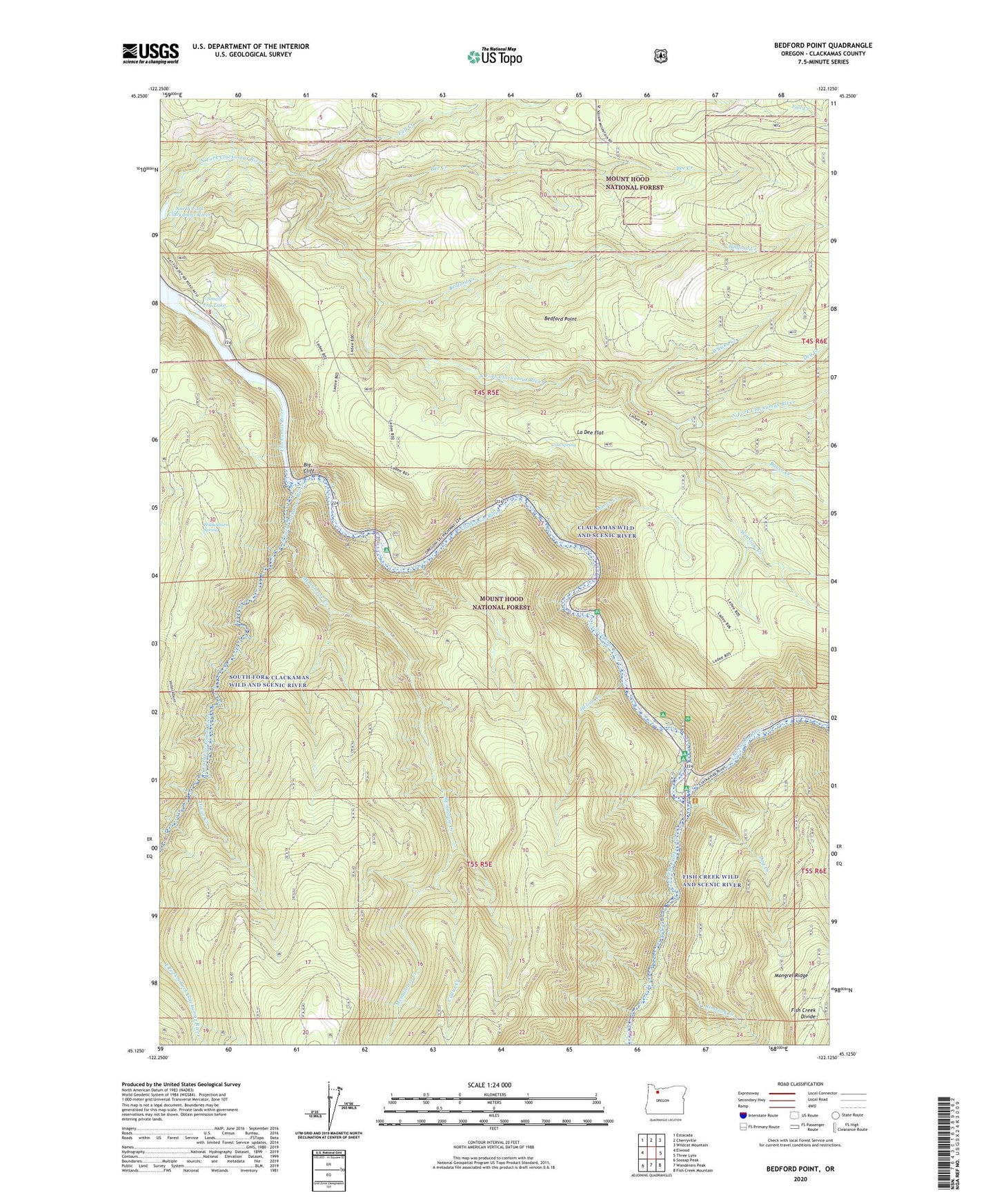
2020 topographic map quadrangle Bedford Point in the state of Oregon. Scale: 1:24000. Based on the newly updated USGS 7.5' US Topo map series, this map is in the following counties: Clackamas. The map contains contour data, water features, and other items you are used to seeing on USGS maps, but also has updated roads and other features. This is the next generation of topographic maps. Printed on high-quality waterproof paper with UV fade-resistant inks.
Quads adjacent to this one:
West: Elwood
Northwest: Estacada
North: Cherryville
Northeast: Wildcat Mountain
East: Three Lynx
Southeast: Fish Creek Mountain
South: Wanderers Peak
Southwest: Soosap Peak
Contains the following named places: Armstrong Recreation Site, Bedford Creek, Bedford Point, Bedford Point Lookout, Bee Creek, Big Cliff, Big Eddy Recreation Site, Bowyer Quarry, Boyer Creek, Carter Bridge Gravel Pit, Carter Bridge Recreation Site, Clackamas County, Cold Spring, Cultus Creek, Dog Creek, Dry Creek, Fall Creek, Fish Creek, Fish Creek Recreation Site, Helion Creek, Helion Quarry, Hesperin Camp, Hillockburn Spring, La Dee Flat, Lazy Bend Quarry, Lazy Bend Recreation Site, Lockaby Recreation Site, Memaloose, Memaloose Creek, Memaloose Trail, Mongrel Ridge Quarry, Moore Creek, Murphy Creek, North Fork Crossing Forest Camp, North Fork Guard Station, Oregon City Water Patrol Station, Oscar Creek, Oz Pit, Portland General Electric Promontory Park Boat Ramp, Portland General Electric Promontory Park Marina, Pup Creek Pit, Rimrock Creek, Small Fry Lake, South Fork Clackamas River, South Fork Clackamas Wild and Scenic River, South Fork Water Board Intake, Torch Quarry, Wanderers Peak Trail, Whisky Creek, Winslow Creek