MyTopo
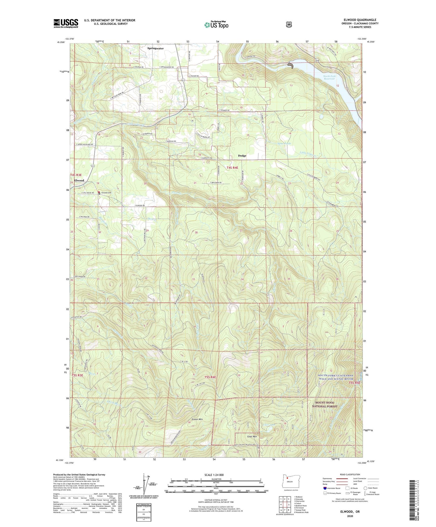
Elwood Oregon US Topo Map
Couldn't load pickup availability
Also explore the Elwood Forest Service Topo of this same quad for updated USFS data
2024 topographic map quadrangle Elwood in the state of Oregon. Scale: 1:24000. Based on the newly updated USGS 7.5' US Topo map series, this map is in the following counties: Clackamas. The map contains contour data, water features, and other items you are used to seeing on USGS maps, but also has updated roads and other features. This is the next generation of topographic maps. Printed on high-quality waterproof paper with UV fade-resistant inks.
Quads adjacent to this one:
West: Colton
Northwest: Redland
North: Estacada
Northeast: Cherryville
East: Bedford Point
Southeast: Wanderers Peak
South: Soosap Peak
Southwest: Fernwood
This map covers the same area as the classic USGS quad with code o45122b3.
Contains the following named places: Clear Lake, Colton Rural Fire Protection District 70 Station 123, D K Quarry, Dodge, Dodge Community Church, Dodge Post Office, East Fork South Fork Clackamas River, Elwood, Elwood Post Office, Goat Mountain, Green Mountain, Hillockburn Guard Station, Lacy Post Office, Little Cedar Creek, Little Clear Creek, Metzler Park Recreation Site, Mount Home Cemetery, North Fork Clackamas River, North Fork Dam, North Fork Reservoir, Sams Ponds, Springwater Golf Course, Swagger Creek