MyTopo
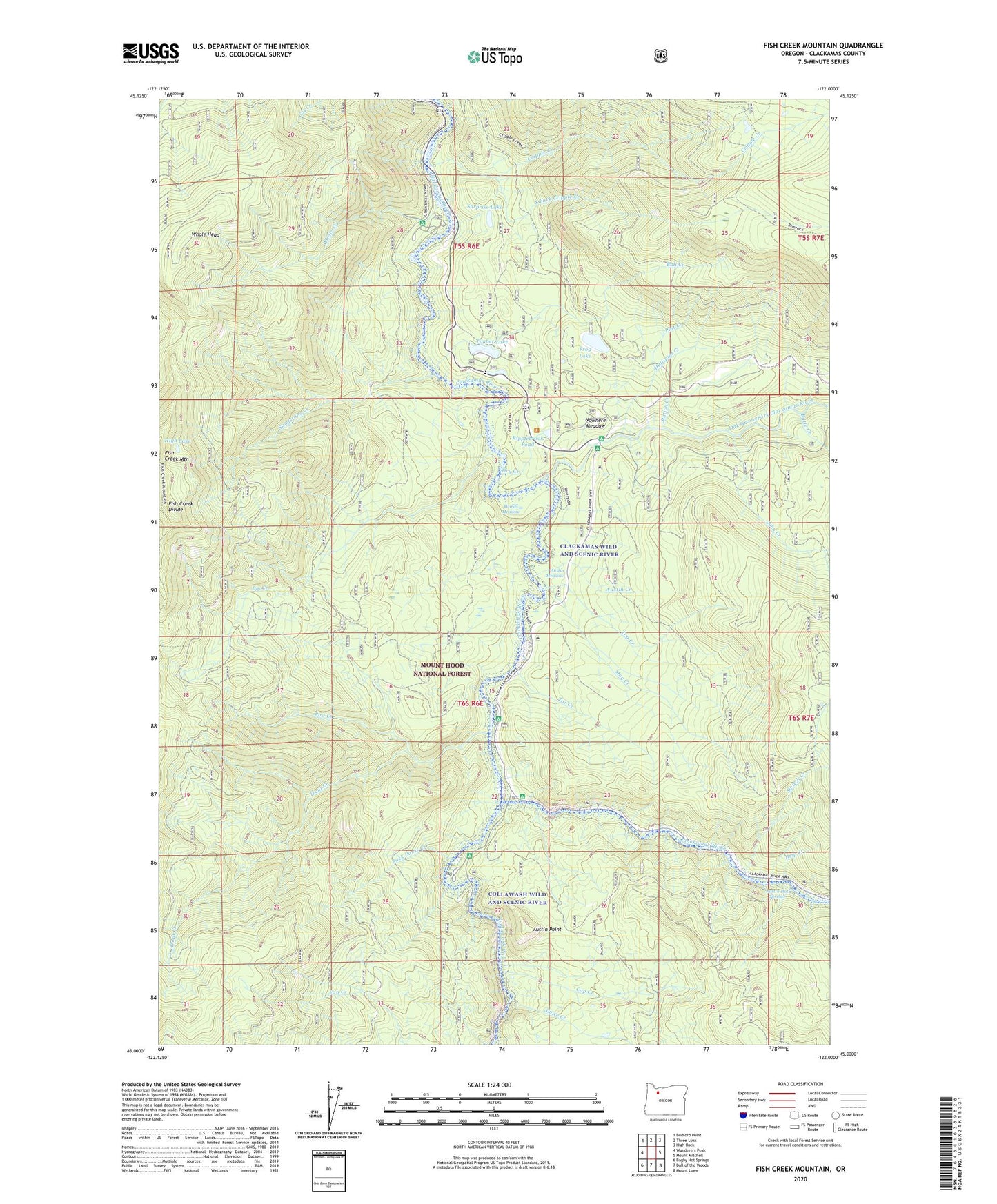
Fish Creek Mountain Oregon US Topo Map
Couldn't load pickup availability
Also explore the Fish Creek Mountain Forest Service Topo of this same quad for updated USFS data
2024 topographic map quadrangle Fish Creek Mountain in the state of Oregon. Scale: 1:24000. Based on the newly updated USGS 7.5' US Topo map series, this map is in the following counties: Clackamas. The map contains contour data, water features, and other items you are used to seeing on USGS maps, but also has updated roads and other features. This is the next generation of topographic maps. Printed on high-quality waterproof paper with UV fade-resistant inks.
Quads adjacent to this one:
West: Wanderers Peak
Northwest: Bedford Point
North: Three Lynx
Northeast: High Rock
East: Mount Mitchell
Southeast: Mount Lowe
South: Bull of the Woods
Southwest: Bagby Hot Springs
This map covers the same area as the classic USGS quad with code o45122a1.
Contains the following named places: Acme Timber Company Mill Dam, Alder Flat Recreation Site, Austin Creek, Austin Hot Springs, Austin Meadow, Austin Point, Austin Quarry, Big Creek, Boneyard Quarry, Bull Creek, Butte Creek, Cap Creek, Cold Spring Trail, Collawash River, Cripple Creek, Cripple Creek Forest Camp, Cripple Creek Quarry, Cripple Creek Trail, Curry Gravel Pit, Drip Creek, Dry Creek, Estacada Division, Frog Lake, Frog Lake Dam, Half-pint Creek, High Lake, High Lake Pit, Indian Henry Recreation Site, Jack Davis Creek, John Creek, Linerunner Quarry, Mag Creek, Mistletoe Gravel Pit, Nowhere Meadow, Oak Grove Fork Clackamas River, Oak Grove Work Center, Pickup Pit, Pint Creek, Quercus Pit, RAAB Recreation Site, Rainbow Recreation Site, Ripplebrook, Ripplebrook Pond, Ripplebrook Ranger Station, Ripplebrook Recreation Site, River Ford Recreation Site, Riverside Recreation Site, Rod Creek, Sandstone Creek, Sandstone Pits, Silver Tip Camp, Sluice Creek, South Fork Cripple Creek, Station Creek, Surprise Lake, Switch Creek, Tag Creek, Tar Creek, Timber Lake, Timber Lake Job Corps Center, Trout Creek, Two Rivers Recreation Site, Umpqua Quarry, Upper Mitchell Quarry, Wards Meadow, Whale Creek, Whale Head