MyTopo
Biscuit Hill Oregon US Topo Map
Couldn't load pickup availability
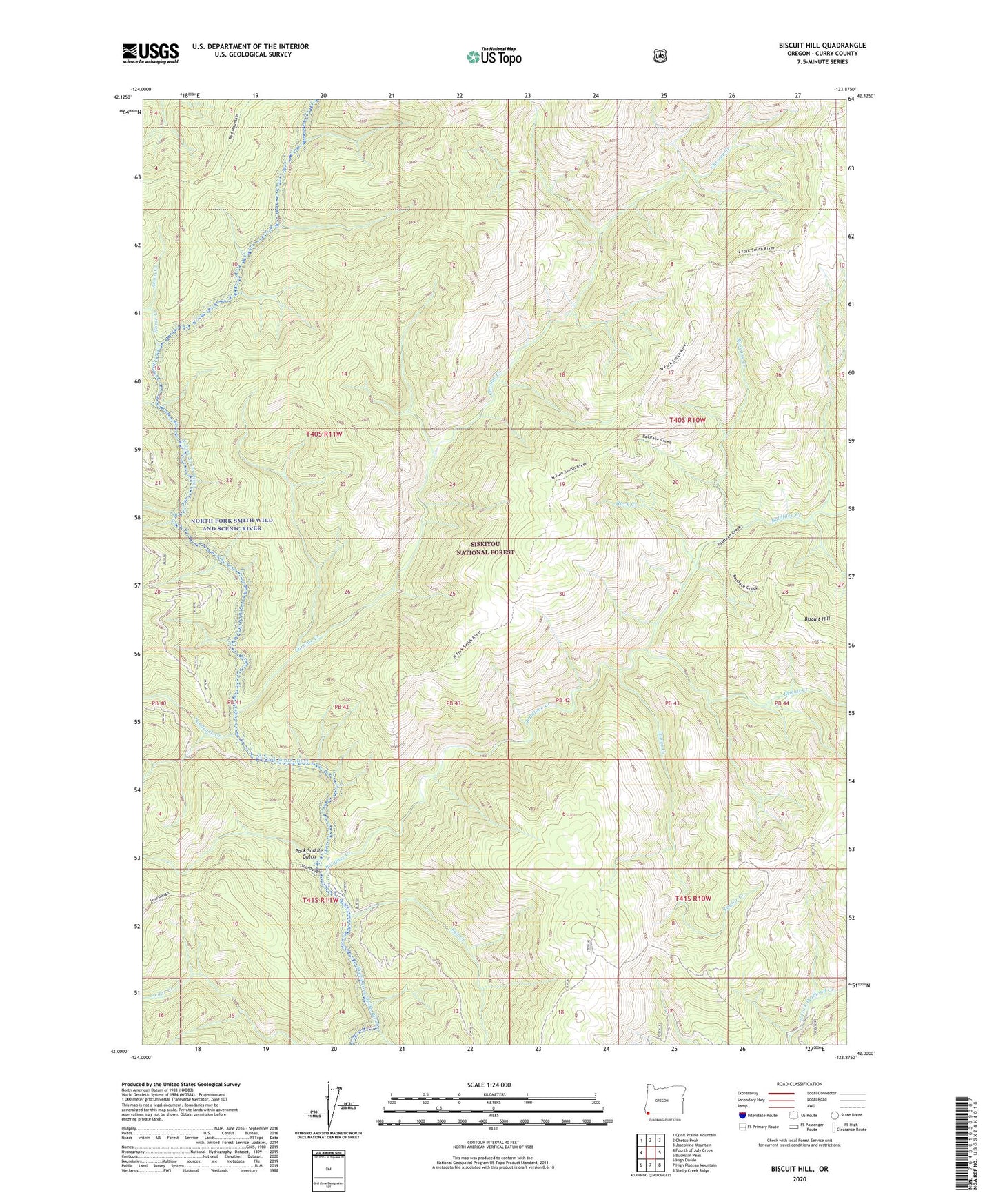
2020 topographic map quadrangle Biscuit Hill in the state of Oregon. Scale: 1:24000. Based on the newly updated USGS 7.5' US Topo map series, this map is in the following counties: Curry. The map contains contour data, water features, and other items you are used to seeing on USGS maps, but also has updated roads and other features. This is the next generation of topographic maps. Printed on high-quality waterproof paper with UV fade-resistant inks.
Quads adjacent to this one:
West: Fourth of July Creek
Northwest: Quail Prairie Mountain
North: Chetco Peak
Northeast: Josephine Mountain
East: Buckskin Peak
Southeast: Shelly Creek Ridge
South: High Plateau Mountain
Southwest: High Divide
Contains the following named places: Acorn Creek, Baldface Creek, Biscuit Creek, Biscuit Hill, Chrome Creek, Cleopatra Lookout, Fall Creek, Hardtack Creek, Horse Creek, McKee Cabin, North Fork Smith Wild and Scenic River, Pack Saddle Gulch, Red Mountain Trail, Rock Creek, Sourdough Camp, Spokane Creek, Taylor Creek, The Oaks