MyTopo
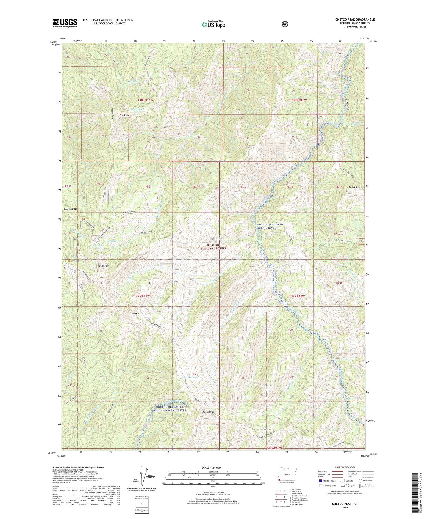
Chetco Peak Oregon US Topo Map
Couldn't load pickup availability
Also explore the Chetco Peak Forest Service Topo of this same quad for updated USFS data
2023 topographic map quadrangle Chetco Peak in the state of Oregon. Scale: 1:24000. Based on the newly updated USGS 7.5' US Topo map series, this map is in the following counties: Curry. The map contains contour data, water features, and other items you are used to seeing on USGS maps, but also has updated roads and other features. This is the next generation of topographic maps. Printed on high-quality waterproof paper with UV fade-resistant inks.
Quads adjacent to this one:
West: Quail Prairie Mountain
Northwest: Big Craggies
North: Tincup Peak
Northeast: Pearsoll Peak
East: Josephine Mountain
Southeast: Buckskin Peak
South: Biscuit Hill
Southwest: Fourth of July Creek
This map covers the same area as the classic USGS quad with code o42123b8.
Contains the following named places: Bailey Mountain, Brokencot Creek, Carter Creek, Chetco Lake, Chetco Lookout, Chetco Peak, Chetco Peak Trail, Cottonwood Camp, Dry Butte, Fresno Camp, Fresno Creek, Gardner Mine, Henry Creek, Lish Lake, Little Chetco River, Little Vulcan Lake, Madstone Cabin, Madstone Creek, Moores Ridge, Red Mountain, Salamander Lake, Valen Lake, Vulcan Lake, Vulcan Peak