MyTopo
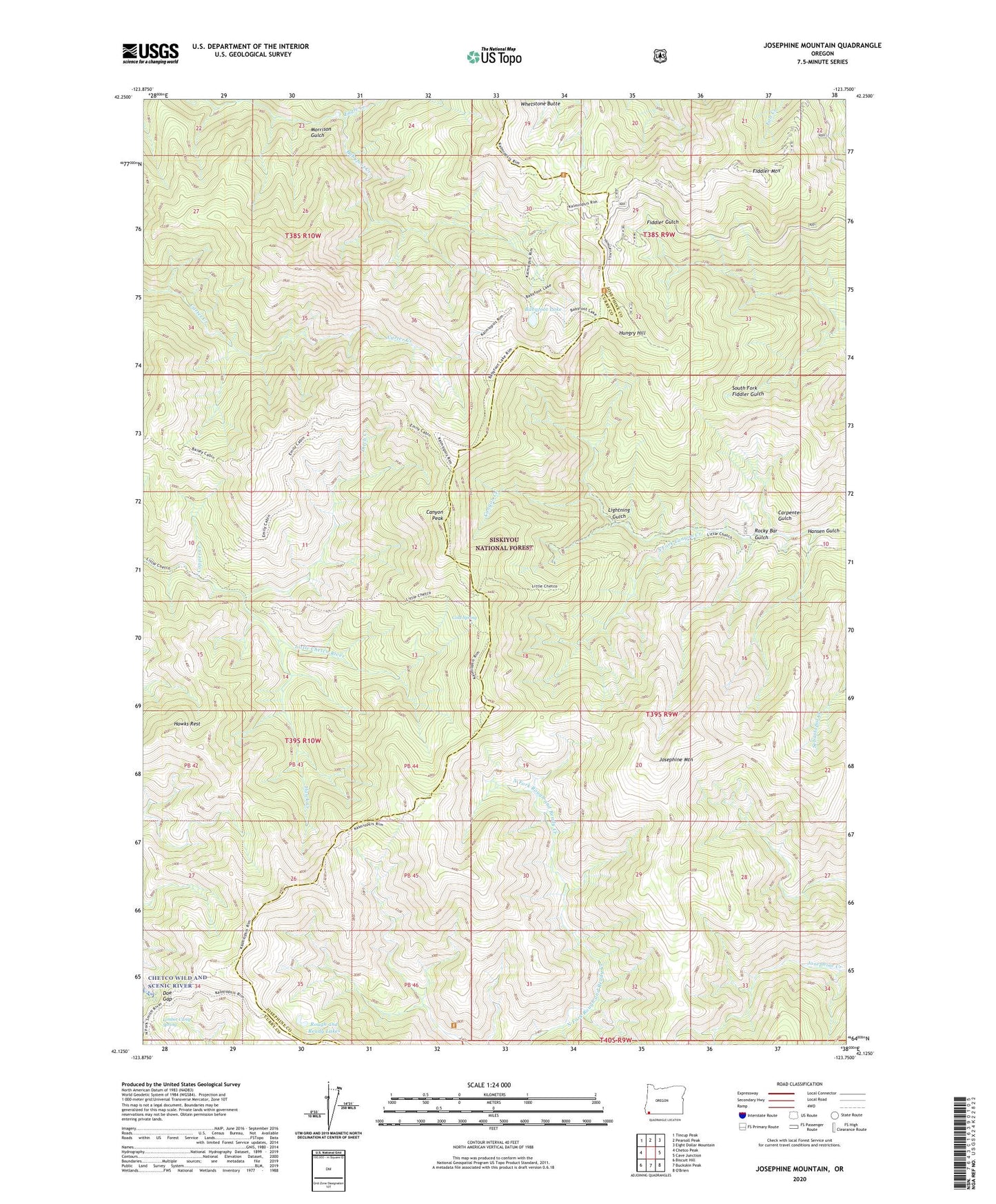
Josephine Mountain Oregon US Topo Map
Couldn't load pickup availability
Also explore the Josephine Mountain Forest Service Topo of this same quad for updated USFS data
2023 topographic map quadrangle Josephine Mountain in the state of Oregon. Scale: 1:24000. Based on the newly updated USGS 7.5' US Topo map series, this map is in the following counties: Josephine, Curry. The map contains contour data, water features, and other items you are used to seeing on USGS maps, but also has updated roads and other features. This is the next generation of topographic maps. Printed on high-quality waterproof paper with UV fade-resistant inks.
Quads adjacent to this one:
West: Chetco Peak
Northwest: Tincup Peak
North: Pearsoll Peak
Northeast: Eight Dollar Mountain
East: Cave Junction
Southeast: O'Brien
South: Buckskin Peak
Southwest: Biscuit Hill
This map covers the same area as the classic USGS quad with code o42123b7.
Contains the following named places: Alberg Mine, Babyfoot Lake, Babyfoot Lake Area, Babyfoot Mine, Bailey Cabin, Canyon Peak, Carpenter Gulch, Cold Spring, Cold Springs Camp, Copper Creek, Ditch Creek, Doe Gap, Eagle Creek, Emily Cabin, Fiddler Mountain, Hansen Gulch, Hawk Creek, Hawks Rest, Hungry Hill, Josephine Mountain, Lightning Gulch, Limber Camp Spring, Morrison Gulch, Onion Camp, Rocky Bar Gulch, Rough and Ready Lakes, South Fork Canyon Creek, Whetstone Butte