MyTopo
Breitenbush Hot Springs Oregon US Topo Map
Couldn't load pickup availability
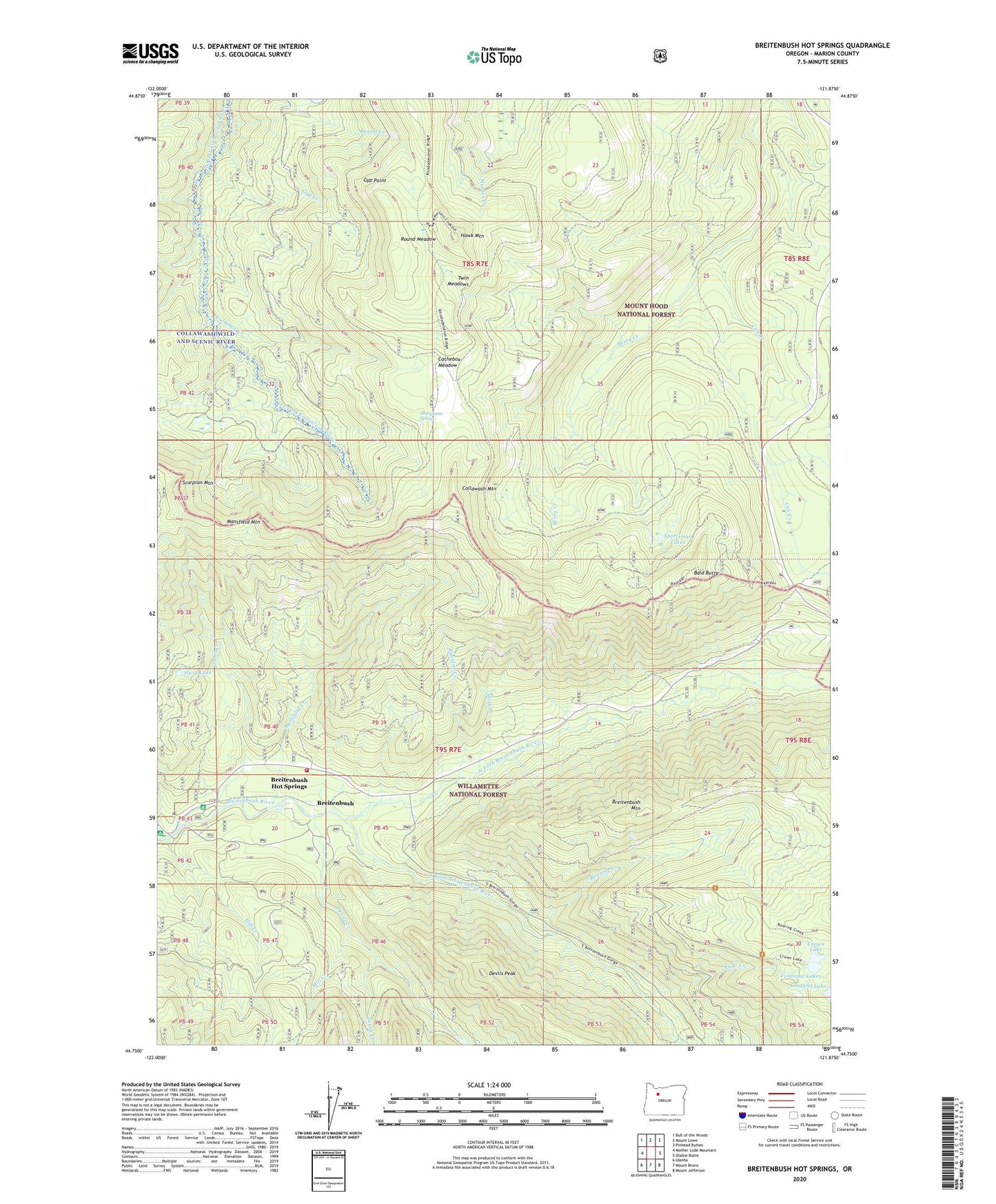
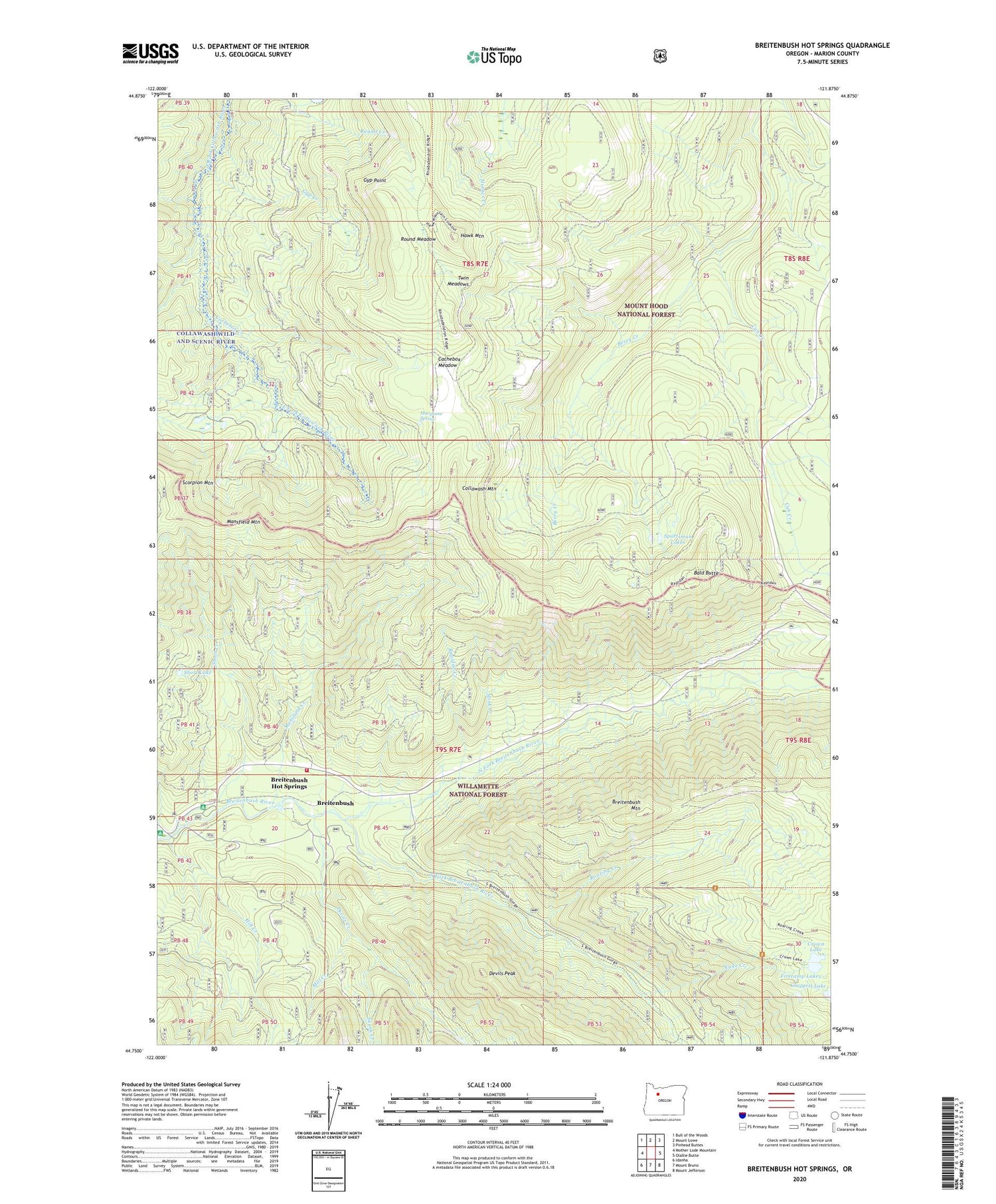
2020 topographic map quadrangle Breitenbush Hot Springs in the state of Oregon. Scale: 1:24000. Based on the newly updated USGS 7.5' US Topo map series, this map is in the following counties: Marion. The map contains contour data, water features, and other items you are used to seeing on USGS maps, but also has updated roads and other features. This is the next generation of topographic maps. Printed on high-quality waterproof paper with UV fade-resistant inks.
Quads adjacent to this one:
West: Mother Lode Mountain
Northwest: Bull of the Woods
North: Mount Lowe
Northeast: Pinhead Buttes
East: Olallie Butte
Southeast: Mount Jefferson
South: Mount Bruno
Southwest: Idanha
Contains the following named places: Bald Butte, Berry Creek, Bow String Pit, Breiten Guard Station, Breitenbush, Breitenbush Fire Department, Breitenbush Hot Springs, Breitenbush Mountain, Breitenbush Post Office, Breitenbush Recreation Site, Cachebox Creek, Cachebox Meadow, Cascade Creek, Cleator Bend Recreation Site, Collawash Mountain, Crown Lake, Devils Creek, Devils Peak, Devils Peak Trail, East Fork Way, Firecamp Lakes, Gyp Creek, Gyp Point, Hawk Mountain, Hawk Mountain Quarry, Hill Creek, Janus Butte Trail, Lake Creek, Little Cedar Quarry, Mansfield Creek, Mansfield Mountain, Mansfield Trail, Maryanne Spring, Mill Creek, Mink Creek, Minnie Boohoo Creek, North Fork Breitenbush River, Queen Quarry, Rapidan Creek, Rapidan Trail, Rhododendron Ridge, Roaring Creek, Roaring Creek Trail, Round Lake Trail, Round Meadow, Scorpion Mountain, Short Creek, Short Lake, Skunk Creek, South Fork Breitenbush River, Sportsman Lakes, Thomas Trail, Twin Meadows, Twin Meadows Trail