MyTopo
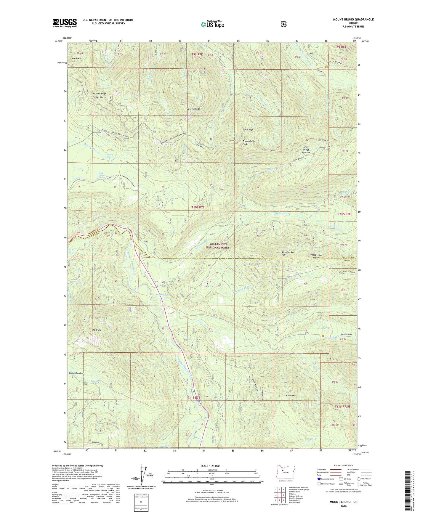
Mount Bruno Oregon US Topo Map
Couldn't load pickup availability
Also explore the Mount Bruno Forest Service Topo of this same quad for updated USFS data
2023 topographic map quadrangle Mount Bruno in the state of Oregon. Scale: 1:24000. Based on the newly updated USGS 7.5' US Topo map series, this map is in the following counties: Marion, Linn. The map contains contour data, water features, and other items you are used to seeing on USGS maps, but also has updated roads and other features. This is the next generation of topographic maps. Printed on high-quality waterproof paper with UV fade-resistant inks.
Quads adjacent to this one:
West: Idanha
Northwest: Mother Lode Mountain
North: Breitenbush Hot Springs
Northeast: Olallie Butte
East: Mount Jefferson
Southeast: Marion Lake
South: Marion Forks
Southwest: Coffin Mountain
This map covers the same area as the classic USGS quad with code o44121f8.
Contains the following named places: Bachelor Mountain Trail, Big Springs Campground, Boulder Ridge, Bruno Meadows, Cheat Creek, Crag Creek, Gale Hill, Grizzly Creek, Little Pigeon Prairie, Milk Creek, Minto Creek, Minto Mountain, Mount Bruno, Outerson Mountain, Pamelia Creek, Peasley Lake, Pigeon Prairie, Red Creek, Riverside Recreation Site, Russell Creek, Sentinel Creek, South Breitenbush Trail, Spire Rock, Spring Creek, Timber Butte, Triangulation Peak, Tunnel Creek, Whitewater Campground, Whitewater Creek, Wild Cheat Meadow, Woodpecker Creek, Woodpecker Hill, Woodpecker Ridge, Woodpecker Trail, ZIP Code: 97342