MyTopo
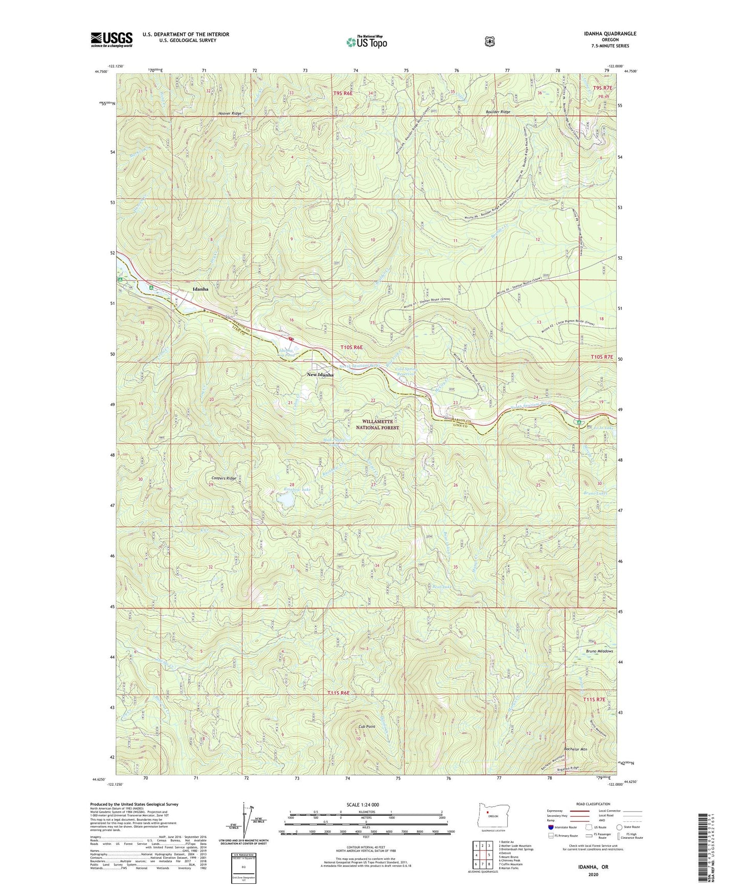
Idanha Oregon US Topo Map
Couldn't load pickup availability
Also explore the Idanha Forest Service Topo of this same quad for updated USFS data
2024 topographic map quadrangle Idanha in the state of Oregon. Scale: 1:24000. Based on the newly updated USGS 7.5' US Topo map series, this map is in the following counties: Linn, Marion. The map contains contour data, water features, and other items you are used to seeing on USGS maps, but also has updated roads and other features. This is the next generation of topographic maps. Printed on high-quality waterproof paper with UV fade-resistant inks.
Quads adjacent to this one:
West: Detroit
Northwest: Battle Ax
North: Mother Lode Mountain
Northeast: Breitenbush Hot Springs
East: Mount Bruno
Southeast: Marion Forks
South: Coffin Mountain
Southwest: Chimney Peak
This map covers the same area as the classic USGS quad with code o44122f1.
Contains the following named places: Bachelor Mountain, Bear Lake, Bear Lake Creek, Birchwood, Blue Lick Creek, Boulder Creek, Bruno Lakes, Bruno Meadows Trail, Cabin Creek, Chitlam Creek, City of Idanha, Cold Spring Reservoir, Coopers Ridge, Corset Creek, Cub Point, Divide Creek, Dry Creek, Hammond Lumber Company Number 1, Hoover, Hoover Campground Boat Ramp, Hoover Group Camp, Hoover Post Office, Hoover Ridge, Idanha, Idanha - Detroit Rural Fire Protection District, Idanha City Hall, Idanha Free Lending Library, Idanha Log Pond, Idanha Municipal Water Treatment Plant, Idanha Post Office, Ivy Creek, Jo Jo Lake, Log Creek, Marys Creek, McCoy Creek, Misery Creek, Mud Puppy Lake, New Idanha, Rainbow Creek, Rainbow Lake, Santiam Flats Recreation Site, Tom Creek, Whispering Falls Recreation Site