MyTopo
Bronx Canyon Oregon US Topo Map
Couldn't load pickup availability
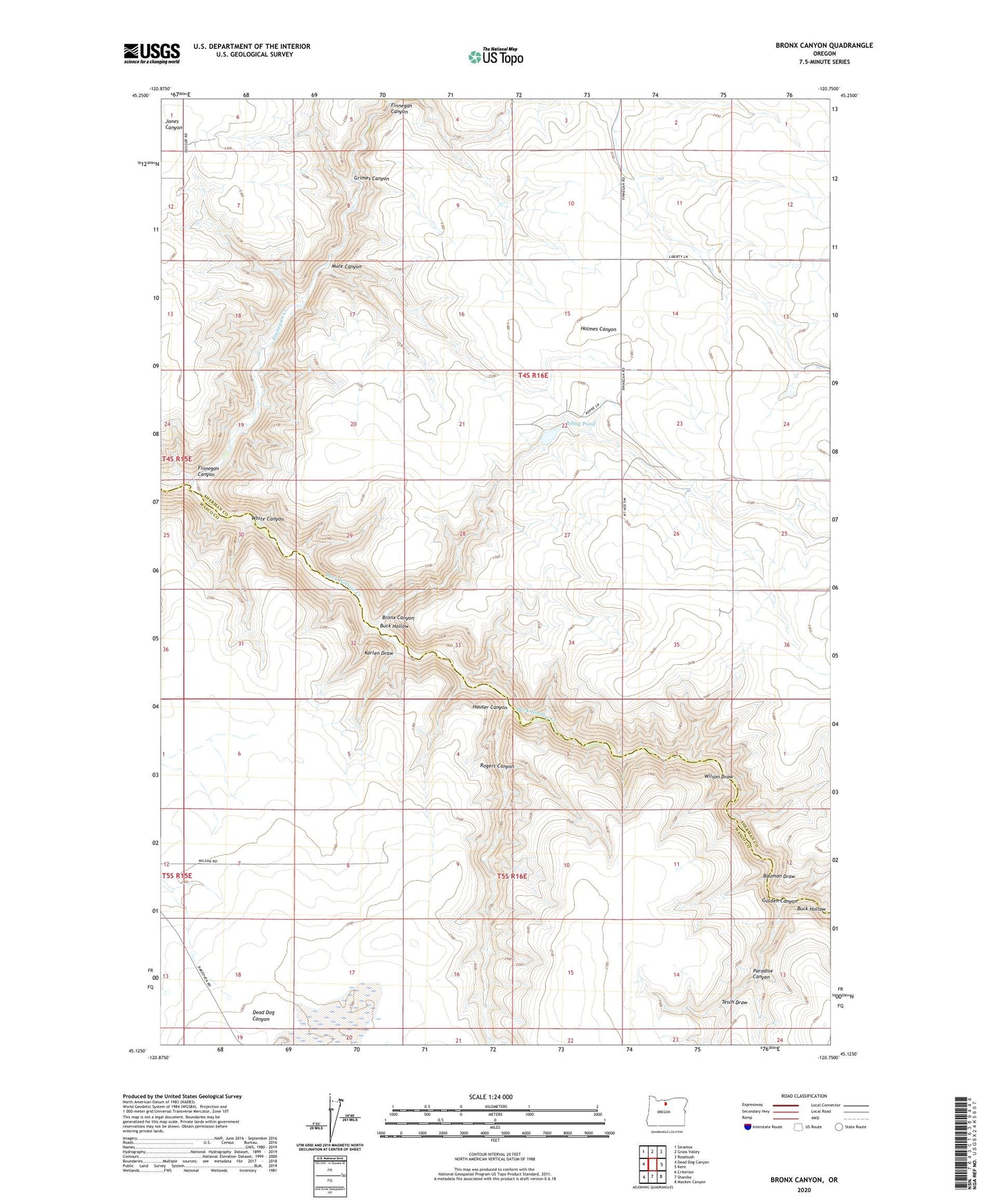
2020 topographic map quadrangle Bronx Canyon in the state of Oregon. Scale: 1:24000. Based on the newly updated USGS 7.5' US Topo map series, this map is in the following counties: Sherman, Wasco. The map contains contour data, water features, and other items you are used to seeing on USGS maps, but also has updated roads and other features. This is the next generation of topographic maps. Printed on high-quality waterproof paper with UV fade-resistant inks.
Quads adjacent to this one:
West: Dead Dog Canyon
Northwest: Sinamox
North: Grass Valley
Northeast: Rosebush
East: Kent
Southeast: Macken Canyon
South: Shaniko
Southwest: Criterion
Contains the following named places: Bauman Draw, Bibby Dam, Bibby Pond, Bronx Canyon, Finnegan Canyon, Finnegan Creek, Golden Canyon, Grimes Canyon, Hauser Canyon, Hinton Creek, Karlen Draw, Liberty, Mule Canyon, Paradise Canyon, Rogers Canyon, Tesch Draw, White Canyon, Wilson Draw