MyTopo
Brown Mountain Oregon US Topo Map
Couldn't load pickup availability
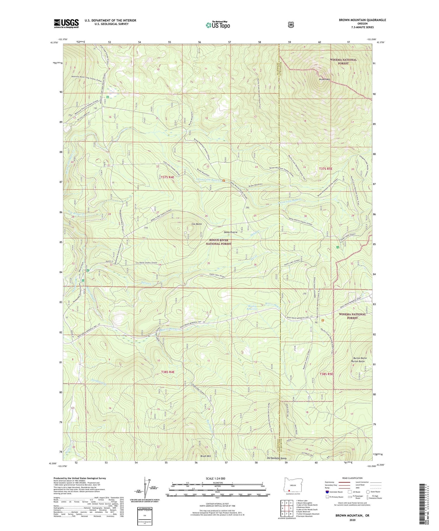
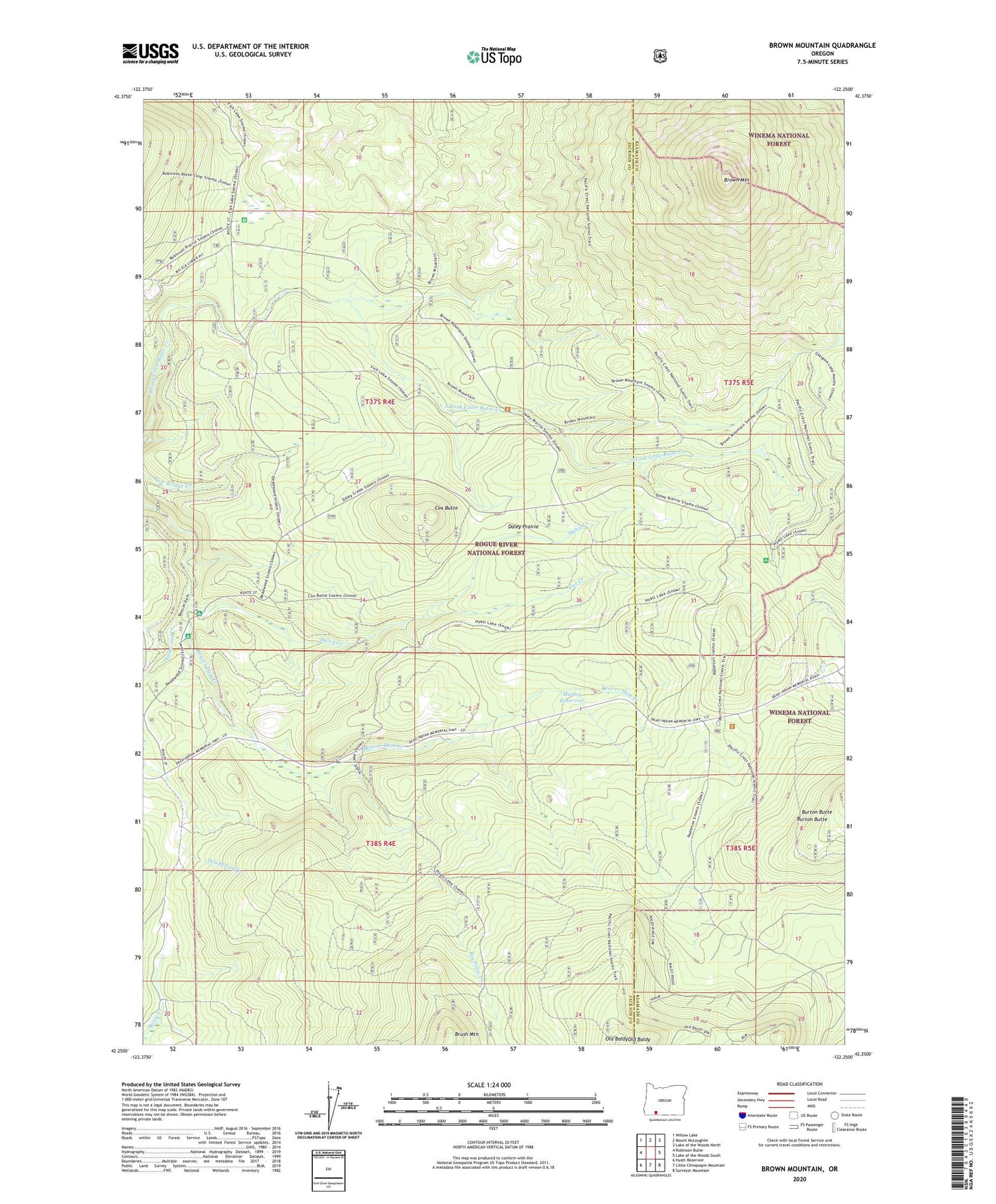
2020 topographic map quadrangle Brown Mountain in the state of Oregon. Scale: 1:24000. Based on the newly updated USGS 7.5' US Topo map series, this map is in the following counties: Jackson, Klamath. The map contains contour data, water features, and other items you are used to seeing on USGS maps, but also has updated roads and other features. This is the next generation of topographic maps. Printed on high-quality waterproof paper with UV fade-resistant inks.
Quads adjacent to this one:
West: Robinson Butte
Northwest: Willow Lake
North: Mount McLoughlin
Northeast: Lake of the Woods North
East: Lake of the Woods South
Southeast: Surveyor Mountain
South: Little Chinquapin Mountain
Southwest: Hyatt Reservoir
Contains the following named places: Beaver Dam Recreation Site, Big Draw Creek, Big Elk Guard Station, Big Elk Meadow, Brown Mountain, Brown Mountain Trail, Brush Mountain, Cox Butte, Cox Creek, Daley Creek, Daley Creek Dam, Daley Creek Recreation Site, Daley Prairie, Danley Creek Canal, Deadwood Creek, Deadwood Junction, Manley Reservoir, Moon Prairie Guard Station, Paradise, Pole Bridge Campgound, South Fork Canal, South Fork Dam, Swastika Post Office