MyTopo
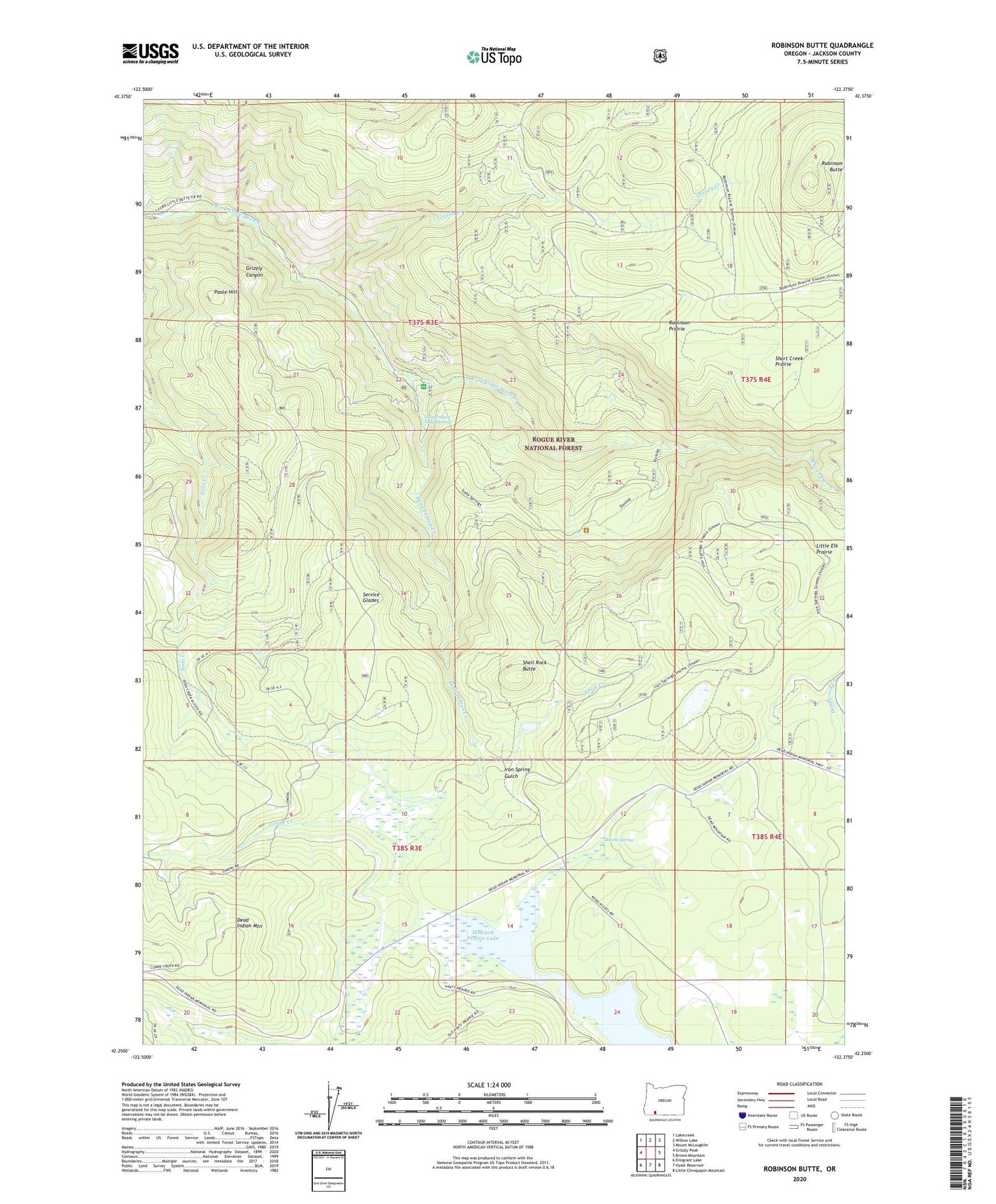
Robinson Butte Oregon US Topo Map
Couldn't load pickup availability
Also explore the Robinson Butte Forest Service Topo of this same quad for updated USFS data
2023 topographic map quadrangle Robinson Butte in the state of Oregon. Scale: 1:24000. Based on the newly updated USGS 7.5' US Topo map series, this map is in the following counties: Jackson. The map contains contour data, water features, and other items you are used to seeing on USGS maps, but also has updated roads and other features. This is the next generation of topographic maps. Printed on high-quality waterproof paper with UV fade-resistant inks.
Quads adjacent to this one:
West: Grizzly Peak
North: Willow Lake
Northeast: Mount McLoughlin
East: Brown Mountain
Southeast: Little Chinquapin Mountain
South: Hyatt Reservoir
Southwest: Emigrant Lake
This map covers the same area as the classic USGS quad with code o42122c4.
Contains the following named places: Beaver Dam Creek, Conde Creek, Deadwood, Deadwood Prairie, Ellick Creek, Gawa Church Camp, Grizzly Canyon, Grizzly County Campground, Grizzly Creek, Grizzly Creek Dam Number 2, Grizzly Creek Jackson County Boat Ramp, Hole-in-the-Rock, Hunts Post Office, Iron Spring Gulch, Latgawa Creek, Latgawa Mountain, Latgawa Pinnacles, Latgawa Soda Springs, Lilly Glen County Campground, Lilyglen, Lilyglen Post Office, Little Elk Prairie, Marjorie Falls, Owens Ranch, Owens Spring, Pole Bridge Creek, Poole Hill, Railroad Prairie, Robinson Butte, Robinson Prairie, Service Glades, Shell Rock Butte, Short Creek Prairie