MyTopo
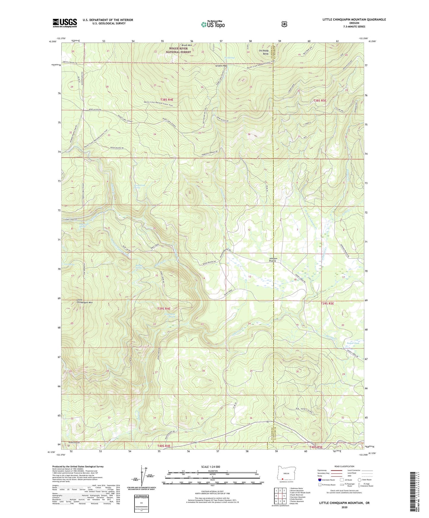
Little Chinquapin Mountain Oregon US Topo Map
Couldn't load pickup availability
Also explore the Little Chinquapin Mountain Forest Service Topo of this same quad for updated USFS data
2024 topographic map quadrangle Little Chinquapin Mountain in the state of Oregon. Scale: 1:24000. Based on the newly updated USGS 7.5' US Topo map series, this map is in the following counties: Jackson, Klamath. The map contains contour data, water features, and other items you are used to seeing on USGS maps, but also has updated roads and other features. This is the next generation of topographic maps. Printed on high-quality waterproof paper with UV fade-resistant inks.
Quads adjacent to this one:
West: Hyatt Reservoir
Northwest: Robinson Butte
North: Brown Mountain
Northeast: Lake of the Woods South
East: Surveyor Mountain
Southeast: Mule Hill
South: Parker Mountain
Southwest: Soda Mountain
This map covers the same area as the classic USGS quad with code o42122b3.
Contains the following named places: Big Springs, Bluejay Creek, Bluejay Spring, Cold Creek, Dogwood Spring, Fredenburg Spring, Green Creek, Griffin Pass, Grizzly Creek, Howard Prairie Canal, Jenny Creek Spring, Johnson Creek, Johnson Prairie, Little Chinquapin Mountain, Old Baldy, Pinehurst Cemetery, Sheepy Creek, Soda Creek, West Fork Johnson Creek, Yew Spring