MyTopo
Christmas Valley Oregon US Topo Map
Couldn't load pickup availability
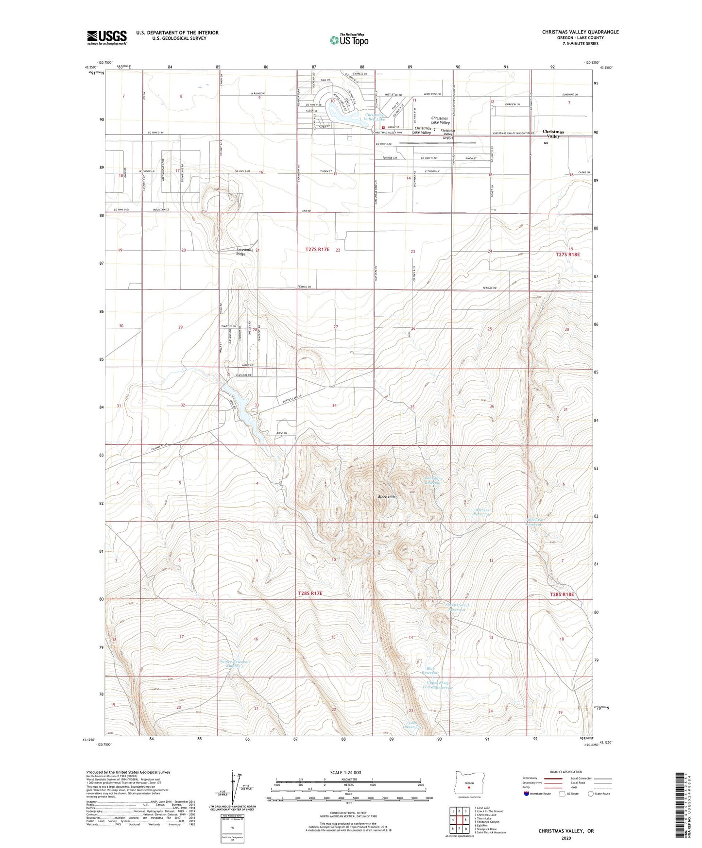
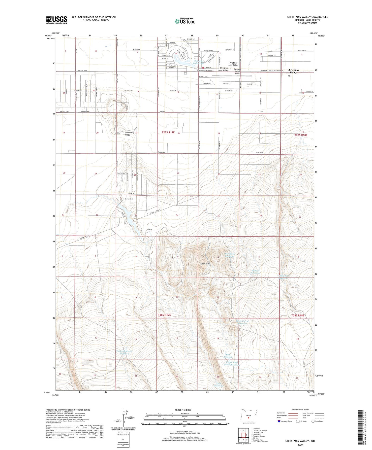
2020 topographic map quadrangle Christmas Valley in the state of Oregon. Scale: 1:24000. Based on the newly updated USGS 7.5' US Topo map series, this map is in the following counties: Lake. The map contains contour data, water features, and other items you are used to seeing on USGS maps, but also has updated roads and other features. This is the next generation of topographic maps. Printed on high-quality waterproof paper with UV fade-resistant inks.
Quads adjacent to this one:
West: Thorn Lake
Northwest: Lane Lake
North: Crack In The Ground
Northeast: Christmas Lake
East: Fandango Canyon
Southeast: Saint Patrick Mountain
South: Sheeplick Draw
Southwest: Egli Rim
Contains the following named places: Black Hills, Blue Reservoir, Boundary Reservoir, Century Ranch, Christmas Valley, Christmas Valley Airport, Christmas Valley Lake, Christmas Valley Post Office, Christmas Valley Rural Fire Protection District, Coffee Pot Reservoir, Guinee Reservoir Number 3, Lake County Libraries Christmas Valley Branch, Lake Post Office, Look Reservoir, Sevan Dam, Sevan Lake, Sevenmile Ridge, Sheep Corral Reservoir, Upper Sheep Corral Reservoir, Withers Reservoir