MyTopo
Sheeplick Draw Oregon US Topo Map
Couldn't load pickup availability
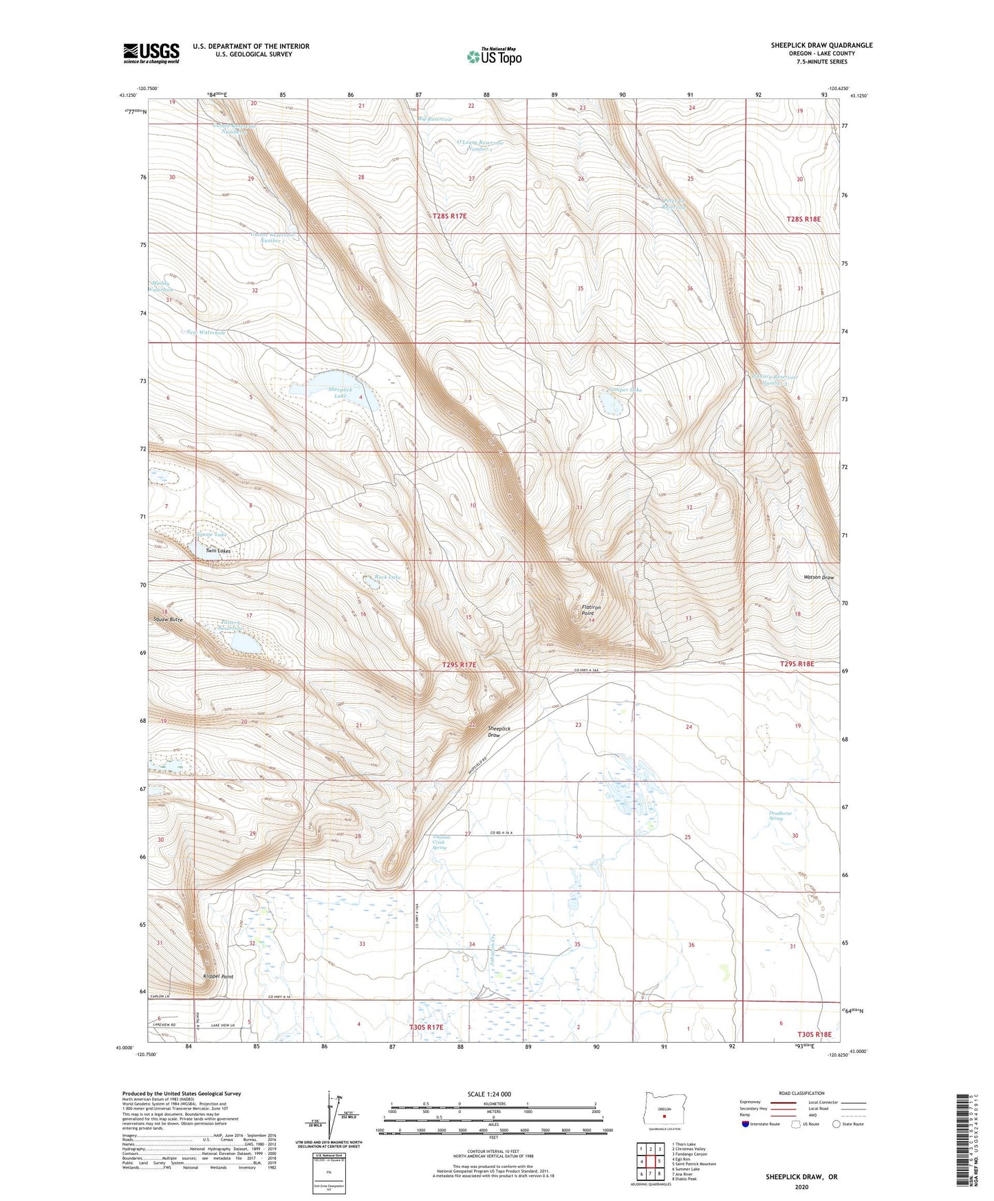
2024 topographic map quadrangle Sheeplick Draw in the state of Oregon. Scale: 1:24000. Based on the newly updated USGS 7.5' US Topo map series, this map is in the following counties: Lake. The map contains contour data, water features, and other items you are used to seeing on USGS maps, but also has updated roads and other features. This is the next generation of topographic maps. Printed on high-quality waterproof paper with UV fade-resistant inks.
Quads adjacent to this one:
West: Egli Rim
Northwest: Thorn Lake
North: Christmas Valley
Northeast: Fandango Canyon
East: Saint Patrick Mountain
Southeast: Diablo Peak
South: Ana River
Southwest: Summer Lake
This map covers the same area as the classic USGS quad with code o43120a6.
Contains the following named places: Big Reservoir, Deadhorse Spring, Flatiron Point, Guinee Reservoir Number 1, Guinee Reservoir Number 2, Hale Well, Harney Well, Hinton Well, Johnson Creek, Johnson Creek Spring, Juniper Lake, Klippel Place, Klippel Point, Klippel Well, New Waterhole, O'Leary Reservoir Number 1, O'Leary Reservoir Number 3, Pattern Reservoir, Peter Creek Reservoir, Rock Lake, Sedora Well, Sheeplick Draw, Sheeplick Lake, Small Ranch, Squaw Butte, Squaw Lake, Swanton Well, Twin Lakes, Watson Draw