MyTopo
Clover Swale Oregon US Topo Map
Couldn't load pickup availability
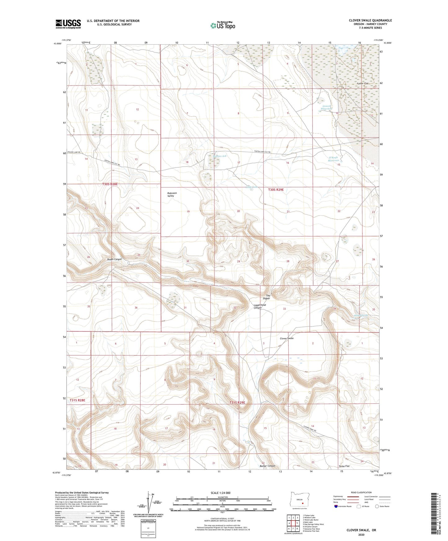
2023 topographic map quadrangle Clover Swale in the state of Oregon. Scale: 1:24000. Based on the newly updated USGS 7.5' US Topo map series, this map is in the following counties: Harney. The map contains contour data, water features, and other items you are used to seeing on USGS maps, but also has updated roads and other features. This is the next generation of topographic maps. Printed on high-quality waterproof paper with UV fade-resistant inks.
Quads adjacent to this one:
West: Balls Lake
Northwest: Flybee Lake
North: Meadow Lake
Northeast: Weed Lake Butte
East: Keg Springs Valley West
Southeast: Duhaime Flat East
South: Duhaime Flat West
Southwest: Orejana Canyon
This map covers the same area as the classic USGS quad with code o42119h3.
Contains the following named places: Barber Canyon, Clover Swale, Dudes Canyon, Foster Flat, Gravel Waterhole, Hidden Spring, Hiddensprings Post Office, Kerns Waterhole, Little Lake, Loggerhead Canyon, Matties Ark, O'Keefe Reservoir, The Dipper