MyTopo
Delena Oregon US Topo Map
Couldn't load pickup availability
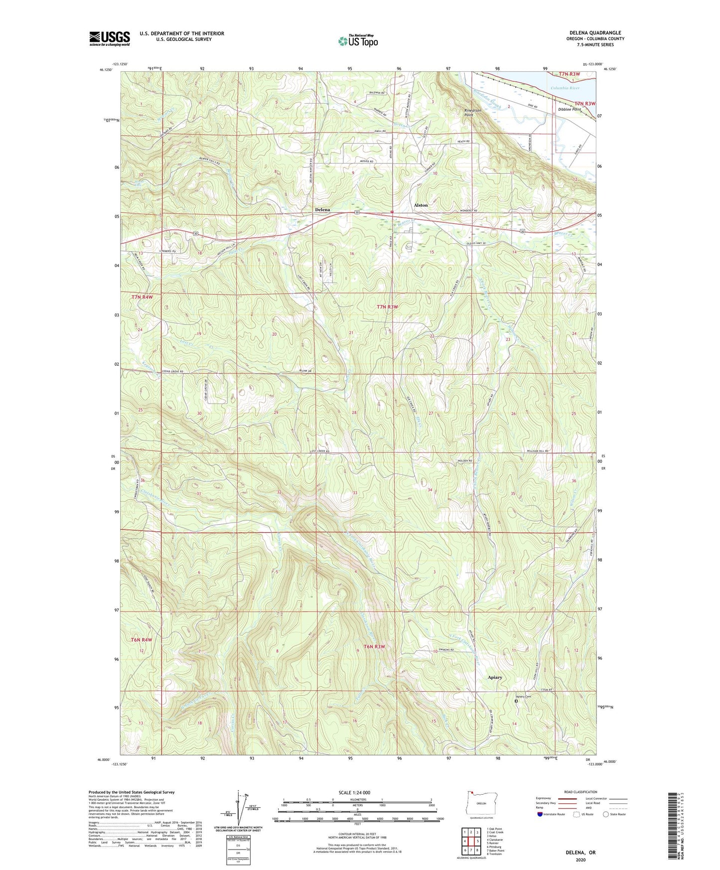
2020 topographic map quadrangle Delena in the state of Oregon. Scale: 1:24000. Based on the newly updated USGS 7.5' US Topo map series, this map is in the following counties: Columbia. The map contains contour data, water features, and other items you are used to seeing on USGS maps, but also has updated roads and other features. This is the next generation of topographic maps. Printed on high-quality waterproof paper with UV fade-resistant inks.
Quads adjacent to this one:
West: Clatskanie
Northwest: Oak Point
North: Coal Creek
Northeast: Kelso
East: Rainier
Southeast: Trenholm
South: Baker Point
Southwest: Pittsburg
Contains the following named places: Alston, Apiary, Apiary Cemetery, Apiary Post Office, Beaver Falls, Buck Creek, Carcus Creek, Cedar Grove School, Clatskanie Rural Fire Delena Station, Delena, Delena Post Office, Dibblee Point, Elk Creek, Falls Creek, Firwood Post Office, Hudson, Hudson Post Office, Kyser, Kyser Post Office, Lost Creek, Lost Creek School, North Fork Clatskanie River, Palm Creek, Rinearson Point, South Fork Beaver Creek, Swedetown, West Fork Carcus Creek, Wilson Creek