MyTopo
Clatskanie Oregon US Topo Map
Couldn't load pickup availability
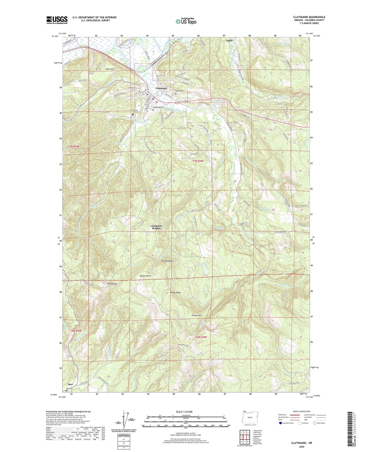
2024 topographic map quadrangle Clatskanie in the state of Oregon. Scale: 1:24000. Based on the newly updated USGS 7.5' US Topo map series, this map is in the following counties: Columbia. The map contains contour data, water features, and other items you are used to seeing on USGS maps, but also has updated roads and other features. This is the next generation of topographic maps. Printed on high-quality waterproof paper with UV fade-resistant inks.
Quads adjacent to this one:
West: Marshland
Northwest: Nassa Point
North: Oak Point
Northeast: Coal Creek
East: Delena
Southeast: Baker Point
South: Pittsburg
Southwest: Birkenfeld
This map covers the same area as the classic USGS quad with code o46123a2.
Contains the following named places: Alder Grove School, Beaver Boat Ramp, Beaver Dredge Cut, Benson Lookout, Benson Point, Big Spring, Bryant Cemetery, City of Clatskanie, Clatskanie, Clatskanie - Vernonia Justice Court, Clatskanie City Hall, Clatskanie City Park, Clatskanie Division, Clatskanie Elementary School, Clatskanie Heights, Clatskanie Library District, Clatskanie Middle - High School, Clatskanie Municipal Court, Clatskanie Police Department, Clatskanie Post Office, Clatskanie Presbyterian Church, Clatskanie Public Works, Clatskanie River, Clatskanie Rural Fire Main Station, Clatskanie Sewage Treatment Plant, Clatskanie Station, Clatskanie Transit Center, Clatskanie Transit Center Park and Ride, Clatskanie United Methodist Church, Conyers Creek, Dent Post Office, East Creek, Eastman Creek, Fall Creek, Gateway Worship Center, Goat Ranch, Keystone Creek, Langfeld Creek, Maplewood Cemetery, Martin Creek, Merril Creek, Messing Creek, Miller Creek, Mist Cemetery, Murray Hill Cemetery, Page Creek, Palm, Palm Hill, Roaring Creek, Scout Lake, The Billboard, Vonberg Creek, West Creek, Windy Gap, Windy Mountain, Windy Ridge