MyTopo
Pittsburg Oregon US Topo Map
Couldn't load pickup availability
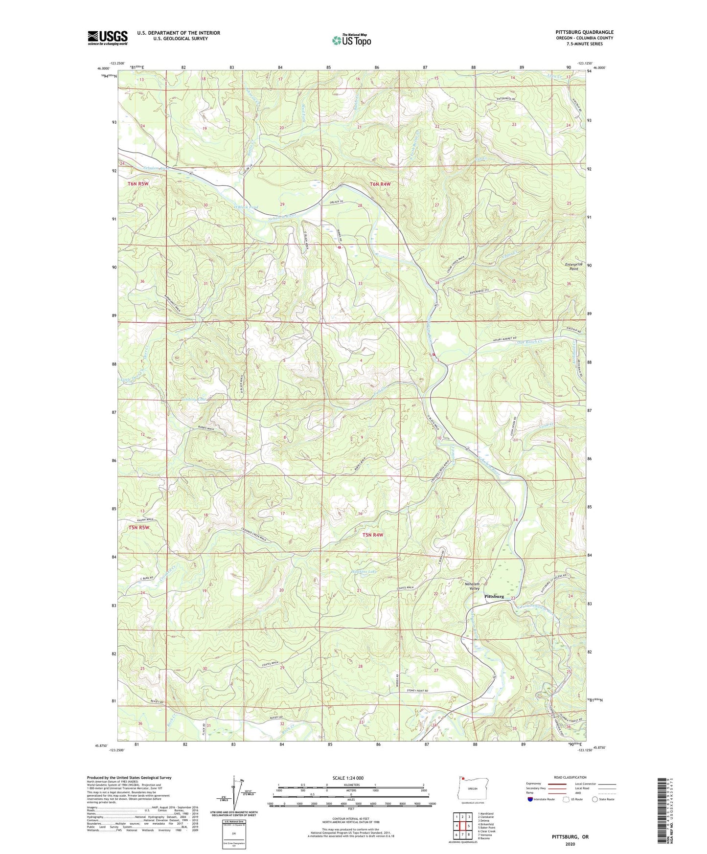
2023 topographic map quadrangle Pittsburg in the state of Oregon. Scale: 1:24000. Based on the newly updated USGS 7.5' US Topo map series, this map is in the following counties: Columbia. The map contains contour data, water features, and other items you are used to seeing on USGS maps, but also has updated roads and other features. This is the next generation of topographic maps. Printed on high-quality waterproof paper with UV fade-resistant inks.
Quads adjacent to this one:
West: Birkenfeld
Northwest: Marshland
North: Clatskanie
Northeast: Delena
East: Baker Point
Southeast: Bacona
South: Vernonia
Southwest: Clear Creek
This map covers the same area as the classic USGS quad with code o45123h2.
Contains the following named places: Archibald Creek, Battle Creek, Big Eddy County Park, Big Eddy Park, Cedar Creek, Clatsop State Forest, Cook Creek, Crooked Creek, Deer Creek, East Fork Nehalem River, Enterprise Point, Fall Creek, Gus Creek, Hawkins Lake, Johnson Creek, Lindsay Lake, Little Deer Creek, Mist - Birkenfeld Rural Fire Protection District Burris Station, Mist - Birkenfeld Rural Fire Protection District Peterson Station, Mud Fork, Natal, Natal Post Office, Oak Ranch Creek, O'Black Pond, Pioneer Park, Pittsburg, Pittsburg Guard Station, Pittsburg Post Office, Poynter, South Fork Battle Creek, Vernonia Division