MyTopo
Devils Peak Oregon US Topo Map
Couldn't load pickup availability
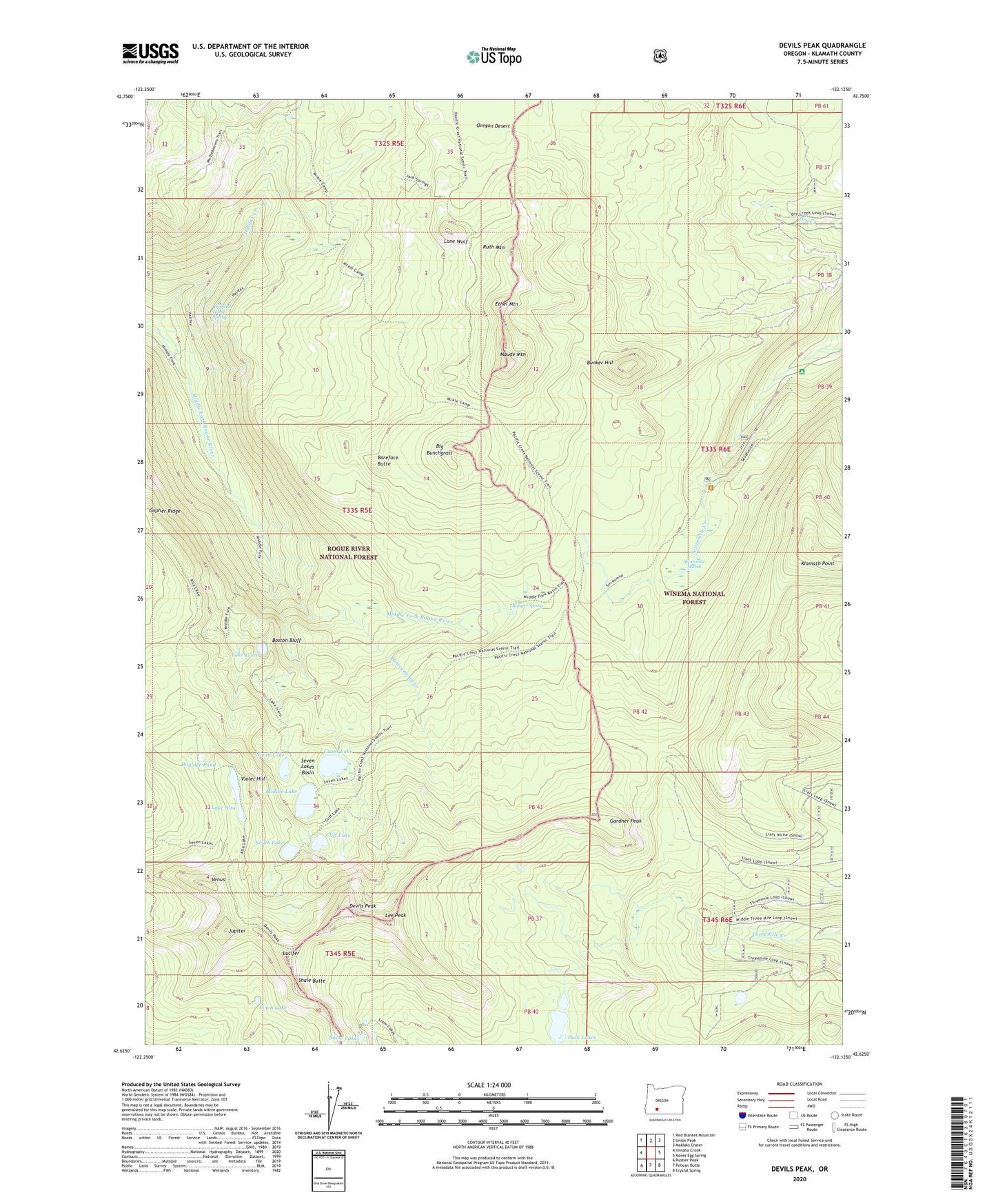
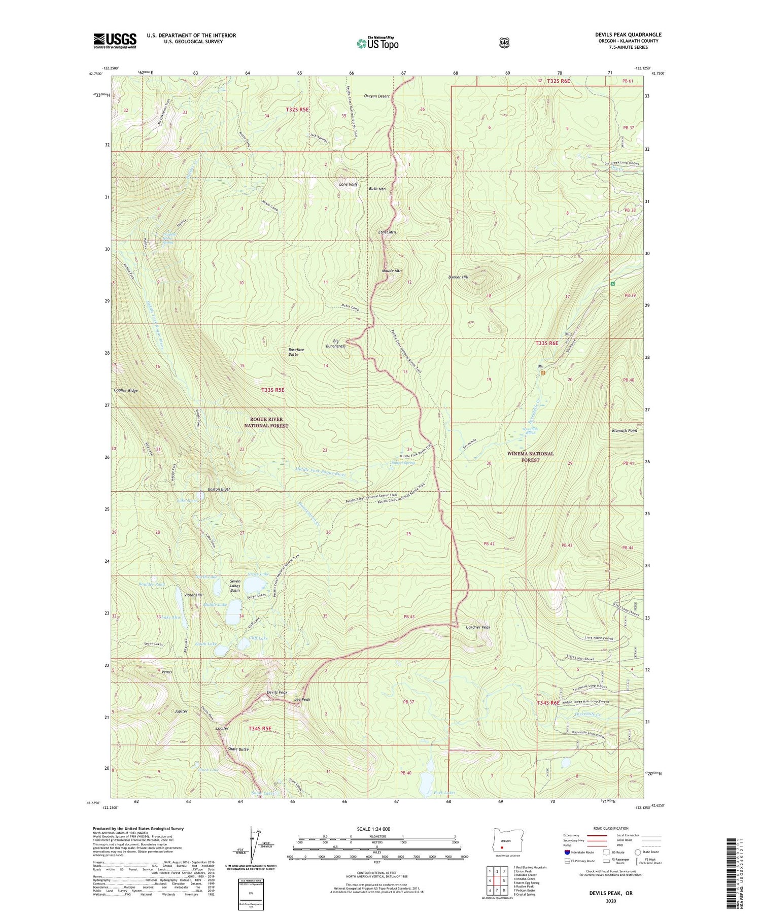
2020 topographic map quadrangle Devils Peak in the state of Oregon. Scale: 1:24000. Based on the newly updated USGS 7.5' US Topo map series, this map is in the following counties: Klamath. The map contains contour data, water features, and other items you are used to seeing on USGS maps, but also has updated roads and other features. This is the next generation of topographic maps. Printed on high-quality waterproof paper with UV fade-resistant inks.
Quads adjacent to this one:
West: Imnaha Creek
Northwest: Red Blanket Mountain
North: Union Peak
Northeast: Maklaks Crater
East: Mares Egg Spring
Southeast: Crystal Spring
South: Pelican Butte
Southwest: Rustler Peak
Contains the following named places: Alta Campground, Alta Lake Trail, Bareface Butte, Big Bunchgrass, Boston Bluff, Boulder Pond, Bunker Hill, Cliff Lake, Cliff Lake Campground, Crippled Horse Spring, Devils Peak, Dry Creek Trail, Ethel Mountain, Finch Lake, Gardner Peak, Gopher Ridge, Grass Lake, Grass Lake Campground, Grass Lake Campground Number 2, Halifax Trail, Honeymoon Creek, Jupiter, Lake Alta, Lake Ivern, Lee Peak, Lone Wolf, Lucifer, Maude Mountain, McKie Camp, Middle Lake, Moude Mountain Trail, North Lake, Oregon Desert, Puck Lakes, Ranger Spring, Ruth Mountain, Seven Lakes Basin, Sevenmile Marsh, Sevenmile Marsh Campground, Sevenmile Marsh Trailhead, Sevenmile Trail, Shale Butte, Snow Lakes, Solace Camp, South Lake, South Lake Campground, Venus, Violet Hill