MyTopo
Red Blanket Mountain Oregon US Topo Map
Couldn't load pickup availability
Also explore the Red Blanket Mountain Forest Service Topo of this same quad for updated USFS data
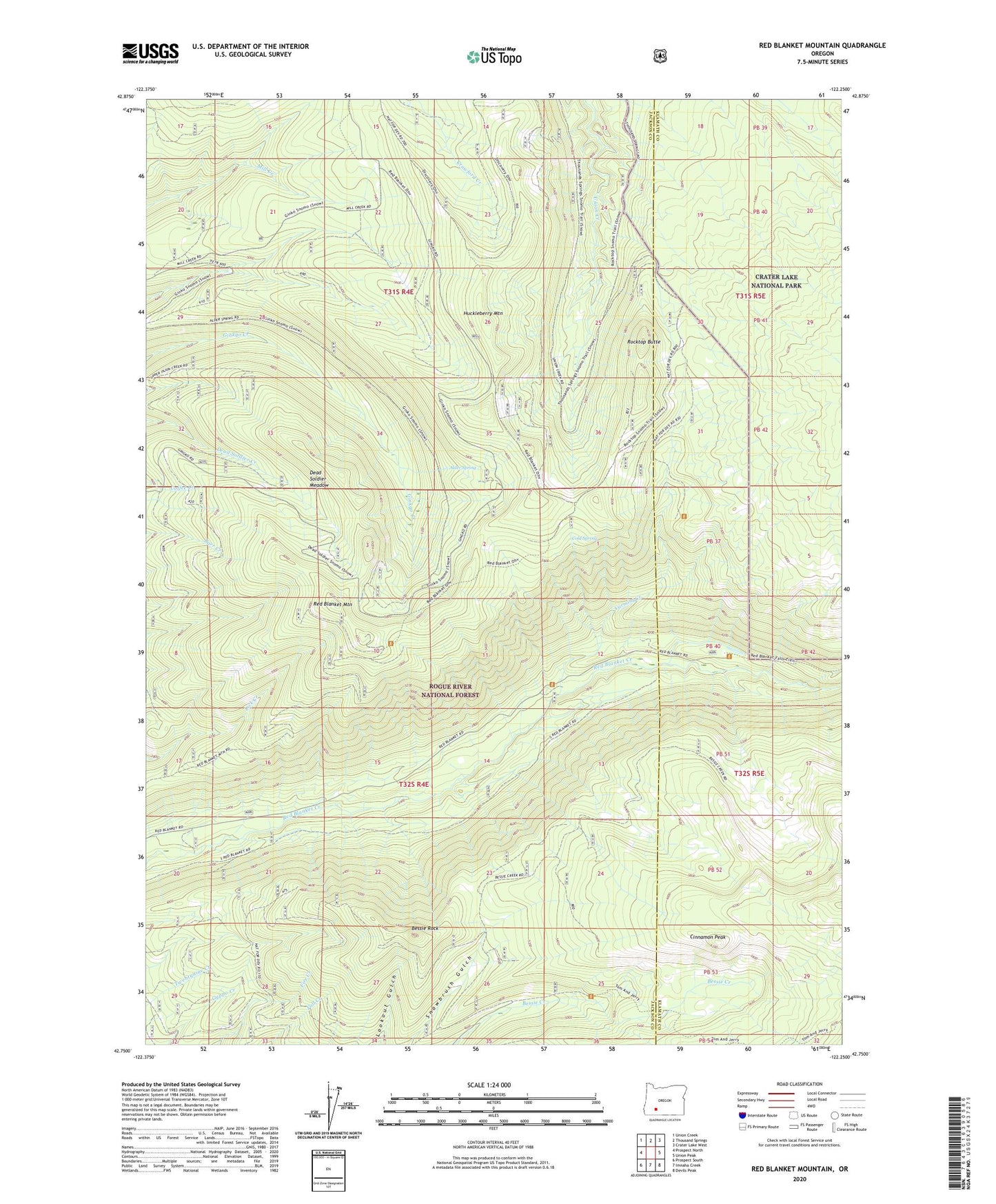
2023 topographic map quadrangle Red Blanket Mountain in the state of Oregon. Scale: 1:24000. Based on the newly updated USGS 7.5' US Topo map series, this map is in the following counties: Jackson, Klamath. The map contains contour data, water features, and other items you are used to seeing on USGS maps, but also has updated roads and other features. This is the next generation of topographic maps. Printed on high-quality waterproof paper with UV fade-resistant inks.
Quads adjacent to this one:
West: Prospect North
Northwest: Union Creek
North: Thousand Springs
Northeast: Crater Lake West
East: Union Peak
Southeast: Devils Peak
South: Imnaha Creek
Southwest: Prospect South
This map covers the same area as the classic USGS quad with code o42122g3.
Contains the following named places: Alder Spring, Bessie Rock, Bessie Shelter, Cinnamon Peak, Cold Spring, Cold Spring Trail, Dead Soldier Camp, Dead Soldier Meadow, Dead Soldier Trail, Frenchman Camp Trail, Huckleberry Mountain, Lucky Camp Trail, Mill Creek Trail, Red Blanket Mountain, Red Blanket Trail, Rocktop Butte, Thousand Springs Trail, Tom and Jerry Trail, Varmint Camp, Varmint Creek