MyTopo
Egli Rim Oregon US Topo Map
Couldn't load pickup availability
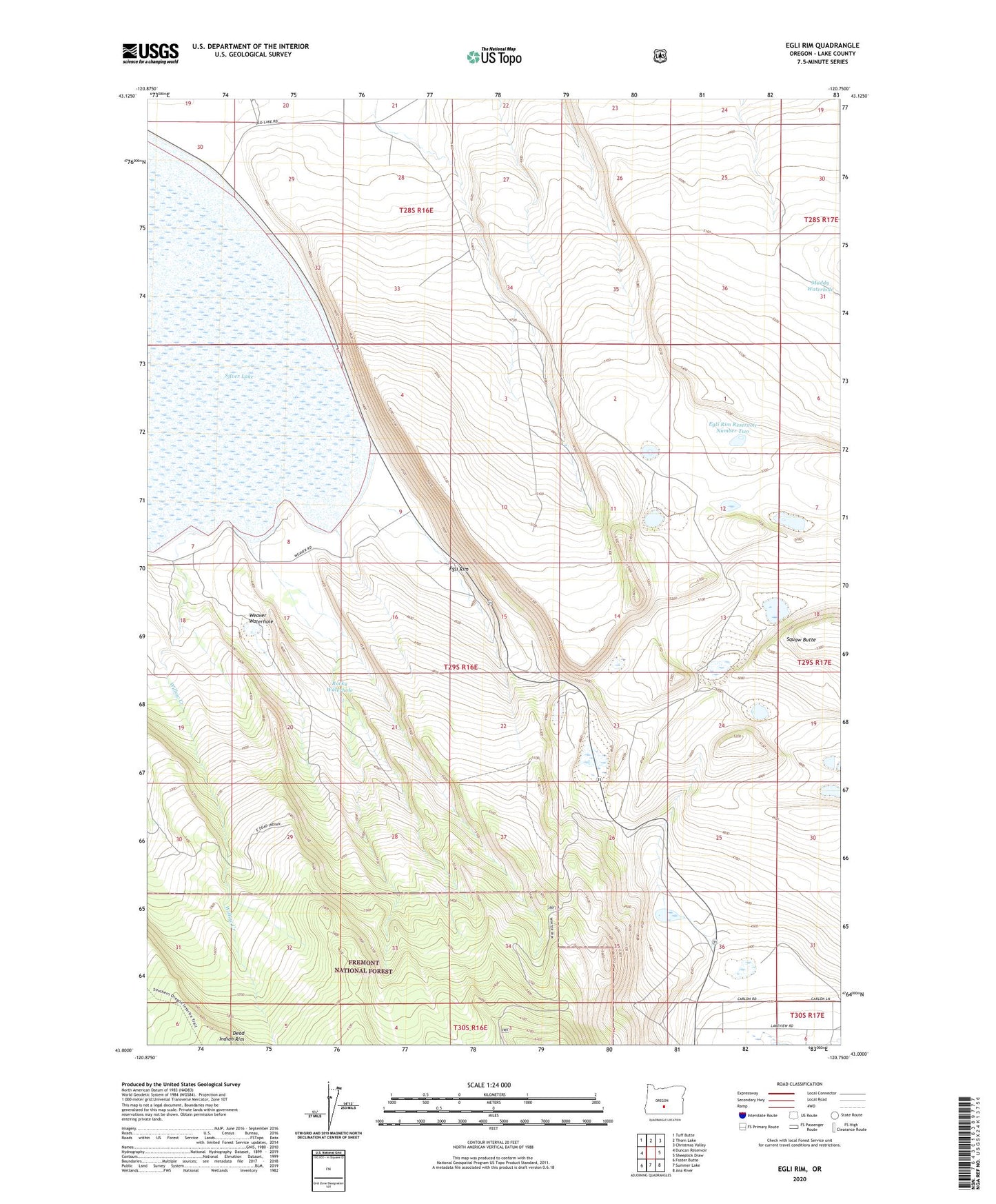
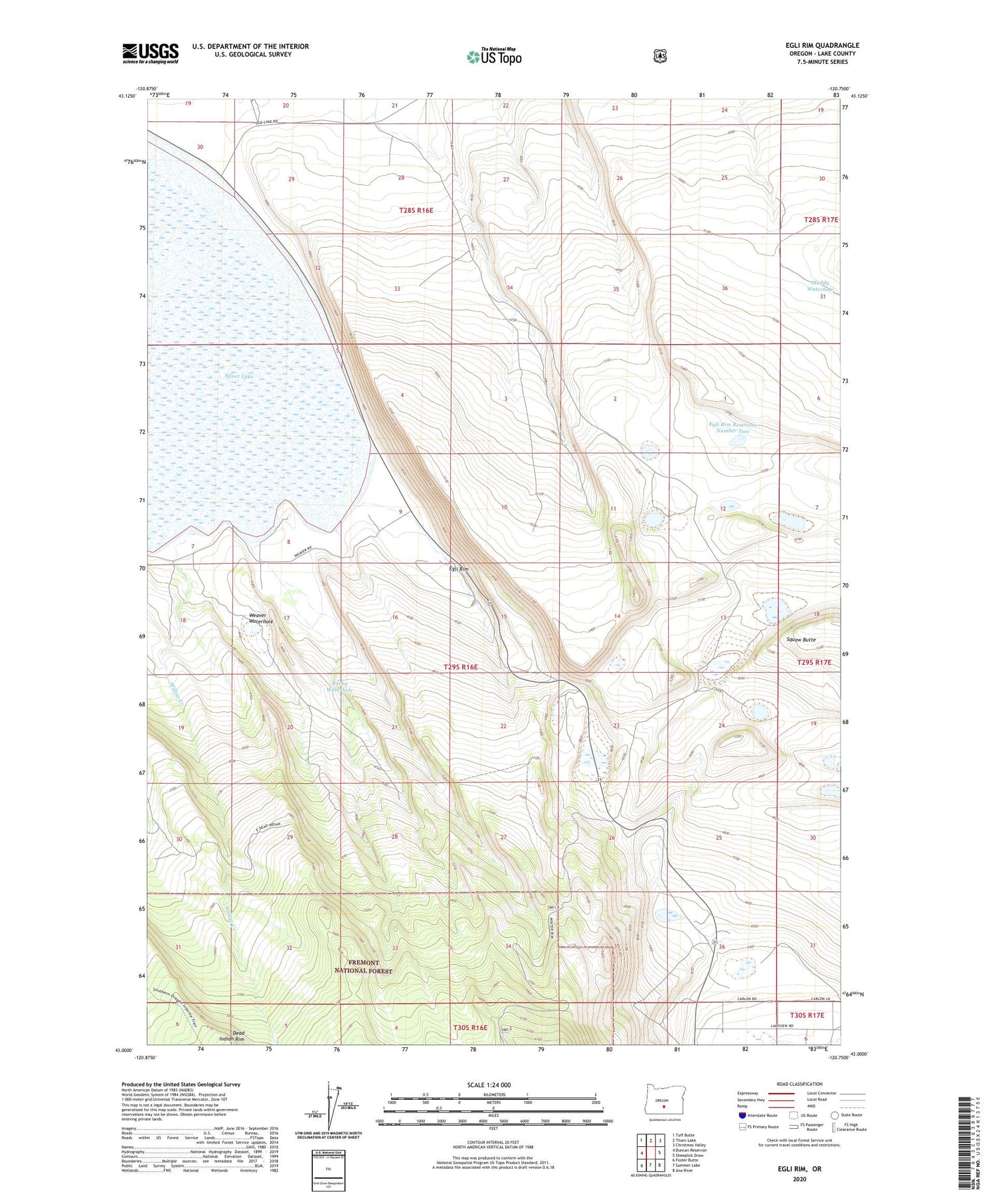
2020 topographic map quadrangle Egli Rim in the state of Oregon. Scale: 1:24000. Based on the newly updated USGS 7.5' US Topo map series, this map is in the following counties: Lake. The map contains contour data, water features, and other items you are used to seeing on USGS maps, but also has updated roads and other features. This is the next generation of topographic maps. Printed on high-quality waterproof paper with UV fade-resistant inks.
Quads adjacent to this one:
West: Duncan Reservoir
Northwest: Tuff Butte
North: Thorn Lake
Northeast: Christmas Valley
East: Sheeplick Draw
Southeast: Ana River
South: Summer Lake
Southwest: Foster Butte
Contains the following named places: Egli Rim, Egli Rim Reservoir Number One, Egli Rim Reservoir Number Two, Muddy Waterhole, Rocky Waterhole, Weaver Waterhole, Willow Creek