MyTopo
Elsie Oregon US Topo Map
Couldn't load pickup availability
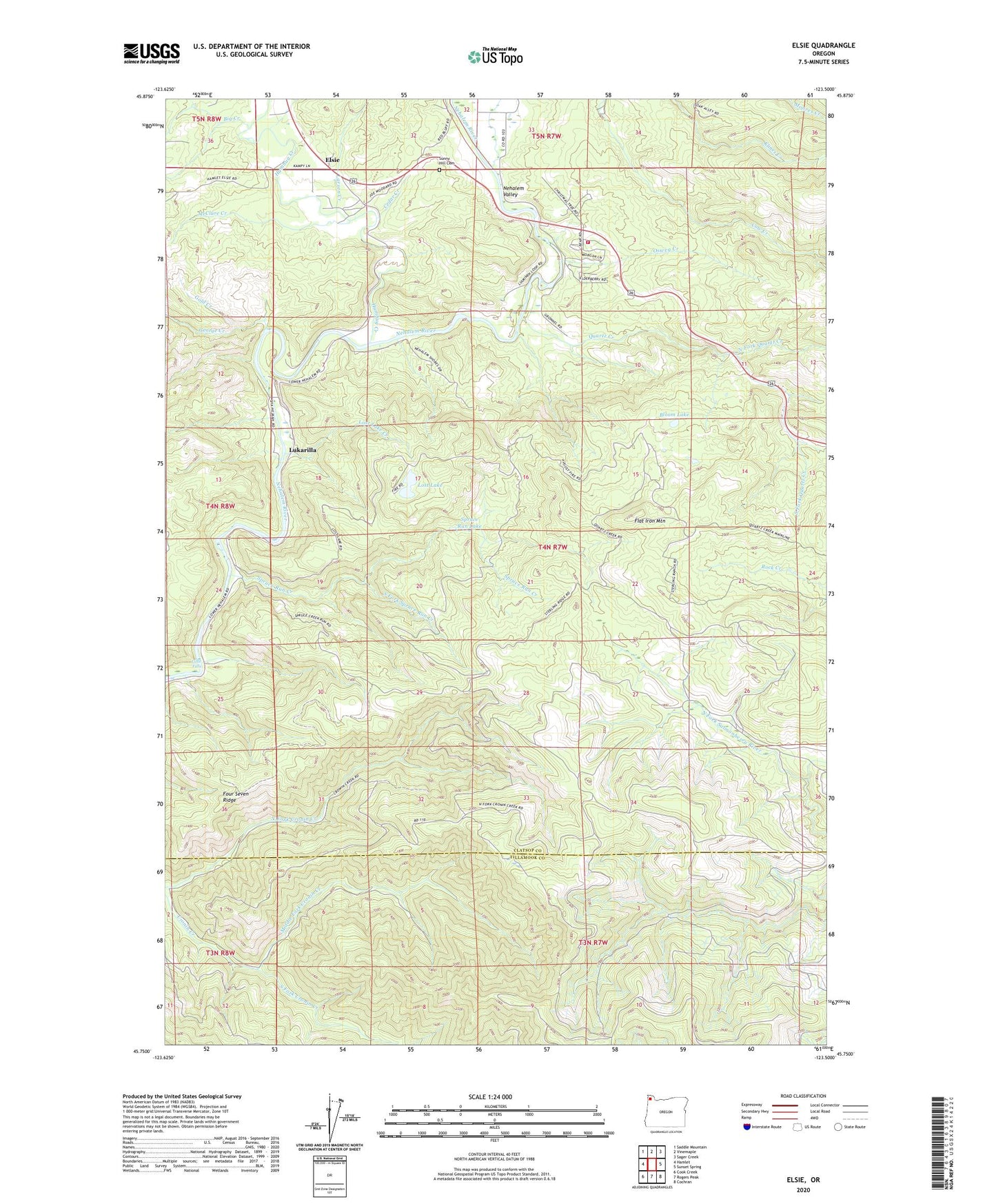
2020 topographic map quadrangle Elsie in the state of Oregon. Scale: 1:24000. Based on the newly updated USGS 7.5' US Topo map series, this map is in the following counties: Clatsop, Tillamook. The map contains contour data, water features, and other items you are used to seeing on USGS maps, but also has updated roads and other features. This is the next generation of topographic maps. Printed on high-quality waterproof paper with UV fade-resistant inks.
Quads adjacent to this one:
West: Hamlet
Northwest: Saddle Mountain
North: Vinemaple
Northeast: Sager Creek
East: Sunset Spring
Southeast: Cochran
South: Rogers Peak
Southwest: Cook Creek
Contains the following named places: Big Creek, Bloom Lake, Camp Olson, Cedar Creek, Elsie, Elsie - Vinemaple Rural Fire Protection District 11, Elsie Post Office, Flat Iron Mountain, Four Seven Ridge, George Creek, Gold Creek, Howard Rierson Spruce Run County Park, Humbug Creek, Jewell Junction, Larsen Creek, Little Falls, Lost Lake, Lost Lake Creek, Lukarilla, McClure Creek, Middle Fork Cronin Creek, Mishawaka, Mishawaka Post Office, Nehalem County Park, Nehalem Valley, North Fork Cronin Creek, North Fork Quartz Creek, Osweg Creek, Pope - Meeker Drift Boat Access, Pope Corner, Quartz Creek, South Fork Cronin Creek, South Fork Quartz Creek, South Fork Spruce Run Creek, Spruce Run Creek, Spruce Run Lake, Sunny Hill Cemetery, ZIP Code: 97138