MyTopo
Cook Creek Oregon US Topo Map
Couldn't load pickup availability
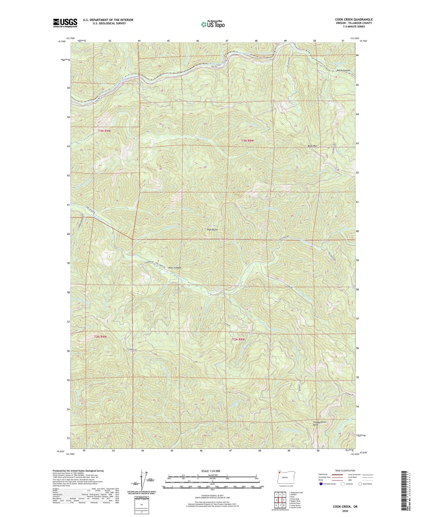
2023 topographic map quadrangle Cook Creek in the state of Oregon. Scale: 1:24000. Based on the newly updated USGS 7.5' US Topo map series, this map is in the following counties: Tillamook. The map contains contour data, water features, and other items you are used to seeing on USGS maps, but also has updated roads and other features. This is the next generation of topographic maps. Printed on high-quality waterproof paper with UV fade-resistant inks.
Quads adjacent to this one:
West: Foley Peak
Northwest: Soapstone Lake
North: Hamlet
Northeast: Elsie
East: Rogers Peak
Southeast: Jordan Creek
South: Cedar Butte
Southwest: Kilchis River
This map covers the same area as the classic USGS quad with code o45123f6.
Contains the following named places: Bastard Creek, Buick, Bulck Canyon, Clammer Creek, Dry Creek, East Fork Cook Creek, French Creek, Granite Creek, Haak Logging Company, Hanson Creek, Harliss Creek, Hatchery Creek, Helloff, Helloff Creek, Helloff Post Office, High Butte, Hoevet Creek, Maples, McAboy, McKenny Creek, Nehalem Division, Nehalem River, Platt Canyon, Rector, Rector Post Office, Salmonberry, Salmonberry Post Office, Salmonberry River, Sibley Creek, Snark, Snark Creek, South Fork Cook Creek, Starr Creek, Strahm Creek, Triangulation Point, Wakefield, Water Tank, Wheeler Lumber Company