MyTopo
Esau Canyon Oregon US Topo Map
Couldn't load pickup availability
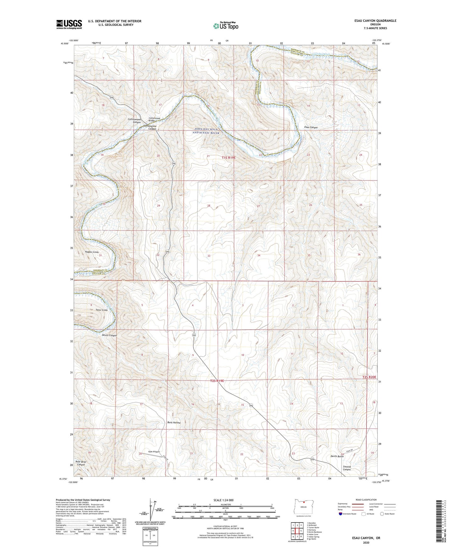
2020 topographic map quadrangle Esau Canyon in the state of Oregon. Scale: 1:24000. Based on the newly updated USGS 7.5' US Topo map series, this map is in the following counties: Gilliam, Sherman. The map contains contour data, water features, and other items you are used to seeing on USGS maps, but also has updated roads and other features. This is the next generation of topographic maps. Printed on high-quality waterproof paper with UV fade-resistant inks.
Quads adjacent to this one:
West: Harmony
Northwest: Klondike
North: McDonald
Northeast: Turner Butte
East: Devils Backbone
Southeast: Igo Butte
South: Indian Spring
Southwest: Indian Cove
Contains the following named places: Ajax Airport, Big Eddy, Cottonwood Bridge, Cottonwood Canyon, Cottonwood J S Burres Park Boat Ramp, Devils Butte, Devils Canyon, Esau Canyon, J S Burres State Park, Kaseburg Ranch, Rietmann Ranch, Rose Briar Canyon, Ruggles Grade, Taylor Grade