MyTopo
Indian Spring Oregon US Topo Map
Couldn't load pickup availability
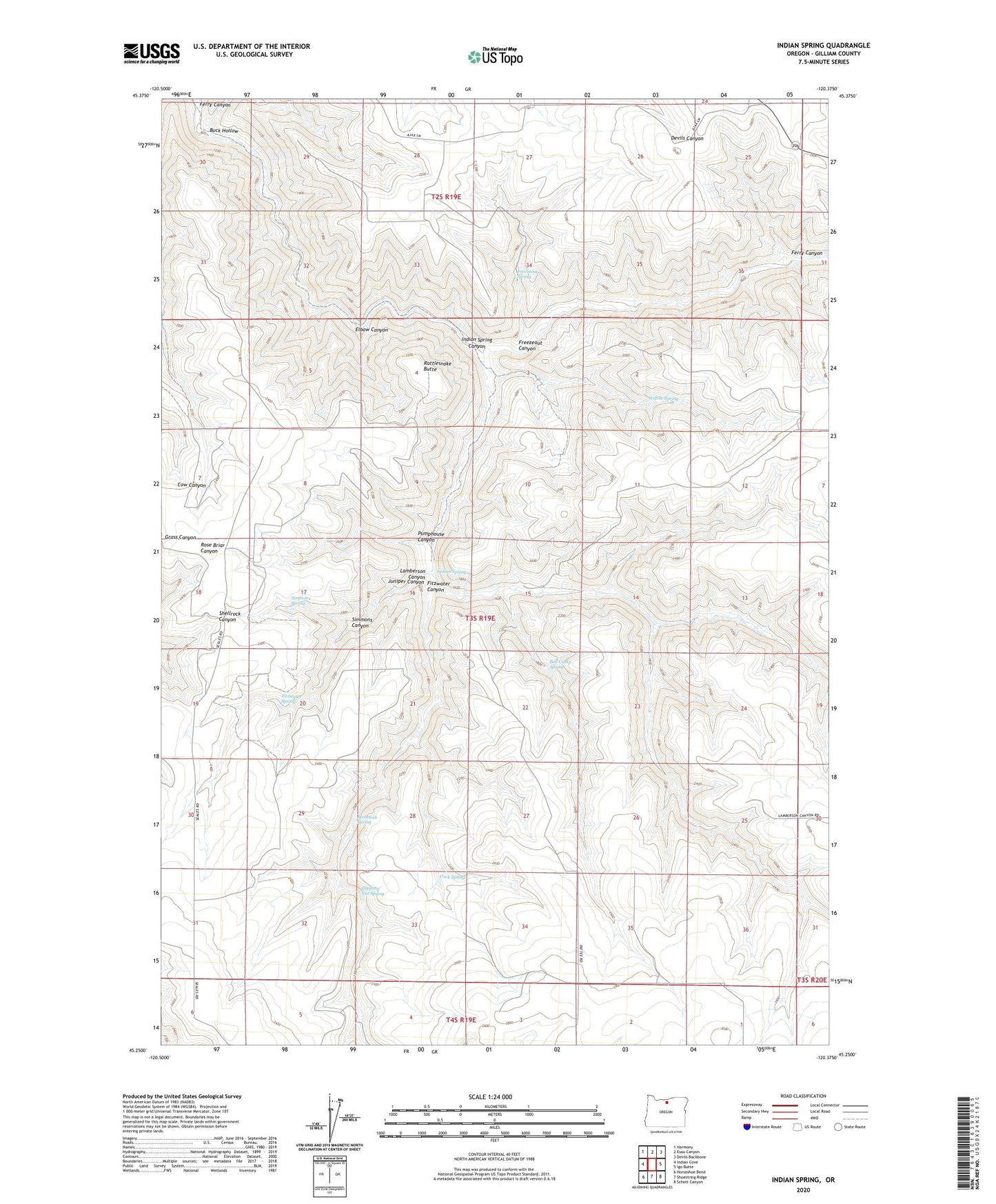
2024 topographic map quadrangle Indian Spring in the state of Oregon. Scale: 1:24000. Based on the newly updated USGS 7.5' US Topo map series, this map is in the following counties: Gilliam. The map contains contour data, water features, and other items you are used to seeing on USGS maps, but also has updated roads and other features. This is the next generation of topographic maps. Printed on high-quality waterproof paper with UV fade-resistant inks.
Quads adjacent to this one:
West: Indian Cove
Northwest: Harmony
North: Esau Canyon
Northeast: Devils Backbone
East: Igo Butte
Southeast: Schott Canyon
South: Shoestring Ridge
Southwest: Horseshoe Bend
This map covers the same area as the classic USGS quad with code o45120c4.
Contains the following named places: Ajax, Ajax Post Office, Ajax School, Bell Camp Spring, Buck Hollow, Cook Spring, Dipping Vat Spring, Elbow Canyon, Fitzwater Canyon, Fitzwater Spring, Freezeout Canyon, Freezeout Spring, Indian Spring, Indian Spring Canyon, Juniper Canyon, Lamberson Canyon, McIntosh Spring, Pumphouse Canyon, Rattlesnake Butte, Simmons Canyon, Simmons Spring, Willow Spring