MyTopo
Euchre Mountain Oregon US Topo Map
Couldn't load pickup availability
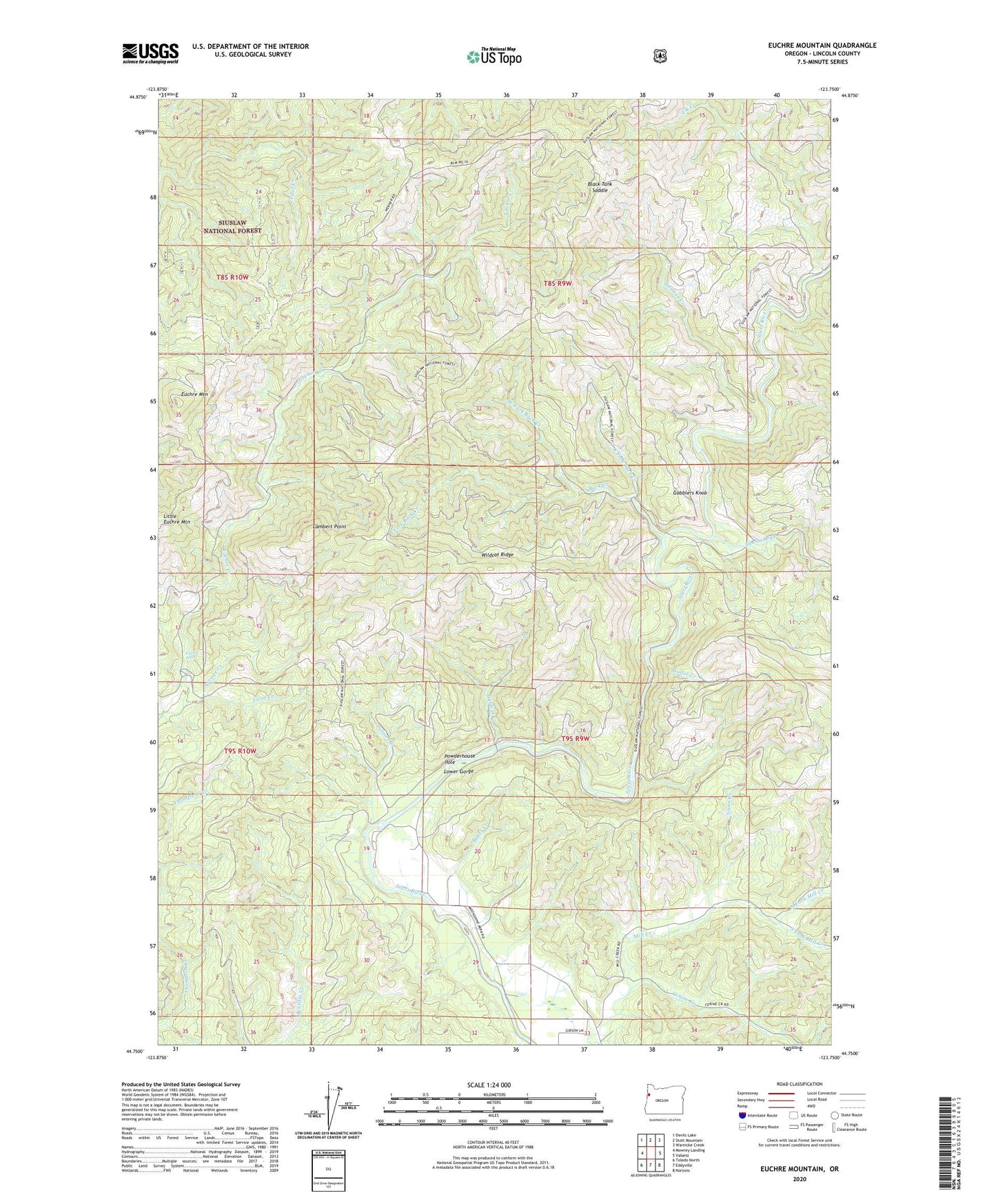
2020 topographic map quadrangle Euchre Mountain in the state of Oregon. Scale: 1:24000. Based on the newly updated USGS 7.5' US Topo map series, this map is in the following counties: Lincoln. The map contains contour data, water features, and other items you are used to seeing on USGS maps, but also has updated roads and other features. This is the next generation of topographic maps. Printed on high-quality waterproof paper with UV fade-resistant inks.
Quads adjacent to this one:
West: Mowrey Landing
Northwest: Devils Lake
North: Stott Mountain
Northeast: Warnicke Creek
East: Valsetz
Southeast: Nortons
South: Eddyville
Southwest: Toledo North
Contains the following named places: Baker Creek, Black Tank Saddle, Buck Creek, Cerine Creek, Coon Creek, East Fork Buck Creek, Elk Creek, Euchre Falls, Euchre Mountain, Gobblers Knob, Gorge Camp, Gunn Creek, Holman Creek, Lambert Point, Lower Gorge, Moonshine County Park, Moonshine Park Boat Launch, North Fork Mill Creek, Palmer Creek, Peck Cabin, Powderhouse Hole, Savage Creek, Siletz Division, South Fork Buck Creek, South Fork Mill Creek, Sugarloaf Post Office, Sunshine Creek, Upper Farm, Werner Camp, West Fork Buck Creek, Wildcat Creek, Wildcat Ridge, Wolfer Creek, ZIP Code: 97357