MyTopo
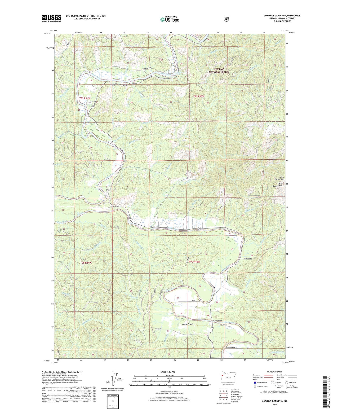
Mowrey Landing Oregon US Topo Map
Couldn't load pickup availability
Also explore the Mowrey Landing Forest Service Topo of this same quad for updated USFS data
2023 topographic map quadrangle Mowrey Landing in the state of Oregon. Scale: 1:24000. Based on the newly updated USGS 7.5' US Topo map series, this map is in the following counties: Lincoln. The map contains contour data, water features, and other items you are used to seeing on USGS maps, but also has updated roads and other features. This is the next generation of topographic maps. Printed on high-quality waterproof paper with UV fade-resistant inks.
Quads adjacent to this one:
West: Depoe Bay
Northwest: Lincoln City
North: Devils Lake
Northeast: Stott Mountain
East: Euchre Mountain
Southeast: Eddyville
South: Toledo North
Southwest: Newport North
This map covers the same area as the classic USGS quad with code o44123g8.
Contains the following named places: Bear Creek, Butterfield Creek, Butterfield Riffle, Camas Prairie, Cedar Creek, Chitwood Creek, Davis Creek, Depoe Bay Division, Dry Creek, Euchre Creek, Foster Creek, Grave Creek, Hough Creek, Jack Morgan County Park, Jaybird Creek, KCRF-FM, Little Euchre Mountain, Mack Landing, Martin Eddy, Martin Eddy Creek, Melco Landing, Misac Creek, Morgan Landing, Morgan Park Boat Ramp, Mowrey Landing, North Roy Creek, Ojalla Bridge, Ojalla Creek, Reed Creek, Reed Creek Grange, Roots Creek, Roots Post Office, Roy Creek, Scare Creek, Skalada Creek, South Roy Creek, Stemple Creek, Stewart Creek, Strome County Park, Strome Park Boat Ramp, The Maples, Thompson Creek, Townsend Creek, Wade Creek, ZIP Code: 97380