MyTopo
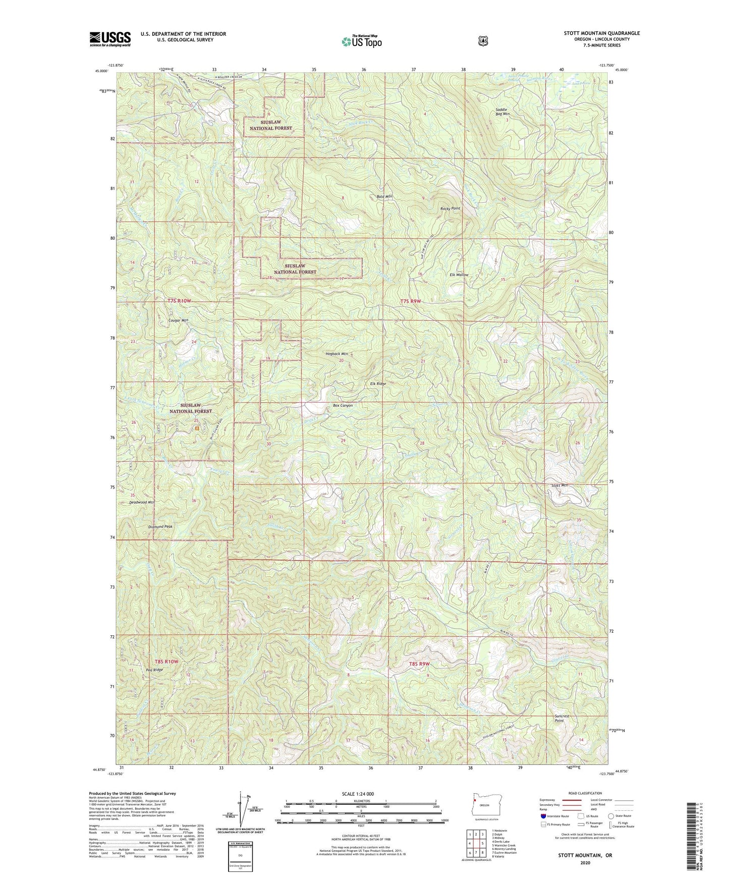
Stott Mountain Oregon US Topo Map
Couldn't load pickup availability
Also explore the Stott Mountain Forest Service Topo of this same quad for updated USFS data
2023 topographic map quadrangle Stott Mountain in the state of Oregon. Scale: 1:24000. Based on the newly updated USGS 7.5' US Topo map series, this map is in the following counties: Lincoln. The map contains contour data, water features, and other items you are used to seeing on USGS maps, but also has updated roads and other features. This is the next generation of topographic maps. Printed on high-quality waterproof paper with UV fade-resistant inks.
Quads adjacent to this one:
West: Devils Lake
Northwest: Neskowin
North: Dolph
Northeast: Midway
East: Warnicke Creek
Southeast: Valsetz
South: Euchre Mountain
Southwest: Mowrey Landing
This map covers the same area as the classic USGS quad with code o44123h7.
Contains the following named places: Bald Mountain, Barn Creek, Box Canyon, Cougar Mountain, Diamond Peak, Elk Ridge, Elk Wallow, Four Cabin Corner, Fowler Creek, Hogback Mountain, Horner Creek, Horner Ranch, Lost Prairie, McMullen Creek, Minski Place, Nelson Creek, Pea Ridge, Rocky Point, Saddle Bag Mountain, Sampson Creek, Seven-Nine Trail, Side Camp, Smith Creek, Stott Mountain, Suncrest Point, Suncrest Point Lookout