MyTopo
Fire Lake Oregon US Topo Map
Couldn't load pickup availability
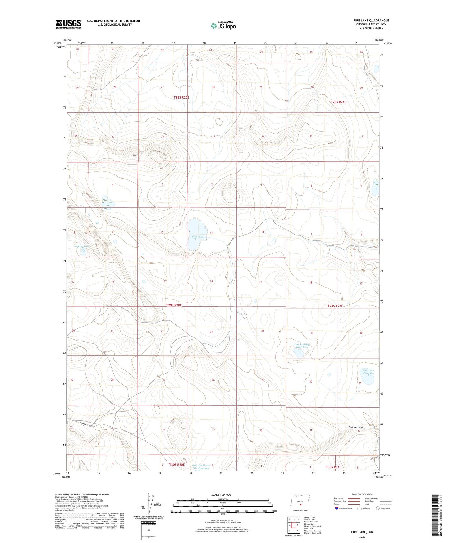
2020 topographic map quadrangle Fire Lake in the state of Oregon. Scale: 1:24000. Based on the newly updated USGS 7.5' US Topo map series, this map is in the following counties: Lake. The map contains contour data, water features, and other items you are used to seeing on USGS maps, but also has updated roads and other features. This is the next generation of topographic maps. Printed on high-quality waterproof paper with UV fade-resistant inks.
Quads adjacent to this one:
West: Sheep Rock
Northwest: Vaughn Well
North: Buffalo Well
Northeast: Horse Mountain
East: Poverty Basin North
Southeast: Poverty Basin South
South: Diatomite Reservoir
Southwest: Bull Lake
Contains the following named places: Depaoli Lake, Fire Lake, North DC Waterhole, Saunders Rim, Saunders Waterhole, South DC Waterhole, West Saunders Waterhole