
MyTopo
Fossil South Oregon US Topo Map
Couldn't load pickup availability
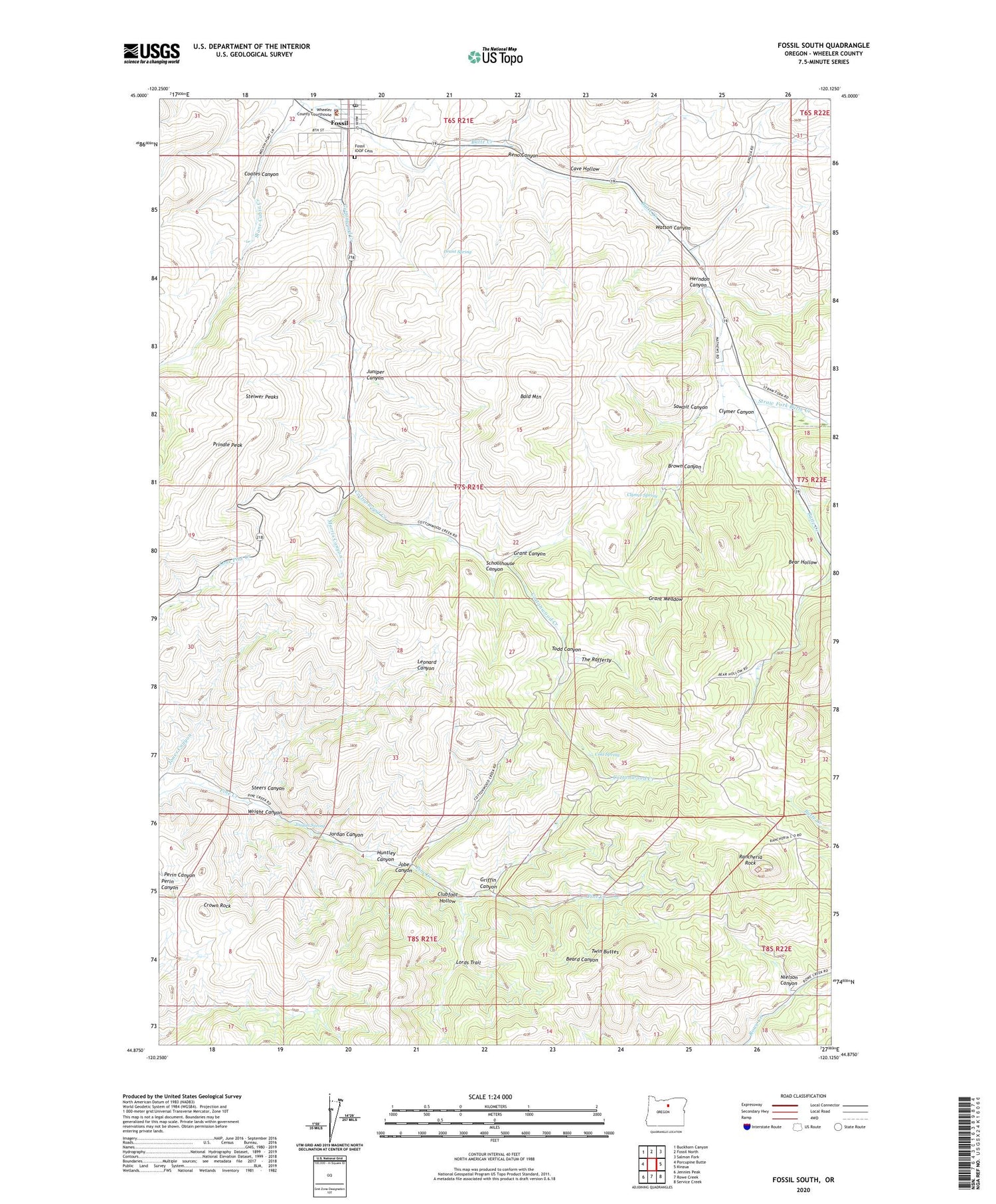
2020 topographic map quadrangle Fossil South in the state of Oregon. Scale: 1:24000. Based on the newly updated USGS 7.5' US Topo map series, this map is in the following counties: Wheeler. The map contains contour data, water features, and other items you are used to seeing on USGS maps, but also has updated roads and other features. This is the next generation of topographic maps. Printed on high-quality waterproof paper with UV fade-resistant inks.
Quads adjacent to this one:
West: Porcupine Butte
Northwest: Buckhorn Canyon
North: Fossil North
Northeast: Salmon Fork
East: Kinzua
Southeast: Service Creek
South: Rowe Creek
Southwest: Jennies Peak
Contains the following named places: Bald Mountain, Bear Hollow, Brown Canyon, Cave Hollow, City of Fossil, Clubfoot Hollow, Clymer Canyon, Clymer Spring, Coates Canyon, Cold Spring, Cottonwood Creek, Crown Rock, Drace Hollow, Fossil, Fossil Division, Fossil IOOF Cemetery, Fossil Museum and Pine Creek Schoolhouse, Fossil Park, Fossil Post Office, Grant Canyon, Grant Meadow, Grant Spring, Griffin Canyon, Herndon Canyon, Huntley Canyon, Jobe Canyon, Jones Canyon, Jordan Canyon, Jordan Spring, Juniper Canyon, Leonard Canyon, Lords Trail, Morris Canyon, Nielson Canyon, Prindle Peak, Rancheria Rock, Reno Canyon, Sawpit Canyon, Schoolhouse Canyon, Steers Canyon, Steiwer Peaks, Stone Cabin Creek, Straw Fork Butte Creek, The Rafferty, Todd Canyon, Twin Buttes, Watson Canyon, Wheeler County Courthouse, Wheeler County Courthouse Park, Wheeler County Fairgrounds, Wheeler County Health Office, Wheeler County Sheriff's Office, Wright Canyon, ZIP Code: 97830


