MyTopo
Buckhorn Canyon Oregon US Topo Map
Couldn't load pickup availability
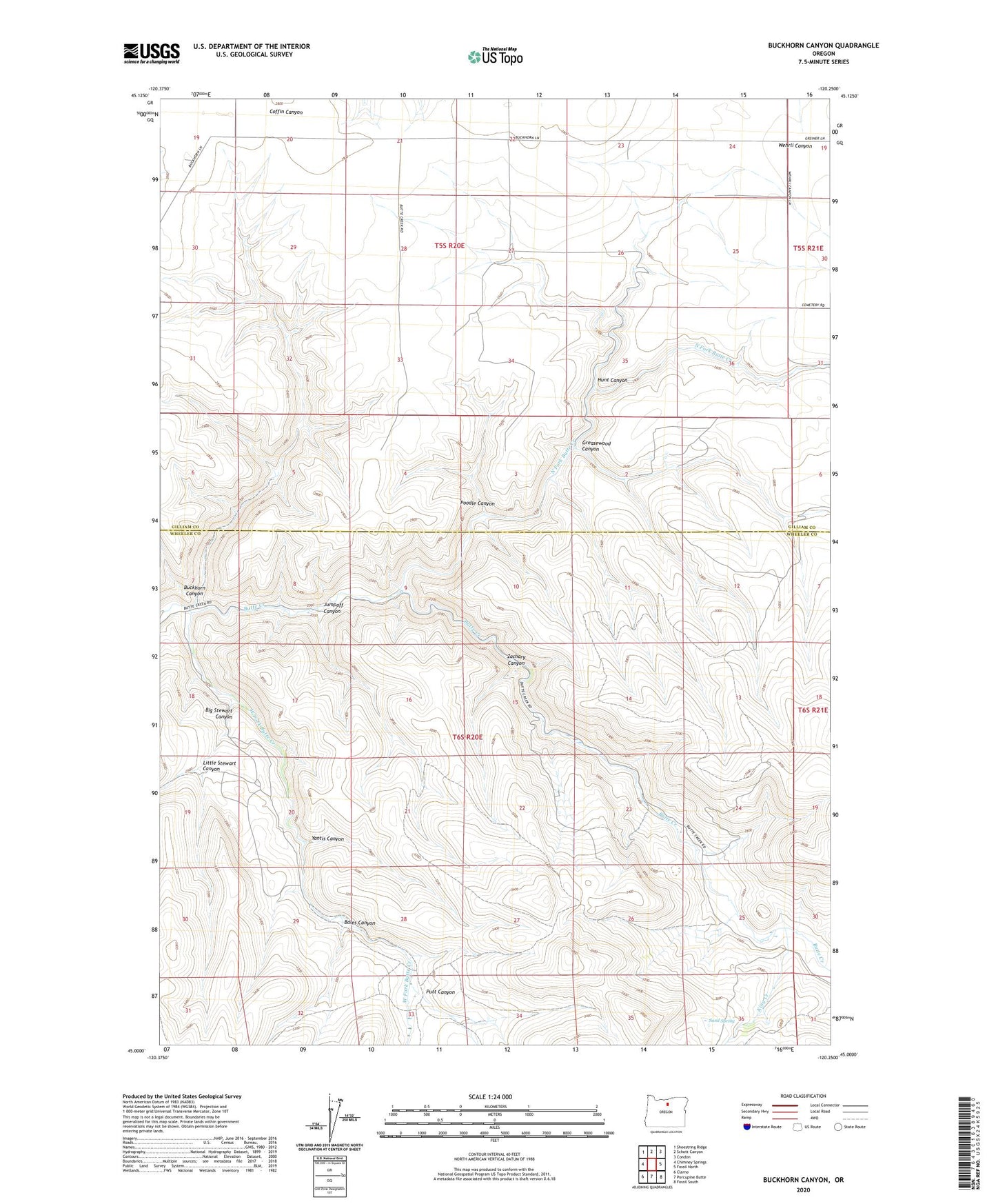
2023 topographic map quadrangle Buckhorn Canyon in the state of Oregon. Scale: 1:24000. Based on the newly updated USGS 7.5' US Topo map series, this map is in the following counties: Gilliam, Wheeler. The map contains contour data, water features, and other items you are used to seeing on USGS maps, but also has updated roads and other features. This is the next generation of topographic maps. Printed on high-quality waterproof paper with UV fade-resistant inks.
Quads adjacent to this one:
West: Chimney Springs
Northwest: Shoestring Ridge
North: Schott Canyon
Northeast: Condon
East: Fossil North
Southeast: Fossil South
South: Porcupine Butte
Southwest: Clarno
This map covers the same area as the classic USGS quad with code o45120a3.
Contains the following named places: Bales Canyon, Big Stewart Canyon, Buckhorn Canyon, Greasewood Canyon, Hunt Canyon, Jumpoff Canyon, King Creek, Little Stewart Canyon, North Fork Butte Creek, Poodle Canyon, Putt Canyon, Sand Spring, West Fork Butte Creek, Yantis Canyon, Zachary Canyon