MyTopo
Fossil North Oregon US Topo Map
Couldn't load pickup availability
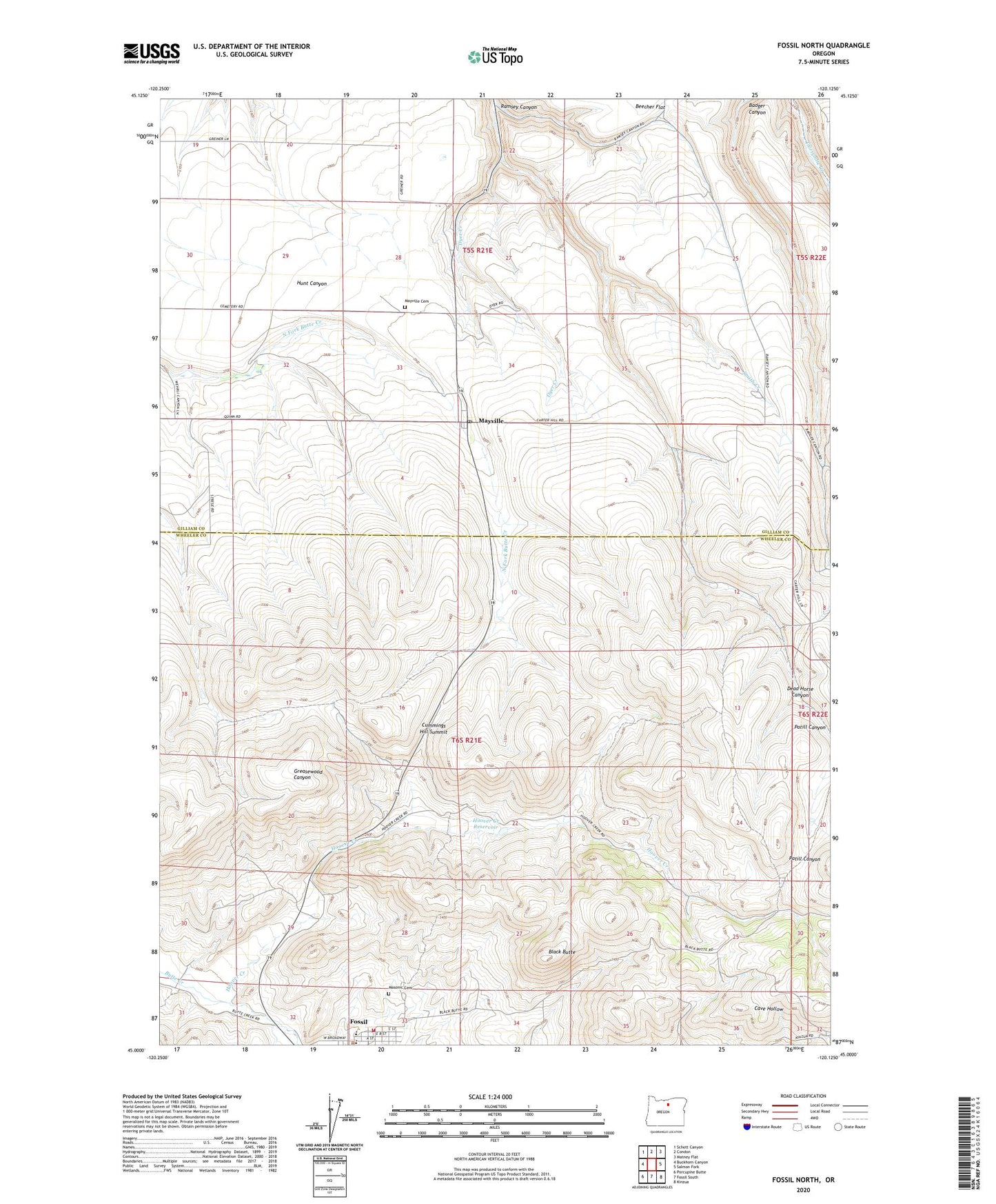
2023 topographic map quadrangle Fossil North in the state of Oregon. Scale: 1:24000. Based on the newly updated USGS 7.5' US Topo map series, this map is in the following counties: Gilliam, Wheeler. The map contains contour data, water features, and other items you are used to seeing on USGS maps, but also has updated roads and other features. This is the next generation of topographic maps. Printed on high-quality waterproof paper with UV fade-resistant inks.
Quads adjacent to this one:
West: Buckhorn Canyon
Northwest: Schott Canyon
North: Condon
Northeast: Matney Flat
East: Salmon Fork
Southeast: Kinzua
South: Fossil South
Southwest: Porcupine Butte
This map covers the same area as the classic USGS quad with code o45120a2.
Contains the following named places: Black Butte, Cummings Hill Summit, Dead Horse Canyon, Dyer Creek, Dyer State Park, Fossil City Hall, Fossil Public Library, Fossil Public Works, Fossil Sewage Treatment Plant, Fossil Volunteer Fire Department, Hoover Creek, Hoover Creek Reservoir, Masonic Cemetery, Mayville, Mayville Cemetery, Mayville Post Office, Mayville School, Putnams Airfield, Ramsey Canyon, Smith Creek, Smith Ranch, Wheeler High School