MyTopo
Fox Butte Oregon US Topo Map
Couldn't load pickup availability
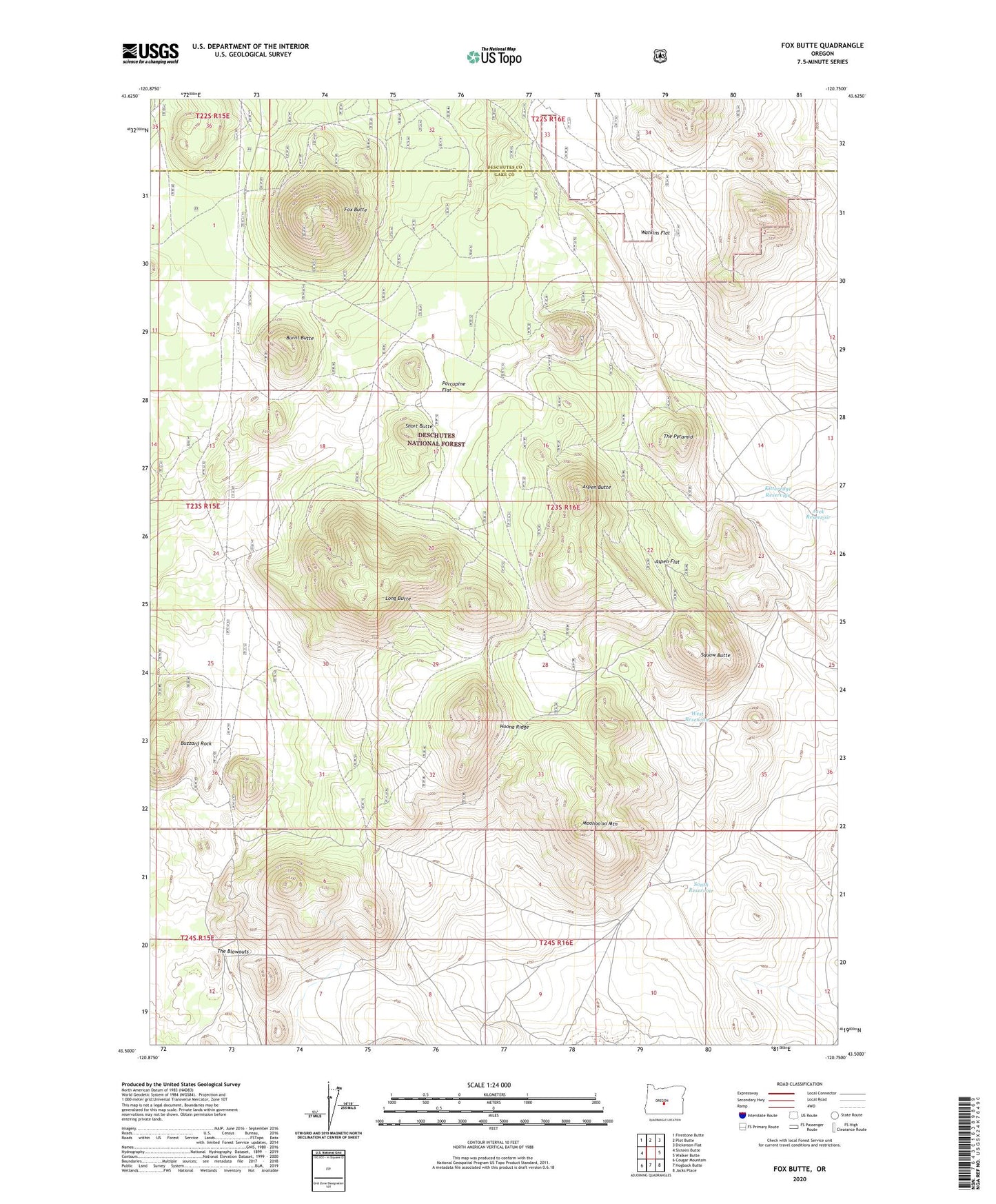
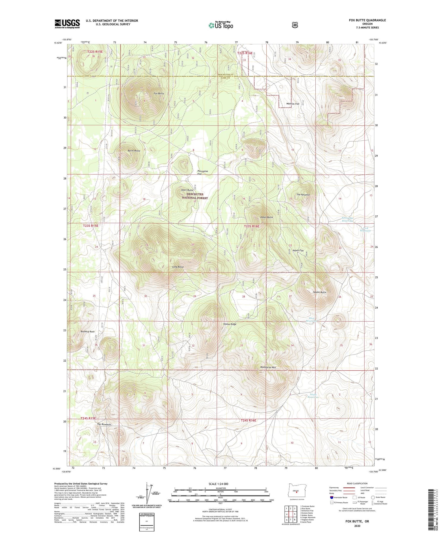
2020 topographic map quadrangle Fox Butte in the state of Oregon. Scale: 1:24000. Based on the newly updated USGS 7.5' US Topo map series, this map is in the following counties: Lake, Deschutes. The map contains contour data, water features, and other items you are used to seeing on USGS maps, but also has updated roads and other features. This is the next generation of topographic maps. Printed on high-quality waterproof paper with UV fade-resistant inks.
Quads adjacent to this one:
West: Sixteen Butte
Northwest: Firestone Butte
North: Plot Butte
Northeast: Dickerson Flat
East: Walker Butte
Southeast: Jacks Place
South: Hogback Butte
Southwest: Cougar Mountain
Contains the following named places: Aspen Butte, Aspen Flat, Burnt Butte, Buzzard Rock, Cook Well, Derrick Well, Fox Butte, Glen Cabin, Hoona Ridge, Jack Reservoir, Kitteredge Reservoir, Long Butte, Ludi Well, Moohoo'oo Mountain, Porcupine Flat, Quarter Butte, Short Butte, South Reservoir, Squaw Butte, Squaw Butte Well, The Blowouts, The Pyramid, West Reservoir