MyTopo
Jacks Place Oregon US Topo Map
Couldn't load pickup availability
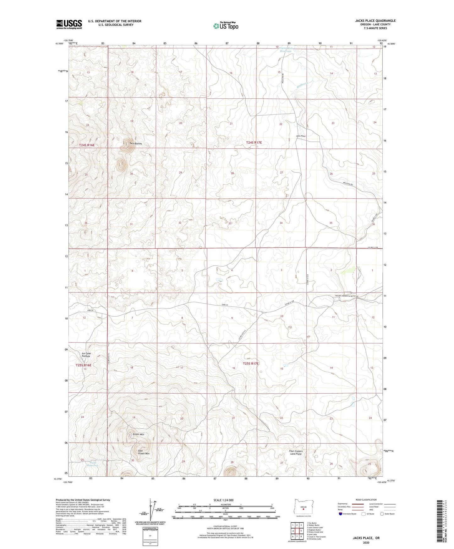
2023 topographic map quadrangle Jacks Place in the state of Oregon. Scale: 1:24000. Based on the newly updated USGS 7.5' US Topo map series, this map is in the following counties: Lake. The map contains contour data, water features, and other items you are used to seeing on USGS maps, but also has updated roads and other features. This is the next generation of topographic maps. Printed on high-quality waterproof paper with UV fade-resistant inks.
Quads adjacent to this one:
West: Hogback Butte
Northwest: Fox Butte
North: Walker Butte
Northeast: Last Chance Lake
East: Peters Creek Sink
Southeast: Christmas Lake
South: Crack In The Ground
Southwest: Lane Lake
This map covers the same area as the classic USGS quad with code o43120d6.
Contains the following named places: Boundary Well, Coyote Hole Reservoir, East Green Mountain, Frazee Ranch, Green Mountain, Green Mountain Lookout, Ice Cave Pothole, Jacks Place, Seventeen Well, Sixteen Well, Twin Buttes, Ward Reservoir