MyTopo
Plot Butte Oregon US Topo Map
Couldn't load pickup availability
Also explore the Plot Butte Forest Service Topo of this same quad for updated USFS data
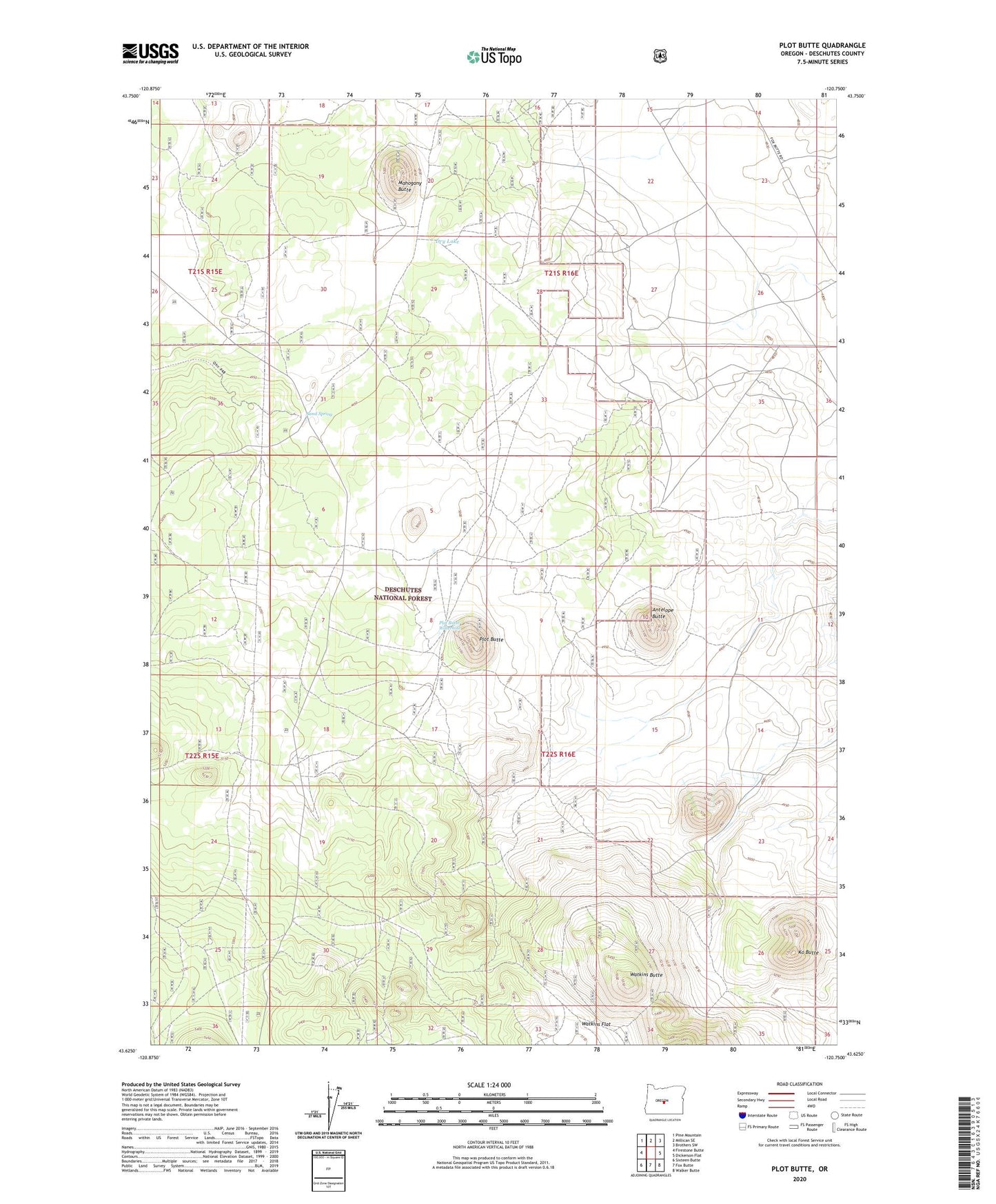
2023 topographic map quadrangle Plot Butte in the state of Oregon. Scale: 1:24000. Based on the newly updated USGS 7.5' US Topo map series, this map is in the following counties: Deschutes. The map contains contour data, water features, and other items you are used to seeing on USGS maps, but also has updated roads and other features. This is the next generation of topographic maps. Printed on high-quality waterproof paper with UV fade-resistant inks.
Quads adjacent to this one:
West: Firestone Butte
Northwest: Pine Mountain
North: Millican SE
Northeast: Brothers SW
East: Dickerson Flat
Southeast: Walker Butte
South: Fox Butte
Southwest: Sixteen Butte
This map covers the same area as the classic USGS quad with code o43120f7.
Contains the following named places: Antelope Butte, Dry Lake, Hemstad Post Office, Ko Butte, Ko Butte Well, Lavacicle Cave Geological Area, Lavacicle Cave Recreation Site, Mahogany Butte, Plot Butte, Plot Butte Waterhole, Sand Spring, Sand Spring Recreation Site, Sand Springs Compensation Station, Watkins Butte, Watkins Flat