MyTopo
Groan Canyon Oregon US Topo Map
Couldn't load pickup availability
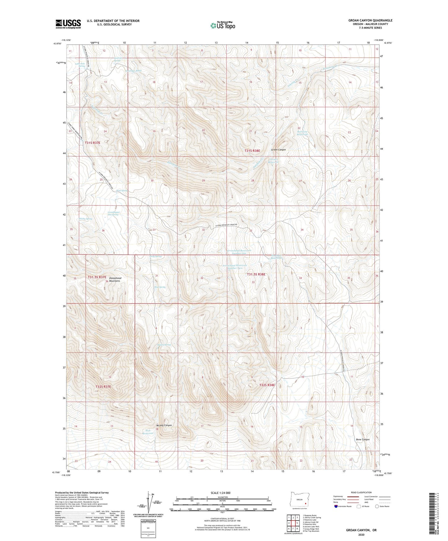
2023 topographic map quadrangle Groan Canyon in the state of Oregon. Scale: 1:24000. Based on the newly updated USGS 7.5' US Topo map series, this map is in the following counties: Malheur. The map contains contour data, water features, and other items you are used to seeing on USGS maps, but also has updated roads and other features. This is the next generation of topographic maps. Printed on high-quality waterproof paper with UV fade-resistant inks.
Quads adjacent to this one:
West: Johnny Creek SW
Northwest: Ryegrass Butte
North: Johnny Creek Spring
Northeast: Palomino Lake
East: Palomino Hills
Southeast: Flat Top Mountain
South: Grassy Ridge Well
Southwest: Ancient Lake Well
This map covers the same area as the classic USGS quad with code o42118g1.
Contains the following named places: Antelope Pond, Antelope Spring, Arrowhead Reservoir Number One, Arrowhead Reservoir Number Three, Arrowhead Reservoir Number Two, Bone Canyon, Bone Spring, Corner Reservoir, Early Spring, Grasshopper Flat Spring, Groan Canyon, Hub Reservoir, Johnny Creek, Little Hole Spring, Mickey Canyon, Mickey Spring, Mud Spring, Red Line Reservoir, Stoddart Reservoir, Whitby Spring