MyTopo
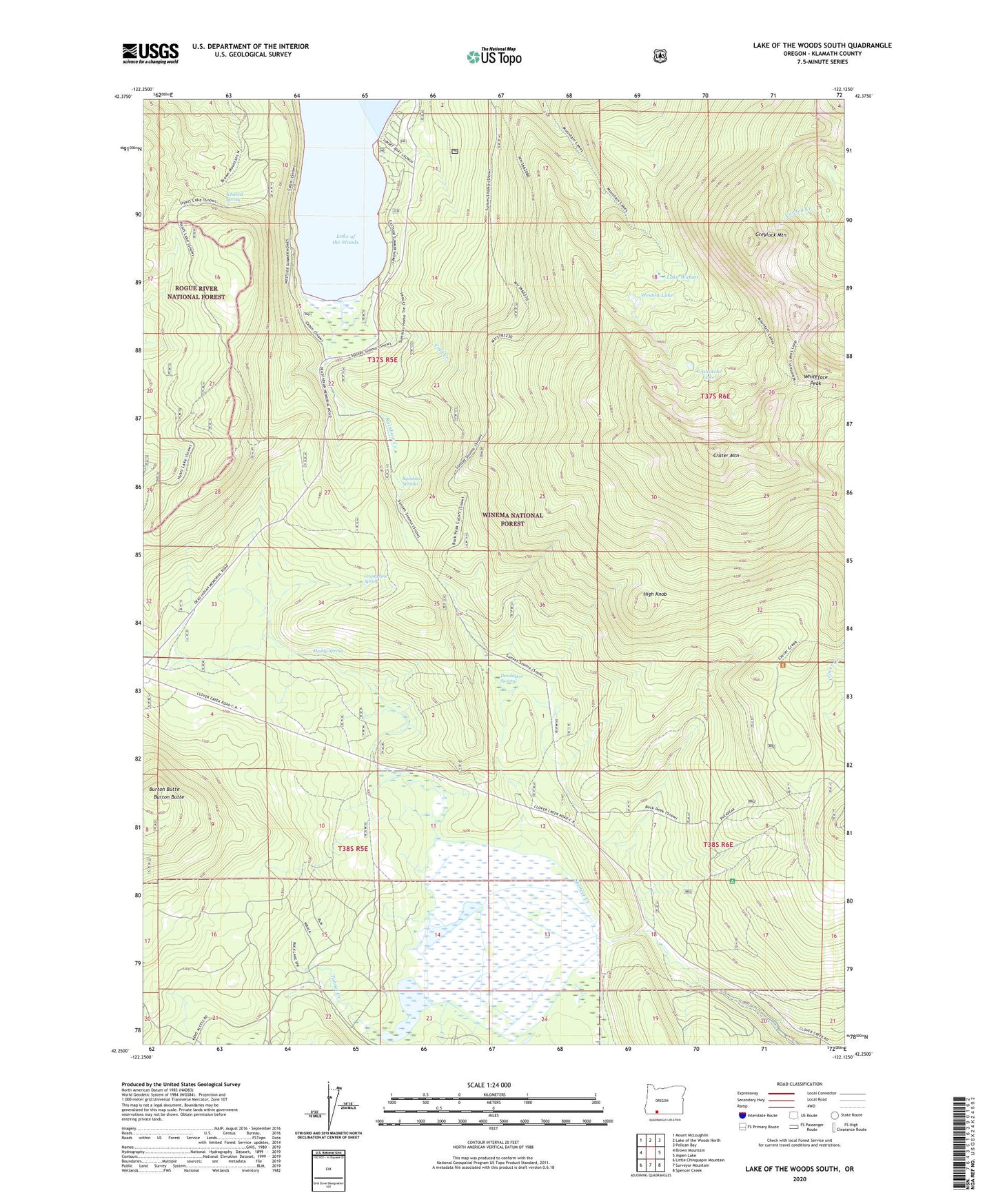
Lake of the Woods South Oregon US Topo Map
Couldn't load pickup availability
2020 topographic map quadrangle Lake of the Woods South in the state of Oregon. Scale: 1:24000. Based on the newly updated USGS 7.5' US Topo map series, this map is in the following counties: Klamath. The map contains contour data, water features, and other items you are used to seeing on USGS maps, but also has updated roads and other features. This is the next generation of topographic maps. Printed on high-quality waterproof paper with UV fade-resistant inks.
Quads adjacent to this one:
West: Brown Mountain
Northwest: Mount McLoughlin
North: Lake of the Woods North
Northeast: Pelican Bay
East: Aspen Lake
Southeast: Spencer Creek
South: Surveyor Mountain
Southwest: Little Chinquapin Mountain
Contains the following named places: Avalanche Lake, Buck Lake, Burton Butte, Camp Esther Applegate, Cold Creek, Crater Mountain, Crystalline Spring, Desolation Swamp, Greylock Mountain, High Knob, Ichabod Spring, Lake of the Woods, Lake Waban, Low Echo Camp, Mountain Lakes Trail, Muddy Spring, Rainbow Bay, Rainbow Creek, Rainbow Springs, Sunset Campground, Sunset Campground Boat Ramp, Surveyor Mountain Recreation Site, Tunnel Creek, Weston Lake, Whiteface Peak