MyTopo
Locust Grove Oregon US Topo Map
Couldn't load pickup availability
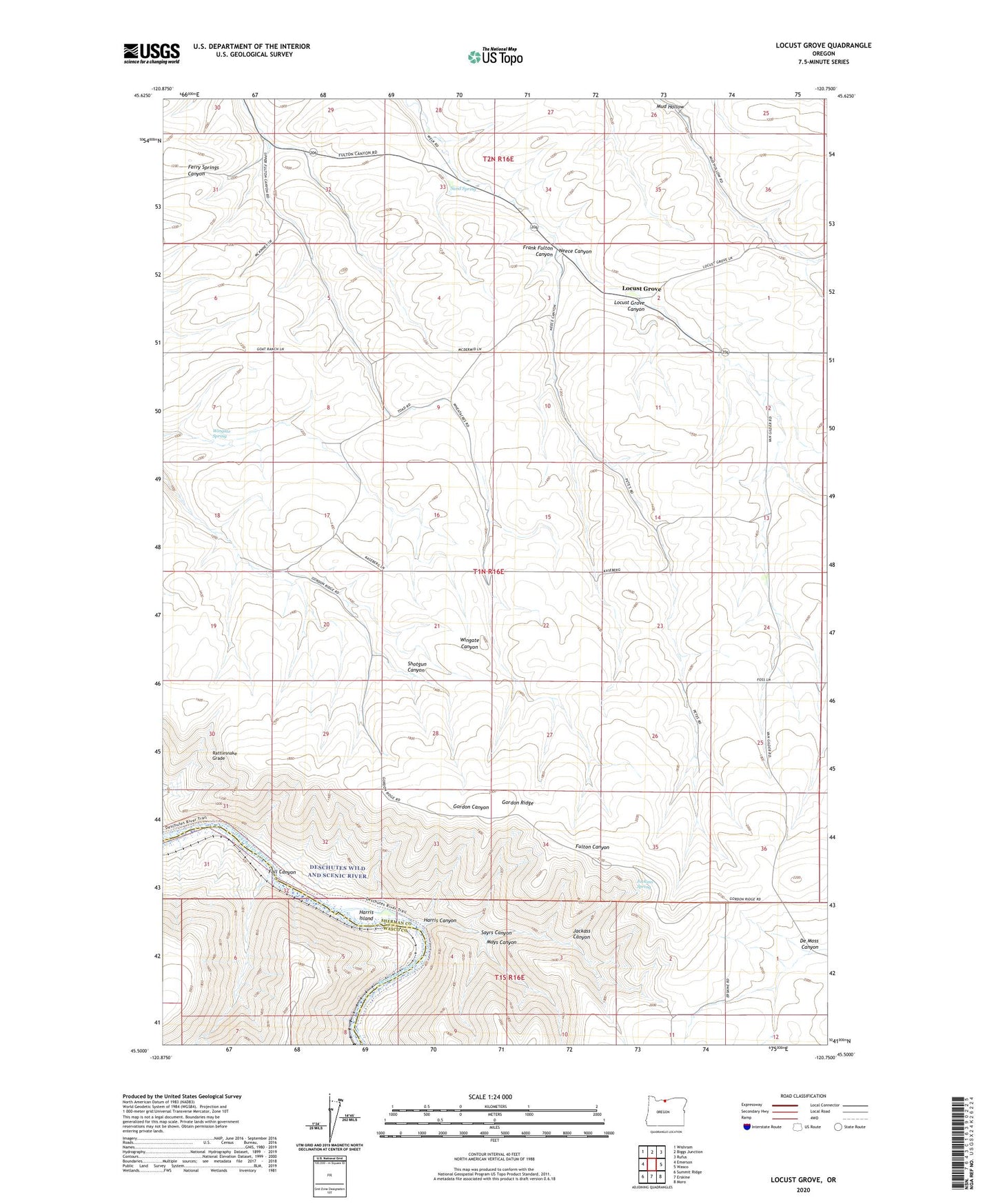
2020 topographic map quadrangle Locust Grove in the state of Oregon. Scale: 1:24000. Based on the newly updated USGS 7.5' US Topo map series, this map is in the following counties: Sherman, Wasco. The map contains contour data, water features, and other items you are used to seeing on USGS maps, but also has updated roads and other features. This is the next generation of topographic maps. Printed on high-quality waterproof paper with UV fade-resistant inks.
Quads adjacent to this one:
West: Emerson
Northwest: Wishram
North: Biggs Junction
Northeast: Rufus
East: Wasco
Southeast: Moro
South: Erskine
Southwest: Summit Ridge
Contains the following named places: Fall Canyon, Gordon Post Office, Gordon Ridge, Harris, Harris Canyon, Harris Island, Jackass Canyon, Jackass Spring, Locust Grove, Locust Grove Canyon, Locust Grove School, Mays, Mays Canyon, Neece Canyon, Rattlesnake Grade, Sand Spring, Sayrs Canyon, Shotgun Canyon, Wingate Spring