MyTopo
Wishram Washington US Topo Map
Couldn't load pickup availability
Also explore the Wishram Forest Service Topo of this same quad for updated USFS data
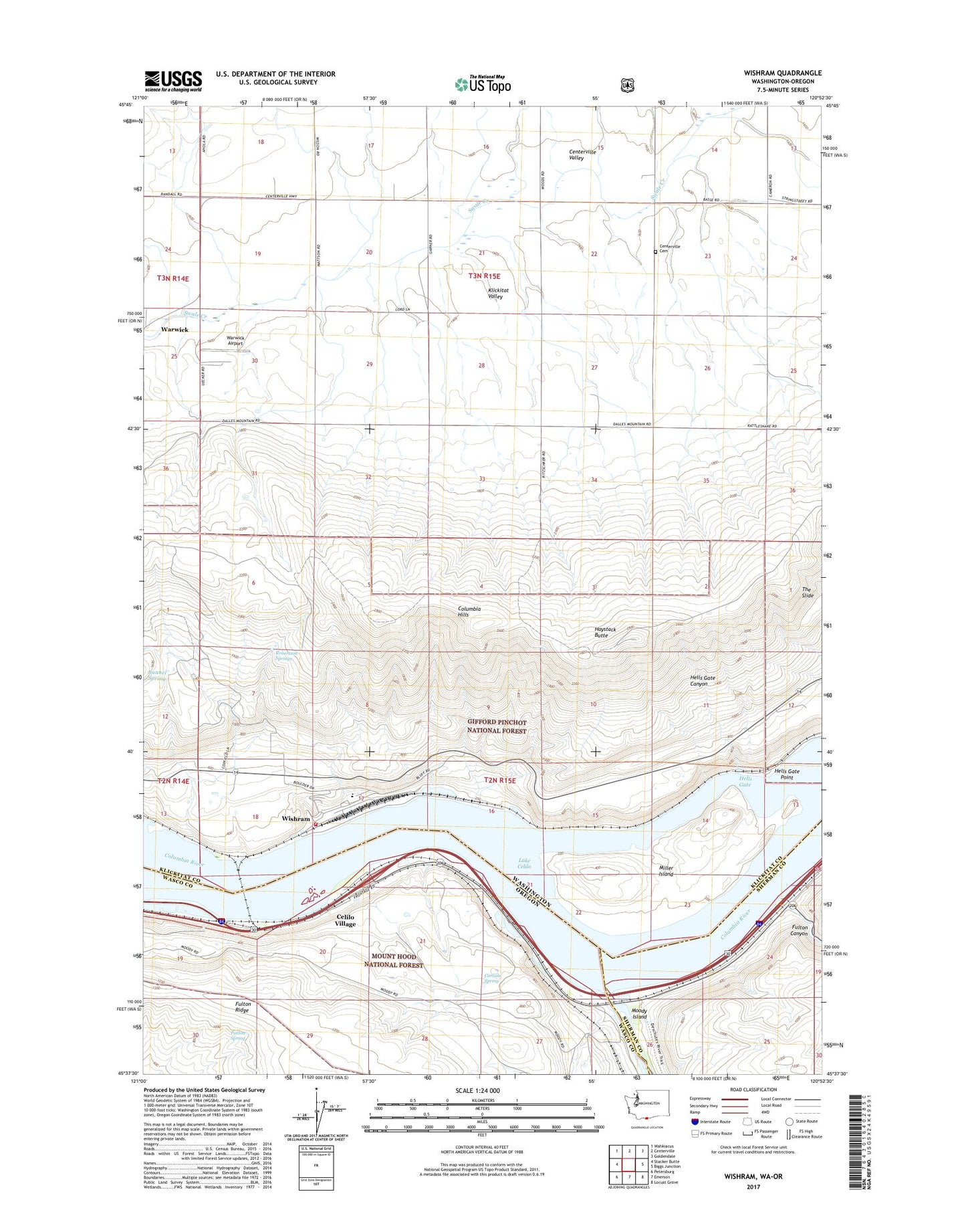
2023 topographic map quadrangle Wishram in the states of Washington, Oregon. Scale: 1:24000. Based on the newly updated USGS 7.5' US Topo map series, this map is in the following counties: Klickitat, Wasco, Sherman. The map contains contour data, water features, and other items you are used to seeing on USGS maps, but also has updated roads and other features. This is the next generation of topographic maps. Printed on high-quality waterproof paper with UV fade-resistant inks.
Quads adjacent to this one:
West: Stacker Butte
Northwest: Wahkiacus
North: Centerville
Northeast: Goldendale
East: Biggs Junction
Southeast: Locust Grove
South: Emerson
Southwest: Petersburg
This map covers the same area as the classic USGS quad with code o45120f8.
Contains the following named places: Ainsworth, Bunnel Spring, Carlisle Spring, Celilo Falls, Celilo Indian Cemetery, Celilo Light, Celilo Park, Celilo Park Boat Ramp, Celilo Post Office, Celilo Treaty Fishing Access Site, Celilo Village, Centerville Cemetery, Centerville Valley, Dechutes Post Office, Des Chutes, Deschutes Bridge Post Office, Deschutes River, Deschutes River Scenic Waterway, Deschutes River State Park, Dillon, Dillon Post Office, Fulton Canyon, Haystack Butte, Hells Gate, Hells Gate Canyon, Hells Gate Point, Hells Gate Range B, Hellsgate Range A, Heritage Landing, Horseshoe Falls Light, Klickitat County Fire District 11, Miller, Miller Island, Miller Post Office, Moody, Moody Island, Moody Post Office, Oregon Trunk Junction, Patton Spring, Robertson Springs, South Channel, South Channel Range A, South Channel Range B, South Channel Range C, The Slide, Tumwater, Warwick, Wild Hair Airport, Wishram, Wishram Census Designated Place, Wishram Heights, Wishram High and Elementary School, ZIP Code: 98613