MyTopo
Biggs Junction Oregon US Topo Map
Couldn't load pickup availability
Also explore the Biggs Junction Forest Service Topo of this same quad for updated USFS data
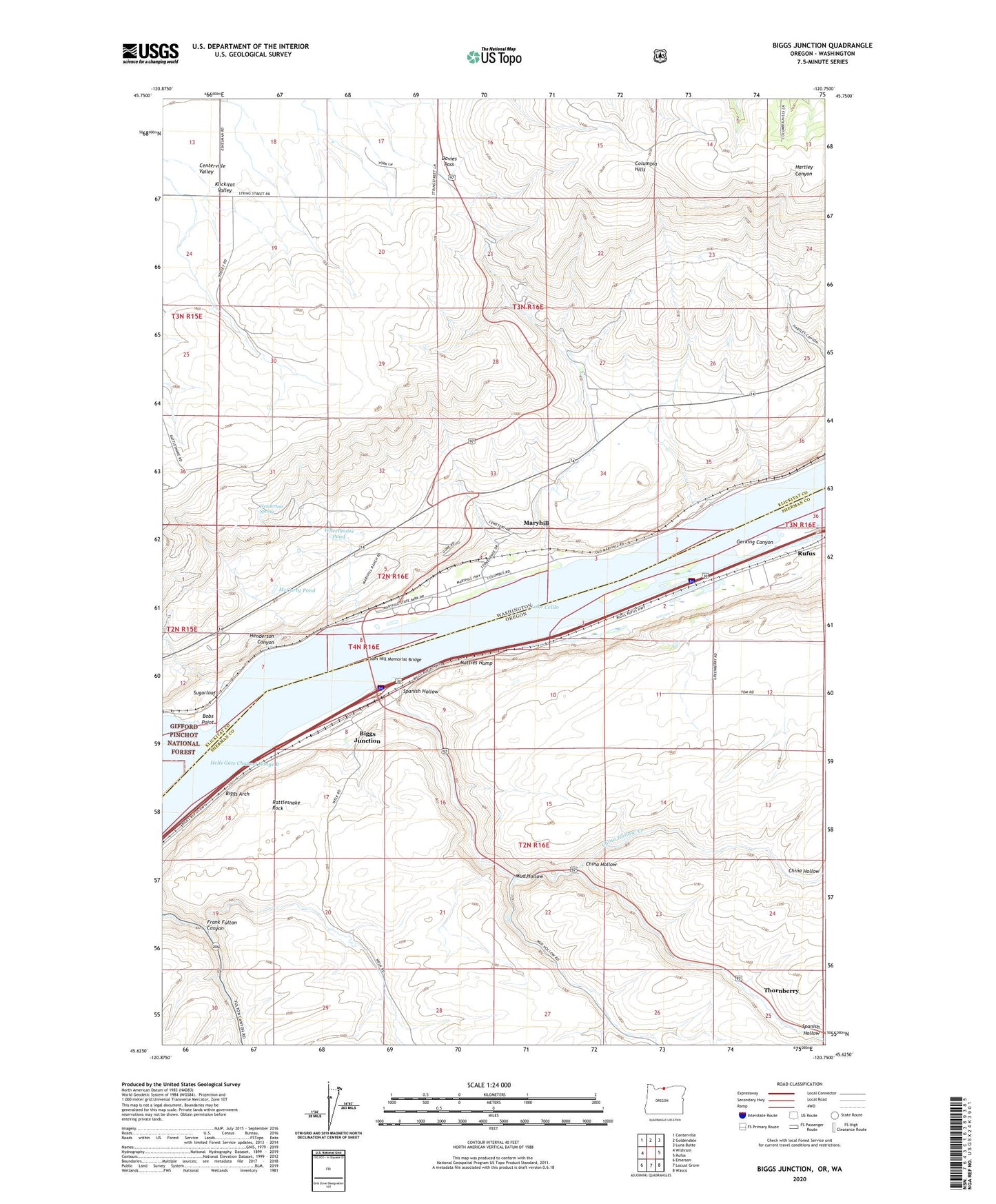
2023 topographic map quadrangle Biggs Junction in the states of Washington, Oregon. Scale: 1:24000. Based on the newly updated USGS 7.5' US Topo map series, this map is in the following counties: Sherman, Klickitat. The map contains contour data, water features, and other items you are used to seeing on USGS maps, but also has updated roads and other features. This is the next generation of topographic maps. Printed on high-quality waterproof paper with UV fade-resistant inks.
Quads adjacent to this one:
West: Wishram
Northwest: Centerville
North: Goldendale
Northeast: Luna Butte
East: Rufus
Southeast: Wasco
South: Locust Grove
Southwest: Emerson
Contains the following named places: Biggs, Biggs Arch, Biggs Junction, Biggs Junction Census Designated Place, Biggs Post Office, Biggs Service District Sewer System Facility, Bobs Point, China Hollow, China Hollow Creek, Davies Pass, Frank Fulton Canyon, Grant, Grant Post Office, Grebe, Gunkel Orchards, Hells Gate Channel Range B, Henderson Canyon, Henderson Spring, Mary Hill Vineyards, Maryhill, Maryhill Census Designated Place, Maryhill Ferry, Maryhill Museum, Maryhill Post Office, Maryhill State Park, Maryhill Treaty Fishing Access Site, Matties Hump, McCarty Pond, Mud Hollow, Rattlesnake Rock, Sam Hill Memorial Bridge, Spanish Hollow, Stonehenge Memorial, Sugarloaf, Thornberry, Thornberry Post Office, Villard Post Office, Wheelhouse Pond, ZIP Code: 97050