MyTopo
Moro Oregon US Topo Map
Couldn't load pickup availability
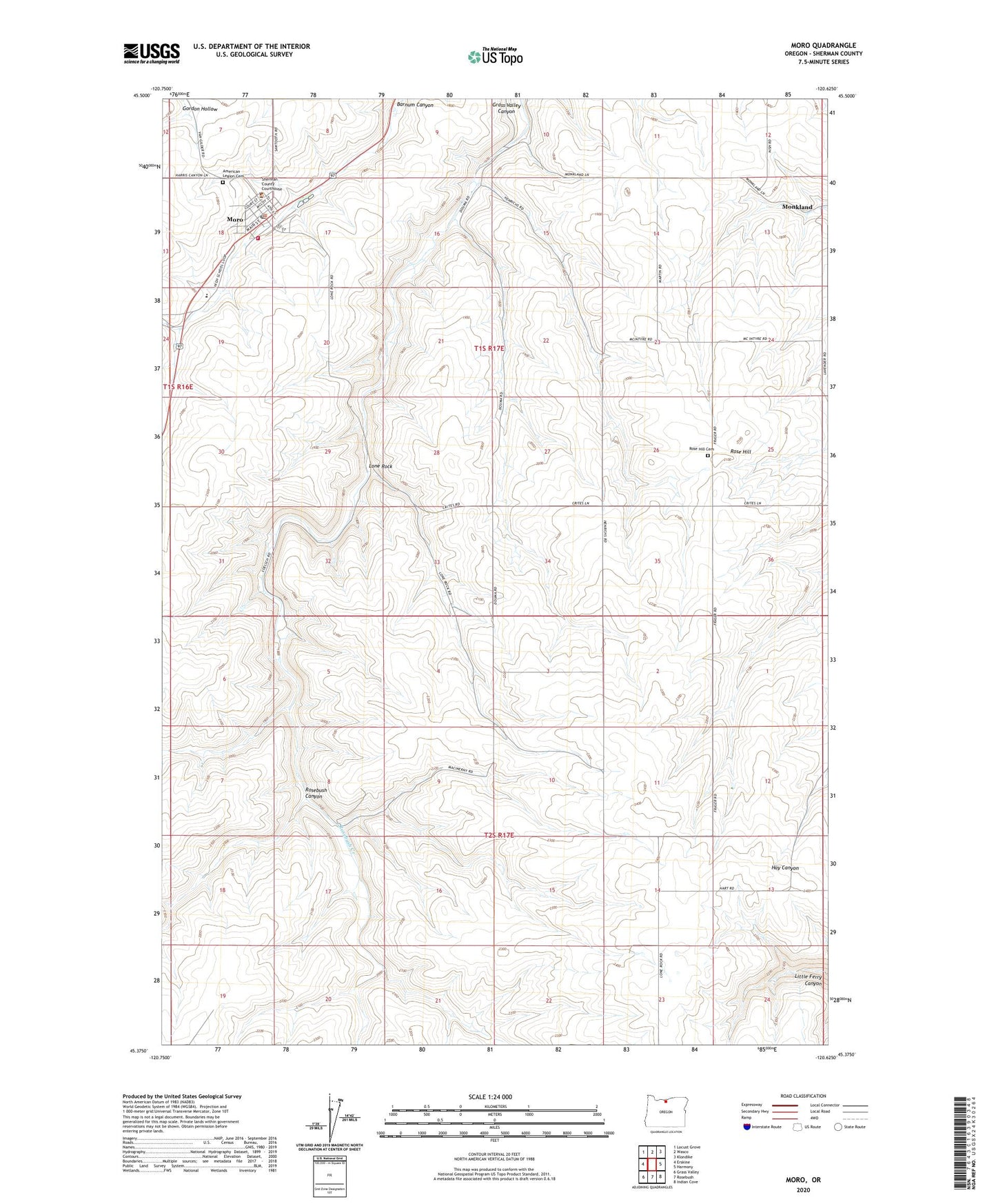
2020 topographic map quadrangle Moro in the state of Oregon. Scale: 1:24000. Based on the newly updated USGS 7.5' US Topo map series, this map is in the following counties: Sherman. The map contains contour data, water features, and other items you are used to seeing on USGS maps, but also has updated roads and other features. This is the next generation of topographic maps. Printed on high-quality waterproof paper with UV fade-resistant inks.
Quads adjacent to this one:
West: Erskine
Northwest: Locust Grove
North: Wasco
Northeast: Klondike
East: Harmony
Southeast: Indian Cove
South: Rosebush
Southwest: Grass Valley
Contains the following named places: American Legion Cemetery, Boardman, City of Moro, City of Moro Fire Department, Lone Rock, Monkland, Monkland Post Office, Moro, Moro City Hall, Moro City Park, Moro Post Office, Moro Public Works, Moro Rural Fire Protection District, Moro Sewage Lagoon, Rose Hill, Rose Hill Cemetery, Rosebush Canyon, Rosebush Creek, Sherman County, Sherman County Ambulance, Sherman County Community Transit, Sherman County Fairgrounds, Sherman County Historical Museum, Sherman County Justice Courthouse, Sherman County Public / School Library, Sherman County RV Park, Sherman County Sheriff's Office, Sherman Experiment Station, Sherman Junior - Senior High School, ZIP Code: 97039