MyTopo
Mount Lowe Oregon US Topo Map
Couldn't load pickup availability
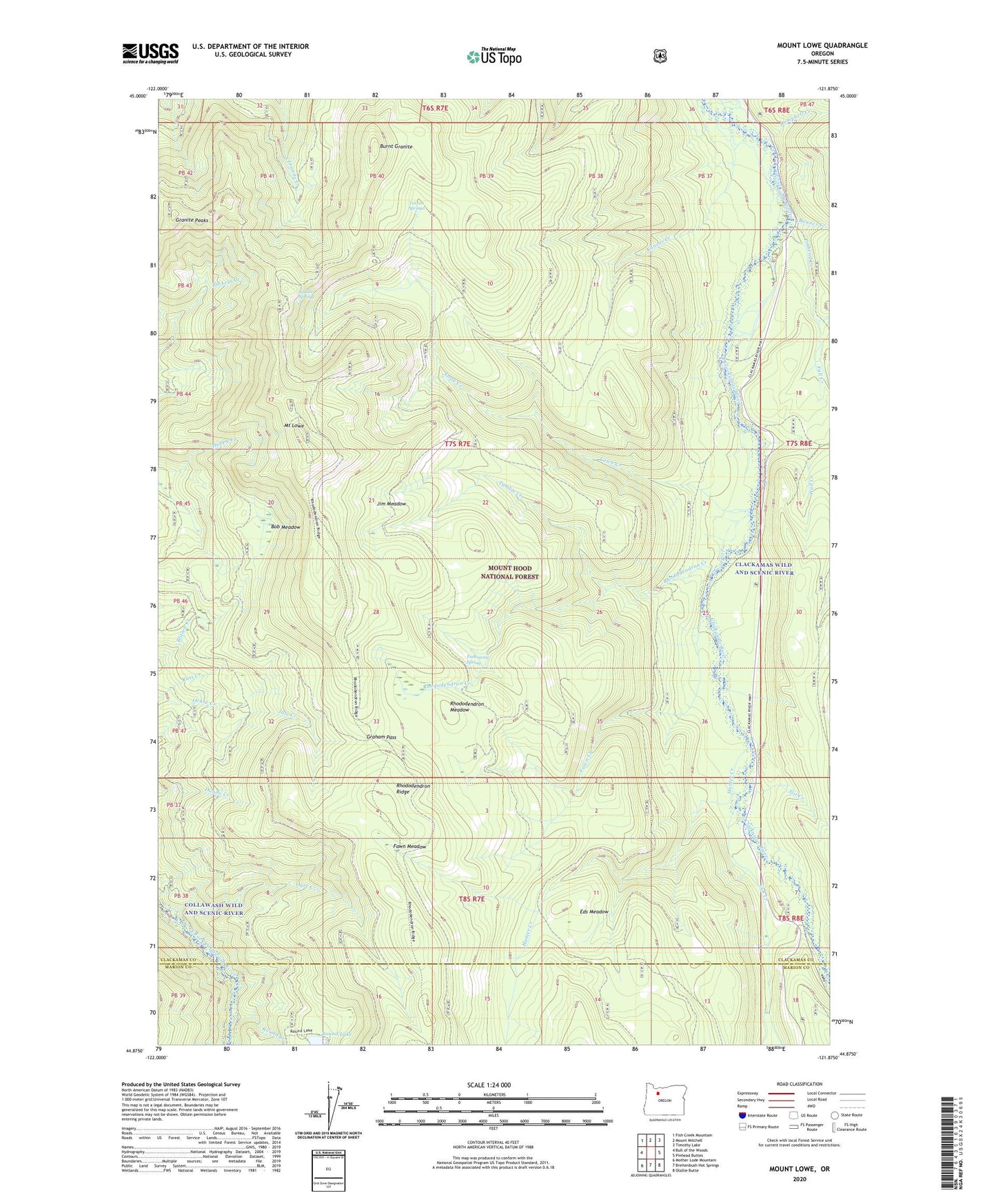
2020 topographic map quadrangle Mount Lowe in the state of Oregon. Scale: 1:24000. Based on the newly updated USGS 7.5' US Topo map series, this map is in the following counties: Clackamas, Marion. The map contains contour data, water features, and other items you are used to seeing on USGS maps, but also has updated roads and other features. This is the next generation of topographic maps. Printed on high-quality waterproof paper with UV fade-resistant inks.
Quads adjacent to this one:
West: Bull of the Woods
Northwest: Fish Creek Mountain
North: Mount Mitchell
Northeast: Timothy Lake
East: Pinhead Buttes
Southeast: Olallie Butte
South: Breitenbush Hot Springs
Southwest: Mother Lode Mountain
Contains the following named places: Beaver Dam Quarry, Bob Meadow, Bonner Creek, Burnt Granite, Campbell Creek, Cub Creek, Cul de sac Quarry, Eds Meadow, Fadeaway Spring, Fawn Creek, Fawn Meadow, Fawn Meadow Pit, Graham Pass, Granite Peaks, Hunter Camp Way, Hunter Creek, Hunter Creek Trail, Hunter Pit, Jim Meadow, June Creek Pit, Kansas Creek, Lacy Pit, Last Creek, Lowe Creek, Lowe Creek Pit, Lowe Creek Trail, Marion Quarry, Mount Lowe, Ochre Creek, Pinhead Creek, Rho Ridge Shelter, Rhododendron Creek, Rhododendron Meadow, Rhododendron Ridge Shelter, Rhododendron Ridge Trail, Round Creek, Round Lake, Round Lake Recreation Site, Saddle Springs, Sisi Creek, Squirrel Quarry, Tarzan Springs, Tumble Creek, Wall Creek, Wall Quarry