
MyTopo
Mount McLoughlin Oregon US Topo Map
Couldn't load pickup availability
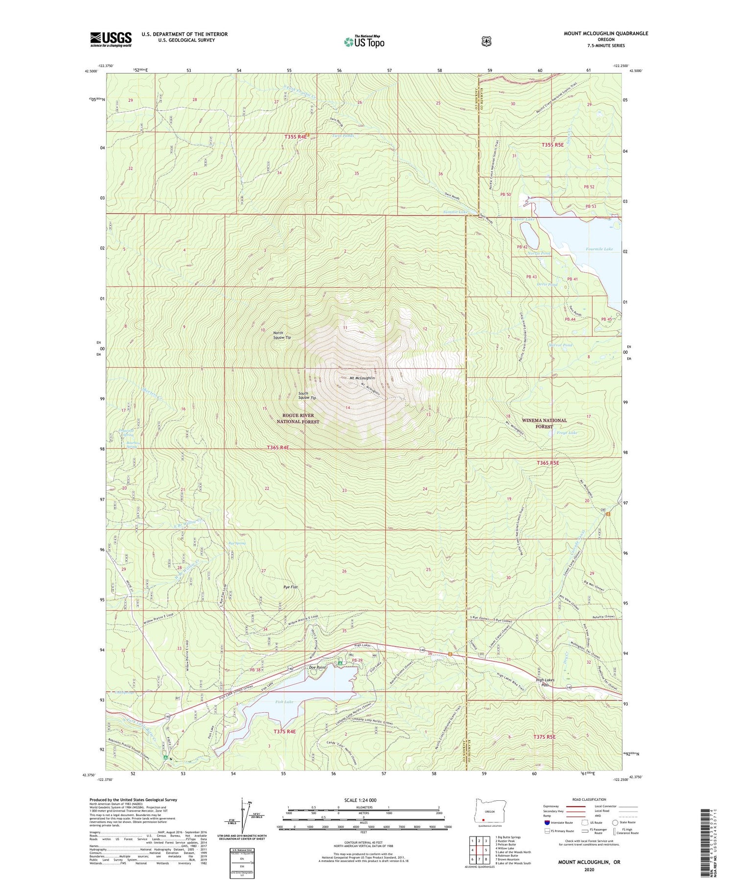
2020 topographic map quadrangle Mount McLoughlin in the state of Oregon. Scale: 1:24000. Based on the newly updated USGS 7.5' US Topo map series, this map is in the following counties: Jackson, Klamath. The map contains contour data, water features, and other items you are used to seeing on USGS maps, but also has updated roads and other features. This is the next generation of topographic maps. Printed on high-quality waterproof paper with UV fade-resistant inks.
Quads adjacent to this one:
West: Willow Lake
Northwest: Big Butte Springs
North: Rustler Peak
Northeast: Pelican Butte
East: Lake of the Woods North
Southeast: Lake of the Woods South
South: Brown Mountain
Southwest: Robinson Butte
Contains the following named places: Blue Rock Trail, Bourbon Spring, Calamity Forest Camp, Camp Seventy-six, Cold Springs, Crater Trail, Doe Point, Doe Point Recreation Site, Dogwood Spring, Dry Creek Camp, Fish Lake, Fish Lake Dam, Fish Lake Recreation Site, Fish Lake Resort, Fish Lake Resort Marina, Fourmile Lake, Freye Lake, High Lakes Pass, Medford Watershed, Mirror Pond, Mount McLoughlin, Mount McLoughlin Trail, Norris Pond, North Fork Recreation Site, North Squaw Tip, Orris Pond, Rye Flat, Rye Spring, South Squaw Tip, Squaw Lake, Squaw Tip Trail, Summit Lake, Summit Sno-Park, Swan Creek, Twin Ponds, Twin Ponds Camp, Twin Ponds Trail, Valley of the Rogue Dairy


