MyTopo
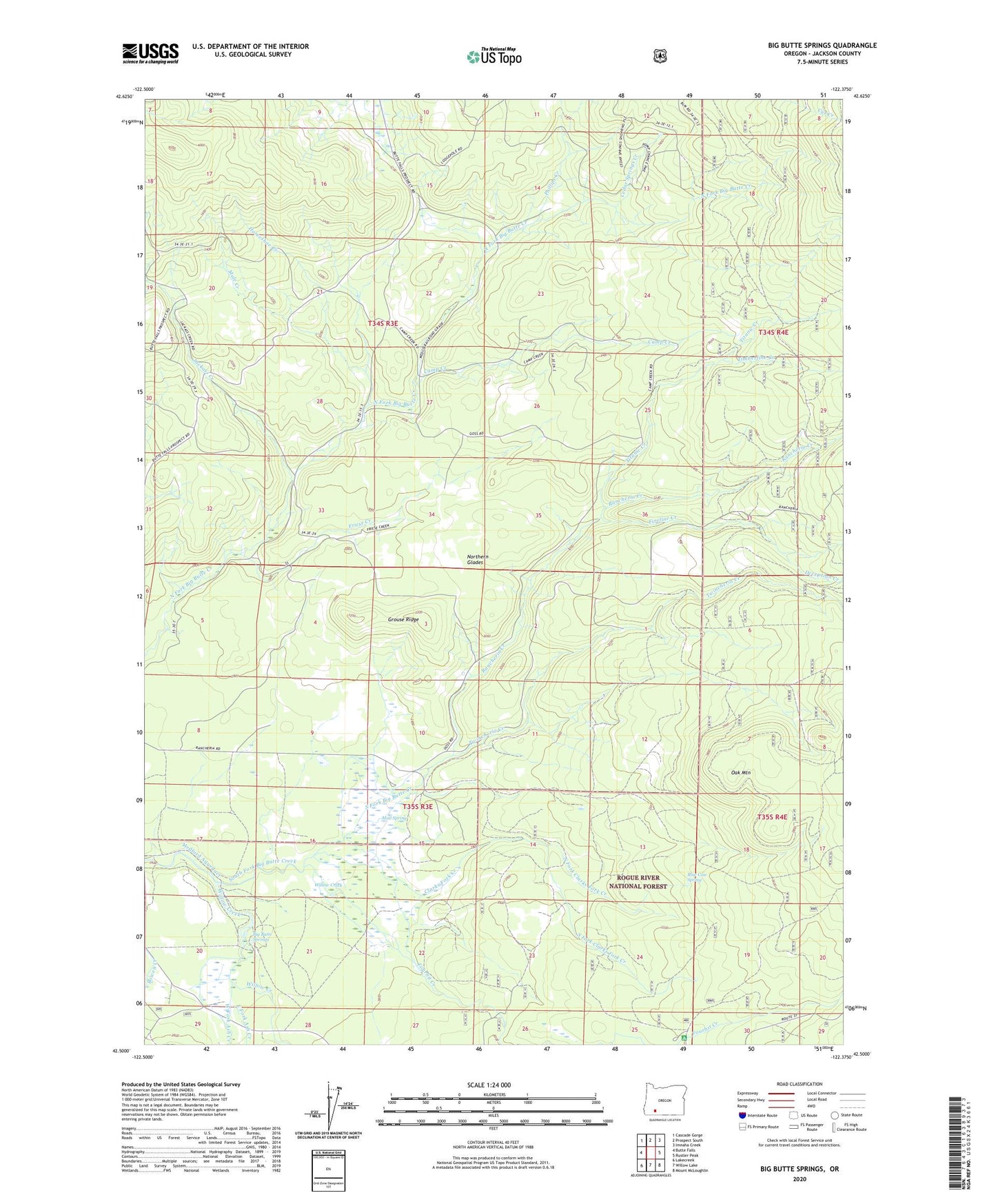
Big Butte Springs Oregon US Topo Map
Couldn't load pickup availability
Also explore the Big Butte Springs Forest Service Topo of this same quad for updated USFS data
2023 topographic map quadrangle Big Butte Springs in the state of Oregon. Scale: 1:24000. Based on the newly updated USGS 7.5' US Topo map series, this map is in the following counties: Jackson. The map contains contour data, water features, and other items you are used to seeing on USGS maps, but also has updated roads and other features. This is the next generation of topographic maps. Printed on high-quality waterproof paper with UV fade-resistant inks.
Quads adjacent to this one:
West: Butte Falls
Northwest: Cascade Gorge
North: Prospect South
Northeast: Imnaha Creek
East: Rustler Peak
Southeast: Mount McLoughlin
South: Willow Lake
This map covers the same area as the classic USGS quad with code o42122e4.
Contains the following named places: Ash Creek, Big Butte Springs, Blue Cow Spring, Camp Creek, Camp Four, Carlson Camp, Cedar Springs Creek, Clarks Fork Creek, Clement Ranch, Cook Ranch, Deception Creek, Doug Ingram Tree, East Fork Ash Creek, Fireline Creek, Fourbit Creek, Fourbit Ford, Fourbit Ford Recreation Site, Friese Creek, Goss Ranch, Grouse Ridge, Hoffman Ranch, Horseshoe Creek, Jackass Creek, Lemont Post Office, Merle Burn, Mount Pitt School, Mud Spring, Mule Creek, North Fork Clarks Fork Creek, Northern Glades, Oak Mountain, Oden Ranch, Parker, Phillips Creek, Rancheria Creek, Rancheria Prairie, Rancheria Ranch, South Fork Clarks Fork Creek, Thomson Ranch, Timberline Creek, Titanic Creek, Twincheria Creek, West Fork Ash Creek, Willow Creek