
MyTopo
Mount Pisgah Oregon US Topo Map
Couldn't load pickup availability
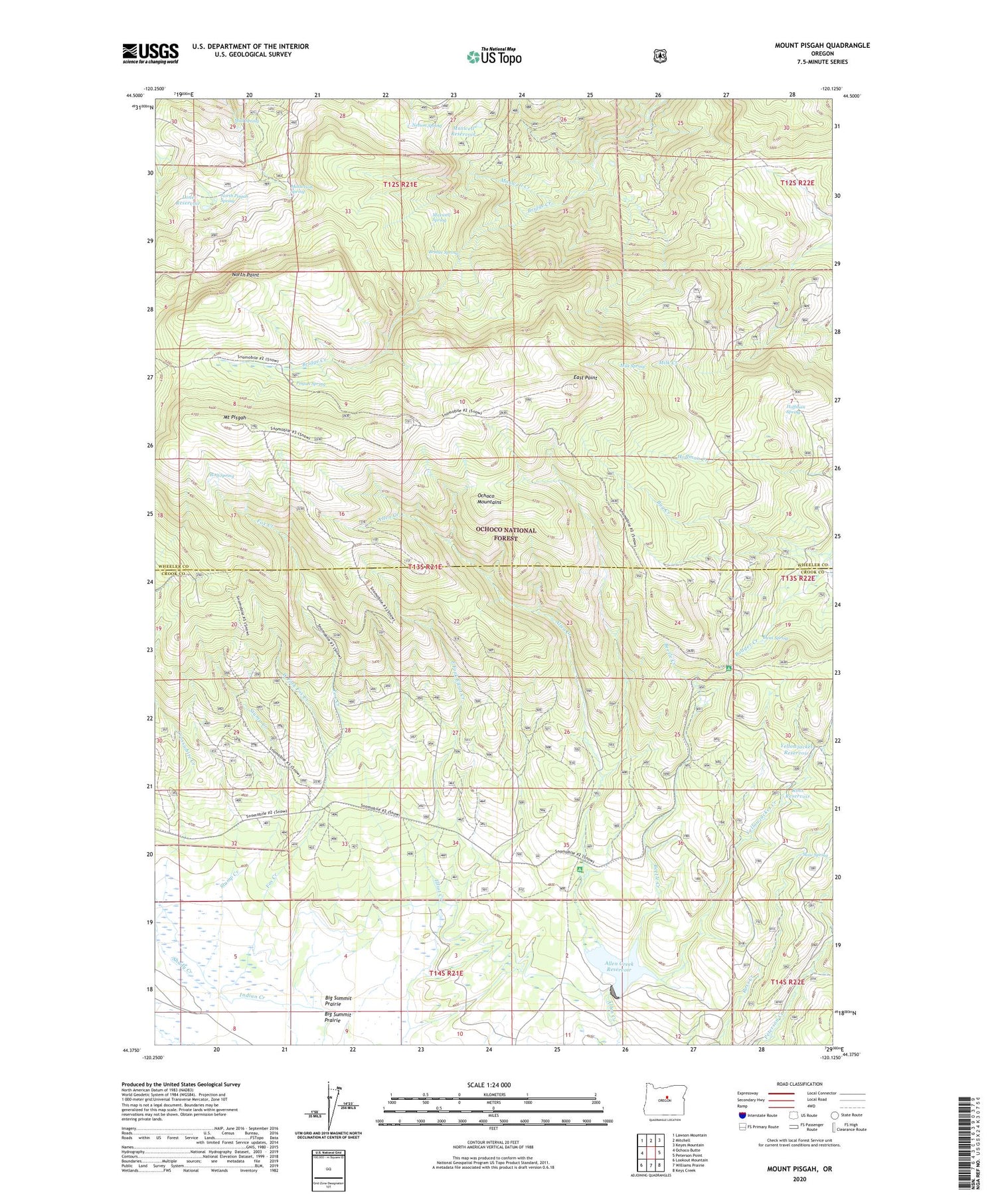
2020 topographic map quadrangle Mount Pisgah in the state of Oregon. Scale: 1:24000. Based on the newly updated USGS 7.5' US Topo map series, this map is in the following counties: Wheeler, Crook. The map contains contour data, water features, and other items you are used to seeing on USGS maps, but also has updated roads and other features. This is the next generation of topographic maps. Printed on high-quality waterproof paper with UV fade-resistant inks.
Quads adjacent to this one:
West: Ochoco Butte
Northwest: Lawson Mountain
North: Mitchell
Northeast: Keyes Mountain
East: Peterson Point
Southeast: Keys Creek
South: Williams Prairie
Southwest: Lookout Mountain
Contains the following named places: Allen Creek Dam, Allen Creek Horse Camp, Allen Creek Reservoir, Badger Cabin, Beetle Creek, Bridge Creek Wilderness, Bridge Spring, Bug Creek, Carrol Campground, Crosswhite Creek, Dent Spring, East Fork Elliot Creek, East Point, Fox Creek, Hemp Spring, Hoffman Spring, Lone Reservoir, Masterson Spring, Maxwell Creek, Maxwell Reservoir, Maxwell Spring, Milk Spring, Mount Pisgah, Mud Spring, Nelson Spring, North Pisgah Spring, North Point, Pisgah Spring, Ross Reservoir, Scotts Recreation Site, Shady Creek, Slow Spring, Stump Creek, West Fork Fox Creek, Wineburger Camp, Wolf Spring, Yellowjacket Creek, Yellowjacket Reservoir


