MyTopo
Keyes Mountain Oregon US Topo Map
Couldn't load pickup availability
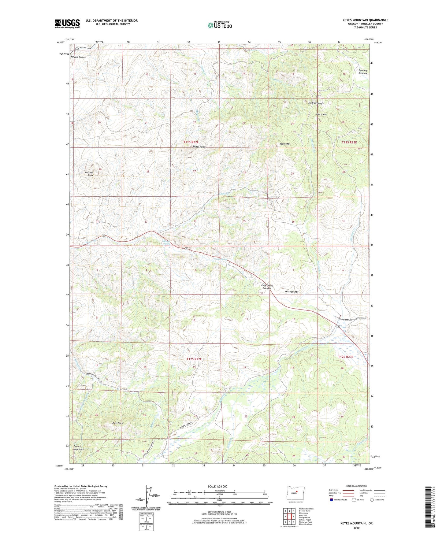
2023 topographic map quadrangle Keyes Mountain in the state of Oregon. Scale: 1:24000. Based on the newly updated USGS 7.5' US Topo map series, this map is in the following counties: Wheeler. The map contains contour data, water features, and other items you are used to seeing on USGS maps, but also has updated roads and other features. This is the next generation of topographic maps. Printed on high-quality waterproof paper with UV fade-resistant inks.
Quads adjacent to this one:
West: Mitchell
Northwest: Sutton Mountain
North: Toney Butte
Northeast: Richmond
East: Frog Hollow
Southeast: Derr Meadows
South: Peterson Point
Southwest: Mount Pisgah
This map covers the same area as the classic USGS quad with code o44120e1.
Contains the following named places: Badger Creek, Flock Mountain, H H Wheeler Historical Marker, Harrison Creek, Indian Creek, Keyes Mountain, Keys Creek Summit, Lewis Rock, Looney Spring, Marshall Butte, Marshall Creek, Maxwell Spring, Mitchell Guard Station, Mitchell Mountain, Monroe Roughs, Peggy Butte, Thorn Hollow, Wood Camp Creek