MyTopo
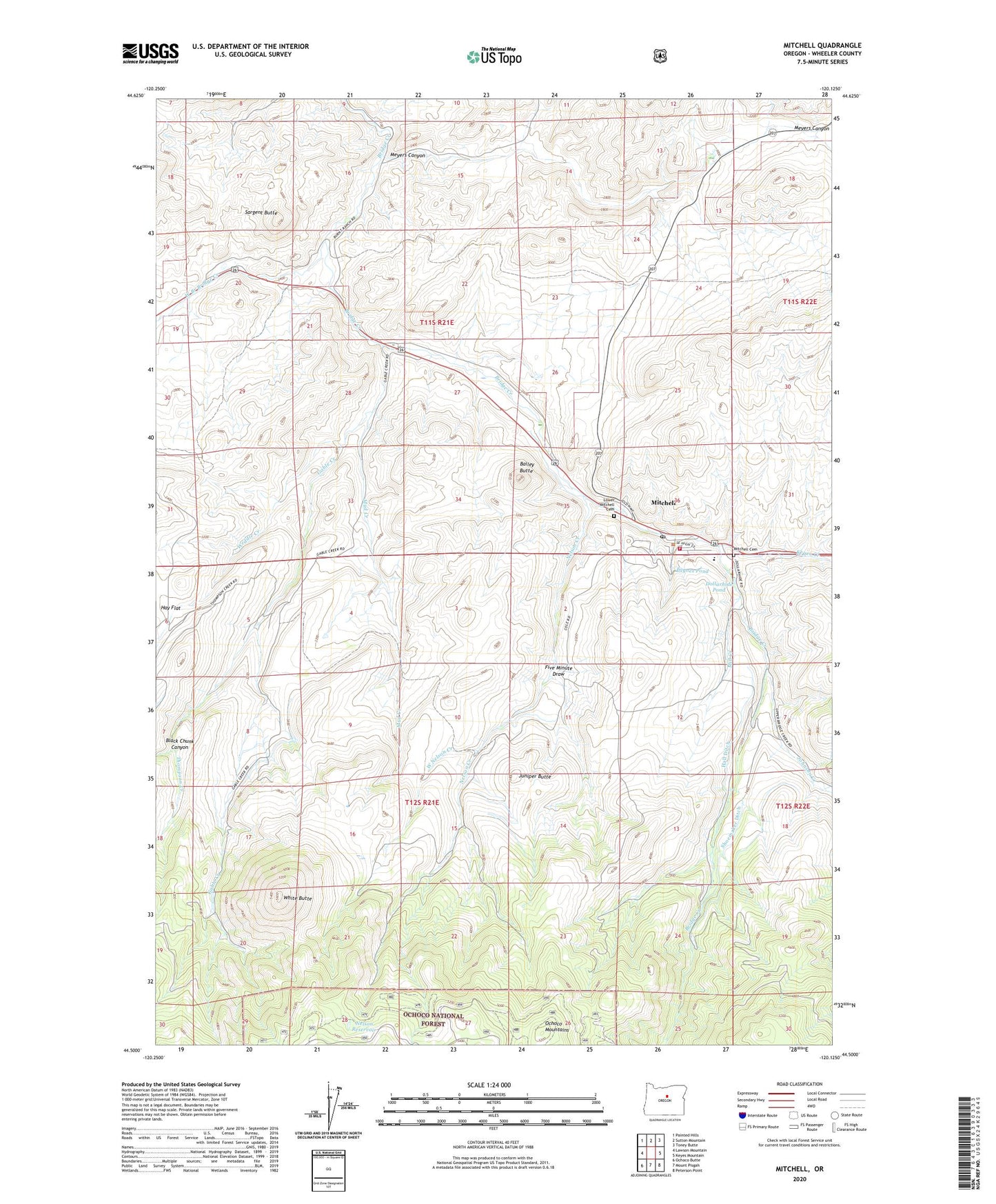
Mitchell Oregon US Topo Map
Couldn't load pickup availability
Also explore the Mitchell Forest Service Topo of this same quad for updated USFS data
2024 topographic map quadrangle Mitchell in the state of Oregon. Scale: 1:24000. Based on the newly updated USGS 7.5' US Topo map series, this map is in the following counties: Wheeler. The map contains contour data, water features, and other items you are used to seeing on USGS maps, but also has updated roads and other features. This is the next generation of topographic maps. Printed on high-quality waterproof paper with UV fade-resistant inks.
Quads adjacent to this one:
West: Lawson Mountain
Northwest: Painted Hills
North: Sutton Mountain
Northeast: Toney Butte
East: Keyes Mountain
Southeast: Peterson Point
South: Mount Pisgah
Southwest: Ochoco Butte
This map covers the same area as the classic USGS quad with code o44120e2.
Contains the following named places: Bailey Butte, Black Chunk Canyon, City of Mitchell, Dollarhide Pond, Five Minute Draw, Gable Creek, Gable Creek School, Hall Ditch, Hudspeth Mill, Johnson Creek, Juniper Butte, Keyes Creek, Lower Mitchell Cemetery, Meyers Canyon, Mill Creek, Mitchell, Mitchell Airstrip, Mitchell Cemetery, Mitchell Community Hall, Mitchell Justice Court, Mitchell Post Office, Mitchell School, Mitchell Volunteer Fire Department, Mud Creek, Nelson Creek, Nelson Reservoir, Paynes Pond, Sargent Butte, Shoemaker Ditch, Thompson Creek, Weddle Creek, West Branch Bridge Creek, West Nelson Creek, White Butte