MyTopo
Muttonchop Butte Oregon US Topo Map
Couldn't load pickup availability
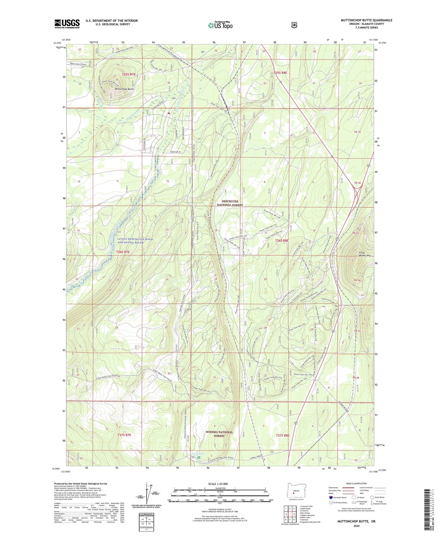
2020 topographic map quadrangle Muttonchop Butte in the state of Oregon. Scale: 1:24000. Based on the newly updated USGS 7.5' US Topo map series, this map is in the following counties: Klamath. The map contains contour data, water features, and other items you are used to seeing on USGS maps, but also has updated roads and other features. This is the next generation of topographic maps. Printed on high-quality waterproof paper with UV fade-resistant inks.
Quads adjacent to this one:
West: Burn Butte
Northwest: Crescent Lake
North: Odell Butte
Northeast: Crescent
East: Walker Mountain
Southeast: Sugarpine Mountain NW
South: Chemult
Southwest: Miller Lake
Contains the following named places: Chemult Rural Fire Protection District Station 2, Corral, Corral Spring, Corral Springs Recreation Site, Cow Camp, Crescent Lake Division, Emigrant Crossing, Gilchrist Junction, Hemlock Creek, Little Walker Mountain, Mowich, Mowich Post Office, Muttonchop Butte, Pacific Telephone and Telegraph Substation, Paunina, Spruce Creek, Swamp Creek